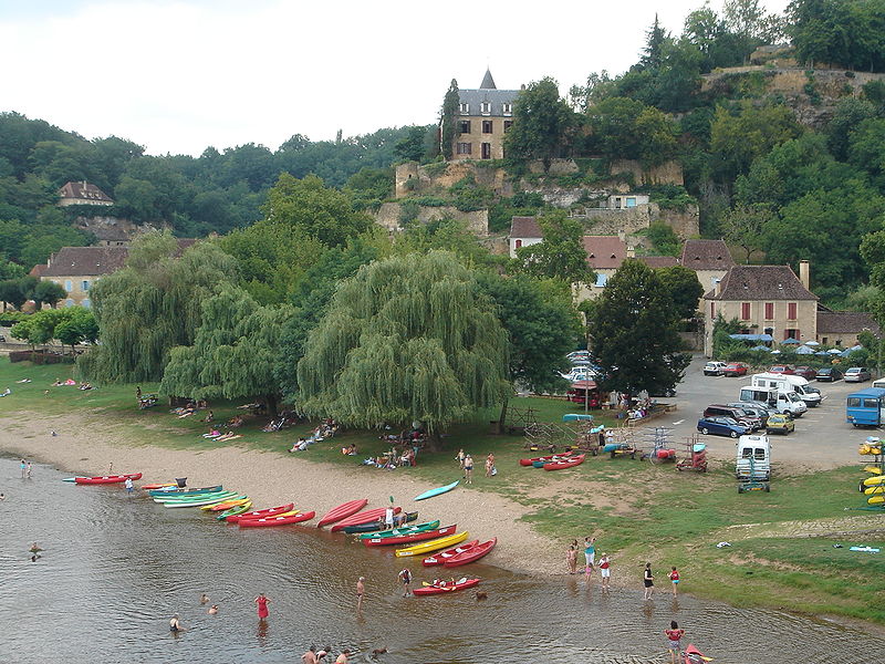
File:Limeuil_Canoe.JPG · Wikimedia Commons · See Wikimedia Commons
Limeuil
Limeuil (; ) is a commune in the Dordogne department in Nouvelle-Aquitaine in southwestern France.
Weather now
cached 9h ago18°broken clouds
46% 1.7 m/s OpenWeatherMap
7-day forecast
via Open-Meteo
Place details
- Locality
- Limeuil
- Region
- Nouvelle-Aquitaine
- Country
- France
- Population
- 0
via · GeoNames
~14 min read
Article
10 sectionsContents
- History of the village
- The chateau
- Wine and the rivers
- Churches
- Post-revolution and into the 20th century
- Tourism
- Population
- Sights
- See also
- References
Limeuil (; ) is a commune in the Dordogne department in Nouvelle-Aquitaine in southwestern France.
Limeuil village is located at the confluence of the Dordogne and Vézère rivers. Historically this location at the meeting of the two major local rivers gave Limeuil immense importance – both commercially and strategically. In medieval times, the rivers were the highways of trade, and to be at the convergence of two of them was a unique advantage in the region: this was, historically, primarily a wine-producing area, much of the wine quite 'rough', but the casks of relatively better wine were delivered into the 'chais' at Limeuil, for subsequent delivery downstream to Bordeaux, on large, flat-bottomed 'gabarres' [See 'the wine trade', below]. The rivermen had to be accommodated here, and to this day the riverside bar/restaurant bears the name '''L'ancre de Salut''' – a boatsman's term meaning literally 'the safety anchor', a place where the rivermen could find food, wine, a bed, and rest, before their return up river. The church at the top of the village [there are two churches – see 'Churches' below] is, significantly, named after Ste Catherine, who was the patron saint of boat people. Strategically, Limeuil consequently had to defend itself (and its inhabitants) from the relentless waves of territory-grabbing that arose from the Hundred Years' War, and the Wars of Religion – endless 'chevauchées' [see 'Medieval Wars' below] that would see the locality relentlessly under attack, for over two hundred years (the so-called Hundred Years' War lasted, in fact, for 116 years!) The hillside promontory on which the village is situated provides a natural defence – and was surmounted by a chateau, enclosed within its defensive circular stone walls [see 'The Chateau'] below.
Gallery (2)
On the map
2 mapped locations