Limpopo River
Sign in to saveriver in southern Africa
AI overview
The Limpopo River is a major river system located in southern Africa that flows through several countries in the region. It is significant as an important water source and geographical feature for the southern African landscape and the communities that depend on it.
AI-generated from the Wikipedia summary — may contain errors.
Article
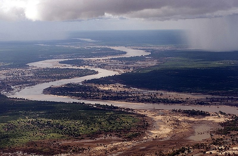
The Limpopo River (/lɪmˈpoʊpoʊ/) rises in South Africa and flows generally eastward through Mozambique to the Indian Ocean. The river is approximately 1,750 km (1,090 mi) long, with a drainage basin of 415,000 km (160,000 mi) in size. The mean discharge measured over a year is 170 m/s (6,000 cu ft/s) to 313 m/s (11,100 cu ft/s) at its mouth. The Limpopo is the second largest African river that drains to the Indian Ocean, after the Zambezi.
The first European to sight the river was Vasco da Gama, who anchored off its mouth in 1498 and named it Rio do Espírito Santo (lit. 'River of the Holy Spirit'). Its lower course was explored by St Vincent Whitshed Erskine in 1868–69, and Captain J F Elton travelled down its middle course in 1870. The river has been called the Vhembe by local Venda communities of the area where now that name has been adopted by the South African government as its District Municipality in the north.