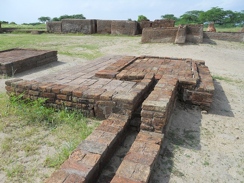
File:The_drainage_system_at_Lothal_2.JPG · Wikimedia Commons · See Wikimedia Commons
Key facts
- Ancient site.name
- lothal
- Ancient site.image
- The drainage system at Lothal 2.JPG
- Ancient site.caption
- Archaeological remains of the drainage system, 2012
- Ancient site.map_type
- India Gujarat#India#South Asia
- Ancient site.relief
- y
- Ancient site.map_size
- 270
- Ancient site.location
- Gujarat, India
- Ancient site.type
- Settlement
- Ancient site.cultures
- Indus Valley Civilization
- Ancient site.discovered
- 1954
- Ancient site.excavations
- 1955–1960
- Ancient site.condition
- Ruined
- Ancient site.ownership
- Public
- Ancient site.management
- Archaeological Survey of India
- Ancient site.public_access
- Yes
via Wikipedia infobox
Wikidata facts
- Instance of
- archaeological site
- Country
- India
- Located in
- Ahmedabad district
- Image
- Archeological Remains at the Lower Town of Lothal.jpg
Show 3 more facts
- inception
- 2400-00-00
- Commons category
- Lothal
- Commons gallery
- Lothal
Sources (2)
via Wikidata · CC0
Article · Nederlands
Lothal (IPA: [/ˈloːtʰəl/]?; Gujarati: લોથલ, heuvel van de doden) was een van de belangrijkste steden van de oude Indusbeschaving. Het lag in de moderne staat Gujarat en werd omstreeks 2400 v.Chr. gesticht. Het is de belangrijkste archeologische vindplaats in India van deze beschaving. Lothal werd in 1954 ontdekt en de opgravingen door de (ASI) begonnen op 13 februari 1955 en duurden tot 19 mei 1960.
Abstract from DBpedia / Wikipedia · CC BY-SA
Gallery (52)
On the map
3 mapped locations