
File:FR-04-Malijai2.JPG · Wikimedia Commons · See Wikimedia Commons
Malijai
Sign in to saveMalijai () is a commune in the Alpes-de-Haute-Provence department in southeastern France. In 1974, it absorbed the former commune Chénerilles.
Weather now
7-day forecast
via Open-Meteo
Place details
- Locality
- Malijai
- Region
- Provence-Alpes-Côte d'Azur
- Country
- France
- Population
- 1,741
- Timezone
- Europe/Paris
via OpenStreetMap · GeoNames
Key facts
- French commune.name
- Malijai
- French commune.commune status
- Commune
- French commune.image coat of arms
- Blason Malijai.svg
- French commune.image
- FR-04-Malijai2.JPG
- French commune.caption
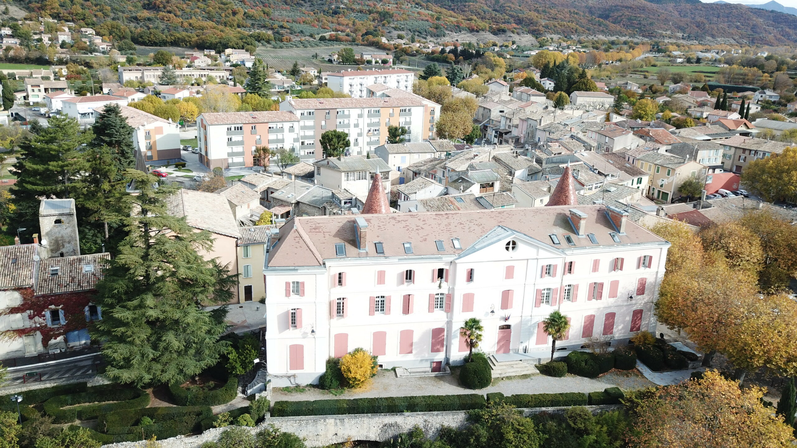
- The chateau of Malijai
- French commune.arrondissement
- Digne-les-Bains
- French commune.canton
- Digne-les-Bains-2
- French commune.INSEE
- 04108
- French commune.postal code
- 04350
- French commune.mayor
- Sonia Fontaine
- French commune.term
- 2020–2026
- French commune.intercommunality
- CA Provence-Alpes
- French commune.elevation m
- 428
- French commune.elevation min m
- 422
- French commune.elevation max m
- 1080
- French commune.area km2
- 26.56
via Wikipedia infobox
Official website
Malijai.fr | Site internet de la commune
Site internet de la commune de Malijai dans les Alpes de Haute-Provence. Retrouvez tous les services de votre Mairie ainsi que notre actualité
malijai.fr →Link to the official site · 8,534 chars · not written by Vinony
Wikidata facts
- Official name
- Malijai
- Population
- 2020
- Area
- 26.56
- Elevation
- 604
- Official website
- www.malijai.fr
- Image
- Château de Malijai.jpg
Show 6 more facts
- Commons category
- Malijai
- postal code
- 04350
- male population
- 962
- female population
- 1013
- email address
- mailto:[email protected]
- phone number
- +33-4-92-34-01-12
via Wikidata · CC0
~1 min read
Article
4 sectionsContents
- Geography
- Population
- See also
- References
Malijai () is a commune in the Alpes-de-Haute-Provence department in southeastern France. In 1974, it absorbed the former commune Chénerilles.
==Geography== The village lies on the right bank of the Bléone, which forms part of the commune's western border, then flows west through the northern part of the commune.
Gallery (3)
On the map
2 mapped locations