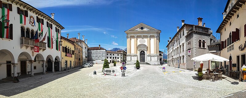
File:Piazza_Papa_Luciani,_Mel.jpg · Wikimedia Commons · See Wikimedia Commons
settlement in the Italian municipality of Borgo Valbelluna
Key facts
- Country
- Italy
- Region
- Veneto
- Province
- Belluno (BL)
- Frazioni
- Bardies, Campo, Campo San Pietro, Carve, Carve Montagna, Col, Conzago, Cordellon, Corte, Farra, Follo, Gus, Marcador, Nave, Pagogna, Pellegai, Samprogno, San Candido, Signa, Tallandino, Tiago, Torta, Tremea, Valmaor, Vanie-Rive di Villa, Villa di Villa, Zottier
- Mayor
- Stefano Cesa
- Total
- 85.7 km (33.1 sq mi)
- Elevation
- 362 m (1,188 ft)
- Density
- 69.6/km (180/sq mi)
- Demonym
- Zumellesi
- Time zone
- UTC+1 ( CET )
- Summer dst
- UTC+2 ( CEST )
- Dialing code
- 0437
- Website
- Official website
via Wikipedia infobox
Wikidata facts
- Official name
- Mel
- Demonym
- zumellesi
- Country
- Italy
- Located in
- Borgo Valbelluna
- Population
- 5968
- Area
- 86.24
- Elevation
- 362
- Time zone
- UTC+02:00
- Capital of
- Borgo Valbelluna
- Shares border with
- Valdobbiadene
- Official website
- www.comune.mel.bl.it
- Image
- Mel panorama.jpg
- Dialing code
- 0437
- Licence plate code
- BL
- Patron saint
- Annunciation
Show 4 more facts
- postal code
- 32026
- Commons category
- Mel (Borgo Valbelluna)
- member of
- The most beautiful villages in Italy
- has certification
- Bandiera arancione
via Wikidata · CC0