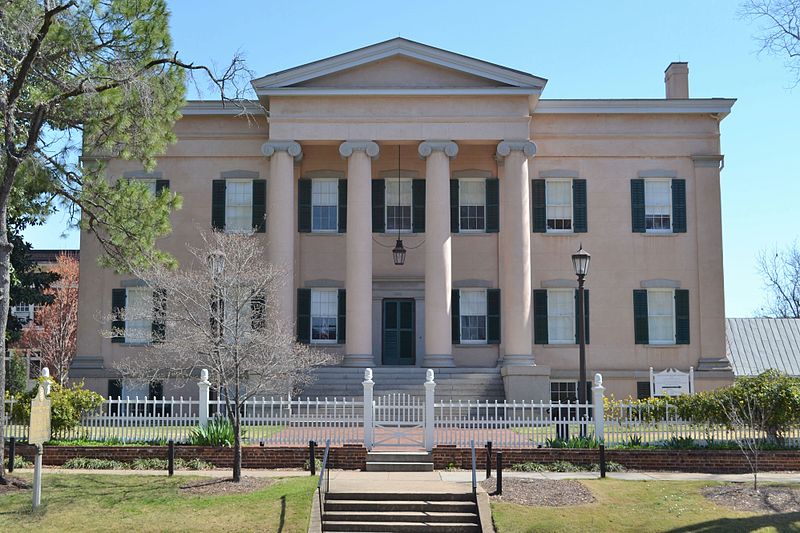
File:Old_Governor's_Mansion;_Milledgeville,_Georgia;_March_13,_2011.JPG · Wikimedia Commons · See Wikimedia Commons
Milledgeville
Sign in to saveAlso known as Milledgeville, Georgia, Milledgeville, GA
county seat of Baldwin County, Georgia, United States
Key facts
- Country
- United States
- State
- Georgia
- County
- Baldwin
- Incorporated
- December 12, 1804 ; 221 years ago ( 1804-12-12 )
- Named after
- John Milledge
- Type
- Council–Manager
- Mayor
- Mary Parham-Copelan
- Manager
- Hank Griffeth
- Council
- Members Dr. Collinda Lee Jeanette Walden Denese Shinholster Walter Reynolds Shonya A. Mapp Steve Chamber – Council President Pro Tem
- Total
- 20.42 sq mi (52.89 km )
- Land
- 20.26 sq mi (52.47 km )
- Water
- 0.161 sq mi (0.416 km )
- Elevation
- 330 ft (100 m)
- Density
- 840.0/sq mi (324.31/km )
- Time zone
- UTC−5 ( Eastern Time )
- Summer dst
- UTC−4 (EDT)
- Fips code
- 13-51492
- Gnis feature id
- 0332390
via Wikipedia infobox
Wikidata facts
- Instance of
- county seat
- Named after
- John Milledge
- Official name
- Milledgeville
- Country
- United States
- Located in
- Baldwin County
- Population
- 17070
- Area
- 53.25332
- Elevation
- 100
- Capital of
- Baldwin County
- Official website
- www.milledgevillega.us
- Image
- Old Governor's Mansion; Milledgeville, Georgia; March 13, 2011.JPG
- Households
- 5864
- Dialing code
- 478
Show 11 more facts
- postal code
- 31059
- Commons category
- Milledgeville, Georgia
- category of associated people
- Category:People from Milledgeville, Georgia
- topic's main category
- Category:Milledgeville, Georgia
- category for people born here
- Category:Births in Milledgeville, Georgia
- inception
- 1804-01-01
- P8168
- La Chapelle-la-Reine
- water as percent of area
- 0.7397
- per capita income
- 26629
- described by source
- Encyclopædia Britannica 11th edition
- P12749
- Alex Harvey
Sources (8)
via Wikidata · CC0
~20 min read
Encyclopedic overview
Milledgeville (/ˈmɪlɪdʒˌvɪl/) is a city in and the county seat of Baldwin County, Georgia, United States. Founded in 1803 along the Oconee River, it served as the state capital of Georgia from 1804 to 1868, including during the American Civil War. The city's layout—modeled after the grid plans of Savannah, Georgia, and Washington, D.C.—reflects Milledgeville's intended role as a seat of government. During its years as the capital, Milledgeville quickly became a hub of political activity and cotton-based commerce before facing significant economic changes after the capital was relocated to Atlanta in 1868.
Today, Milledgeville lies along the Fall Line Freeway, a major east-west corridor that connects Milledgeville with historically significant cities like Augusta, Macon, and Columbus. Its historic core, including the Old State Capitol, is preserved within the Milledgeville Historic District in downtown Milledgeville.
Excerpted from Wikipedia’s “Milledgeville” article, available under the CC BY-SA 4.0 licence.