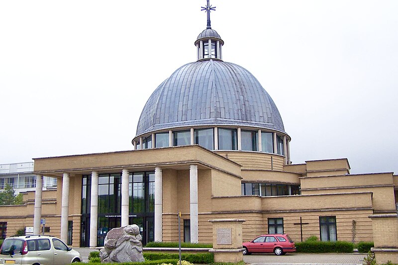
File:MiltonKeynesChristtheCornerstone01.jpg · Wikimedia Commons · See Wikimedia Commons
Milton Keynes
Sign in to saveAlso known as Milton Keynes, Buckinghamshire
city in Buckinghamshire, England, United Kingdom
OverviewAI-generated
Milton Keynes is a city and planned community in England, United Kingdom. It serves as the capital of the City of Milton Keynes administrative entity. The town was established on 23 January 1967. It is situated near the River Great Ouse and shares a border with Deanshanger. The area covers 88 square units and has an elevation of 102 meters above sea level.
The population of Milton Keynes is 264,349. It operates within the UTC±00:00 and UTC+01:00 time zones. The local dialing code is 01908, and postal codes range from MK1 to 15. The city is twinned with Schwerte, Almere, and Huai'an.
Synthesized by Vinony from 52 facts across 8 sources: Wikidata, Openweathermap, OpenStreetMap, GeoNames, Firecrawl, Open Meteo, Vinony graph, Geo. Generated from structured data (not the Wikipedia text) and checked against those facts — may still contain errors.
Weather now
7-day forecast
via Open-Meteo
Place details
- Locality
- Milton Keynes
- Region
- England
- Country
- United Kingdom
- Population
- 256,385
- Timezone
- Europe/London
via OpenStreetMap · GeoNames
Official website
Link to the official site · 13,057 chars · not written by Vinony
Wikidata facts
- Instance of
- new town (UK)
- Country
- United Kingdom
- Located in
- City of Milton Keynes
- Population
- 264349
- Area
- 88
- Elevation
- 102
- Time zone
- UTC+01:00
- Body of water
- River Great Ouse
- Capital of
- City of Milton Keynes
- Shares border with
- Deanshanger
- Official website
- milton-keynes.gov.uk
- Image
- MK Montage.jpg
- Dialing code
- 01908
Show 13 more facts
- twinned administrative body
- Huai'an
- Commons category
- Milton Keynes
- OS grid reference
- SP841386
- topic's main category
- Category:Milton Keynes
- inception
- 1967-01-23
- Commons gallery
- Milton Keynes
- category of associated people
- Category:People from Milton Keynes
- category for people born here
- Q17112988
- postal code
- MK1 - 15
- native label
- Milton Keynes
- social media followers
- 41026
- different from
- City of Milton Keynes
- P12749
- Krefeld
Sources (8)
via Wikidata · CC0
Travel guide
Understand
Imagine being able to design the perfect city almost completely from scratch. This is the premise under which internationally renowned urban planners and architects set out to create Milton Keynes in the 1960s and '70s. Of course, when mentioning Milton Keynes, people will often be met with "Ugh, it’s a soulless new city" or "What, is that the place with the concrete cows?" Most irritating is that often, the people that make those comments have neither lived there nor indeed spent much time there. Yes, it is a new city and yes, the centre of that city could be described as a little soulless with its chain restaurants and large shopping centre, but it was built on and around land already settled and dotted around the 22,000 acres of countryside it resides in are many things to do, see and explore. Sites dating back to 2000 BC have been unearthed along with the remains of a major Roman villa, then dispersed amongst the city, itself built amongst many old towns. Also are numerous green spaces, a plethora of indoor and outdoor activities, and fabulous shopping opportunities. The Ministry of Housing and Local Governments brief in 1967 requested a new town that could accommodate an incoming population of 150,000 Londoners over a period of 20 years.
The city includes a number of previous settlements and villages including Wolverton, Bletchley and Stony Stratford, all of which have expanded as part of its development. Stony Stratford in particular has fabulous British pubs serving …
Get around
Buses in Milton Keynes are frequent, and all estates are quite well covered. There are regular buses from most places to the city centre, train station, and Bletchley. Travelling by car is usually preferable as one of Milton Keynes's saving graces is its road network, although during rush hour, it can get somewhat congested in some areas.
The dominance of the car is greatly helped by the road layout – the main roads of the city are laid out in a grid system with roundabouts at the intersections, so getting about is quick, although predictably less so in rush hour. The grid is formed of numbered 'H' roads running horizontally on the map and 'V' roads running vertically. Visitors who drive to Milton Keynes often get lost on these roads because they all look the same—the main roads are in tree-lined linear valleys to reduce road noise so there are few landmarks visible to navigate by. A map is recommended for people who are new to the town.
Pedestrians and cyclists have their own network of 'redways' – paths made of red tarmac that broadly follow the grid roads but never meet them, either crossing over or underneath. The redways are a good way to get about. As with any place you are unfamiliar with, caution is advised, and as many of the redways cross minor roads cyclists and those with children should beware of traffic!
The redways are often not well signposted, and that traversing them without a map can lead to you getting lost quite quickly!
See
thumb|Bletchley Park thumb|Concrete cows
Do
Milton Keynes has attractions for the adventurous. Willen Lake has a wakeboard tow rope system; the Xscape has an indoor snow slope, a climbing wall and an indoor skydiving tower; the central bus station has a skate park' and the town has also a BMX track at Pineham. Families with younger children might like to head for the Gulliver's Land theme park or Eco Park next door or take a stroll and have a picnic at the nearby Willen Lake. Football: Because of the local value of the car culture, a growing car cruise and meet is staged in the car parks around the Network Rail head office on Sunday nights, and it is popular both with modders and the police. Stony Stratford is worth a visit to experience the more tranquil and traditional side of Milton Keynes. About 10 min from the City Centre by car, you will find a quaint high-street with some quirky independent shops, lots of pubs where you can get good old-fashioned British grub, a pint of beer and warm yourself by a real fire during colder months. If you feel like taking a stroll, you can walk out of the town and take a pleasant stroll along the river. Woburn Village is about a 15-minute car journey from Milton Keynes and is well worth a visit.
Buy
The Centre: MK is the main shopping centre for the surrounding area and is where most of the shopping in Milton Keynes is to be had. It features branches of many high street chains, with over 230 stores. The centre is undercover with good disabled access.
The High Street in Stony Stratford offers a pleasant but small alternative. Most residential areas have their own convenience store.
There are various retail parks with the larger DIY, carpet, furniture and warehouse-style clothes shops.
Eat
Milton Keynes has a wide variety of restaurants both in the City Centre and in the outlying areas.
In the city centre the restaurants are centred around the theatre district, Xscape and a new area called "The Hub".
The Centre: MK, John Lewis restaurant is convenient.
There is a wider range of smaller independent restaurants in outlying areas such as Stony Stratford, Wolverton, and Fenny Stratford. There is also decent pub food (and somewhat better beer) at The Plough in Simpson, and Ye Olde Swan in Woughton on the Green. Pub grub at the Old Beams in Shenley Lodge can not be beaten.
The Salford Swan, while not in Milton Keynes, is well worth a look for some excellent pub-restaurant food with a delightful atmosphere.
Treat yourself to an English fry-up at Kay’s Kitchen in Stony Stratford.
Drink
On a summer evening a trip to the theatre district or Xscape almost transports you to a Spanish holiday resort, such are the number of bars and clubs with people walking between them. Not much for a CAMRA member here though, as it's more for the bottle of Bud or Smirnoff Ice crowd.
More traditional pubs can be found along the Stony Stratford high street, popular for pub crawls at weekends. Newport Pagnell, a few miles from the city centre, is also a good option with many good pubs and a good atmosphere
Go next
Woburn Buckingham Towcester Bedford
Travel guide from Wikivoyage (CC BY-SA 4.0)
~40 min read
Encyclopedic overview
Milton Keynes (/kiːnz/ KEENZ) is a city in Buckinghamshire, England, about 50 miles (80 km) north-west of London. At the 2021 census, the population of its urban area was 264,349. The River Great Ouse forms the northern boundary of the urban area; a tributary, the River Ouzel, meanders through its linear parks and balancing lakes. Approximately 25% of the urban area is parkland or woodland, including two Sites of Special Scientific Interest (SSSIs). By design, the city comprises many well-delineated neighbourhoods.
In the 1960s, the government decided that a further generation of new towns in the south east of England was needed to relieve housing congestion in London. Milton Keynes was to be the biggest yet, with a population of 250,000 and area of 22,000 acres (9,000 ha). At designation, its area incorporated the existing towns of Bletchley, Fenny Stratford, Wolverton and Stony Stratford, along with another fifteen villages and farmland in between. These settlements had an extensive historical record since the Norman Conquest; detailed archaeological investigations before development revealed evidence of human occupation from the Neolithic period, including the Milton Keynes Hoard of Bronze Age gold jewellery. The government established Milton Keynes Development Corporation (MKDC) to design and deliver this new city. The Corporation decided on a softer, more human-scaled landscape than in the earlier English new towns but with an emphatically modernist architecture. Recognising how traditional towns and cities had become choked in traffic, they established a grid of distributor roads about 1 km (0.6 mi) between edges, leaving the spaces between to develop more organically. An extensive network of shared-use paths for leisure cyclists and pedestrians criss-crosses through and between them. Rejecting the residential tower block concept that had become unpopular, they set a height limit of three storeys outside Central Milton Keynes.
Excerpted from Wikipedia’s “Milton Keynes” article, available under the CC BY-SA 4.0 licence.
Gallery (12)
On the map
Available in 66 languages
- Español
- Français
- Deutsch
- 中文
- 日本語
- Русский
- Português
- Italiano
- العربية
- Afrikaans
- Armenian
- Asturian
- azb
- Azerbaijani
- Bahasa Indonesia
- Balinese
- Bashkir
- Basque
Show 47 more
- be_x_old
- Belarusian
- Breton
- Catalan
- Cebuano
- Czech
- Danish
- Egyptian Arabic
- Esperanto
- Estonian
- Finnish
- Georgian
- Greek
- Hakka Chinese
- Hebrew
- Icelandic
- Irish
- Latvian
- Lithuanian
- lld
- Nederlands
- Northern Frisian
- Norwegian
- Norwegian Nynorsk
- Old English
- Ossetic
- Polski
- Romanian
- Scots
- Serbian
- Serbian (Latin)
- Silesian
- simple
- Slovak
- Svenska
- Swahili
- Tatar
- Türkçe
- Ukrainian
- Urdu
- Volapük
- Waray
- Welsh
- zh_min_nan
- zh_yue
- فارسی
- 한국어
via Wikidata sitelinks · CC0