Montjovet
Montjovet (; Valdôtain: ) is a comune in the lower Aosta Valley region of north-western Italy. Though it only has an area of 18.7 square kilometers, the commune has several villages and hamlets. The highest point is mont Lyan (2174 metres).
AI overview
Montjovet is a small commune located in the lower Aosta Valley region of northwestern Italy, covering just 18.7 square kilometers but containing multiple villages and hamlets. Its highest point is Mont Lyan, which reaches 2,174 meters in elevation.
AI-generated from the Wikipedia summary — may contain errors.
Key facts
- Italian comune.name
- Montjovet
- Italian comune.official_name
- Comune di MontjovetCommune de Montjovet
- Italian comune.native_name
- Mondzouèt / Mondjouèt (Valdôtain)
- Italian comune.image_skyline
- Montj 2018 abc8 veduta.jpg
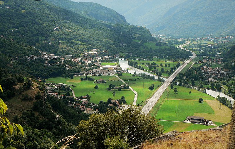
- Italian comune.image_caption
- The municipality of Montjovet seen from the Mont-Saint-Germain.
- Italian comune.image_shield
- Blason ville It Montjovet (AO).svg
- Italian comune.shield_size
- 75px
- Italian comune.province
- none
- Italian comune.frazioni
- Les Balmes, Barmachande, Barmataz, Berger, Berriat (chef-lieu), Le Bourg, Brocard, Le Brun, Chambis, Champérioux, Champ-Sitirou, Chenal, Chénoz, Chosaley, Ciséran, Le Creston, Croux, Devin, Estaod, Fénillettaz, Fiusey, Fornet, Gaspard, Gettaz, Guat, Le Grand-Hoël, Janton, Laval, Le Laveché, Lillaz, Lorial, Méran, Montat, Montquert, Muret, Oley, Plangerp, Perral, Le Petit-Hoël, Le Petit-Monde, Plout, Le Provaney, Quignonat, Reclou, Rodoz, Ros, Ruelle, Saint-Germain, Tavernaz, Toffoz, Traversière, Le Tron, Verval, Vianad, Vignolaz
- Italian comune.area_total_km2
Article
4 sectionsContents
- History
- Landmarks
- References
- External links
Montjovet (; Valdôtain: ) is a comune in the lower Aosta Valley region of north-western Italy. Though it only has an area of 18.7 square kilometers, the commune has several villages and hamlets. The highest point is mont Lyan (2174 metres).
==History== The parish of Montjovet was mentioned as being under the control of the Bishop of Aosta in Pope Alexander III's ecclesia sancti Eusebii de Plubeio of 20 April 1176. In the 13th century, a massive landslide altered a lot of the terrain in the commune, destroying the original parish church. It was ceded in 1433 to the provost of Saint-Gilles of Verrès, which it remained under until the mid 18th century when it was returned to Borso.