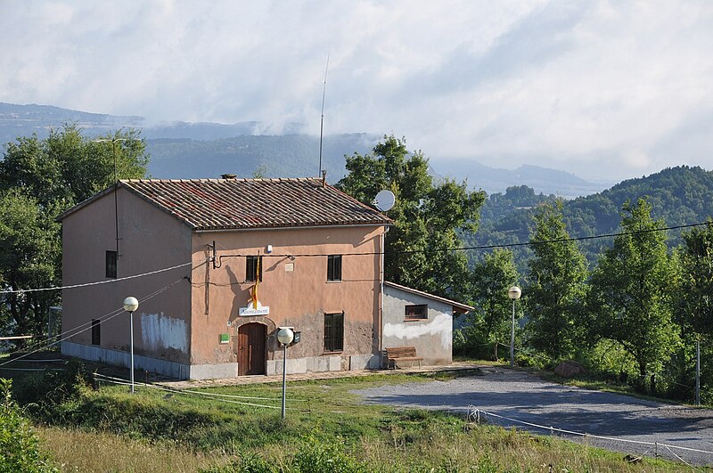
File:Spain,_Catalonia,_Muntanyola_(1).JPG · Wikimedia Commons · See Wikimedia Commons
Muntanyola
Sign in to saveMuntanyola () is a municipality in the comarca of Osona, Catalonia, northern Spain.
Key facts
- Settlement.name
- Muntanyola
- Settlement.settlement_type
- Municipality
- Settlement.image_skyline
- Spain, Catalonia, Muntanyola (1).JPG
- Settlement.imagesize
- 250px
- Settlement.image_caption
- Muntanyola town hall
- Settlement.image_shield
- Escudo de Montanyola (Barcelona).svg
- Settlement.pushpin_map
- Spain Catalonia
- Settlement.pushpin_map_caption
- Location in Catalonia
- Settlement.subdivision_type
- Country
- Settlement.subdivision_type1
- Community
- Settlement.subdivision_type2
- Province
- Settlement.subdivision_name2
- Barcelona
- Settlement.subdivision_type3
- Comarca
- Settlement.subdivision_name3
- Osona
- Settlement.leader_title
- Mayor
- Settlement.leader_name
- Carles Morera Calm (2019)
- Settlement.area_total_km2
- 40.3
- Settlement.elevation_m
- 807
via Wikipedia infobox
Wikidata facts
- Official name
- Muntanyola
- Country
- Spain
- Located in
- Barcelona Province
- Official language
- Catalan
- Population
- 721
- Area
- 40.30
- Elevation
- 900
- Time zone
- UTC+01:00
- Shares border with
- Sant Bartomeu del Grau
- Official website
- www.muntanyola.cat
- Image
- Spain, Catalonia, Muntanyola, Múnter.JPG
- Households
- 41
- Licence plate code
- B
Show 4 more facts
- postal code
- 08529
- Commons category
- Muntanyola
- female population
- 313
- male population
- 321
via Wikidata · CC0
~3 min read
Encyclopedic overview
5 sectionsContents
- General description
- Population and economy
- History
- References
- External links
Muntanyola () is a municipality in the comarca of Osona, Catalonia, northern Spain.
== General description == thumb|left|Parish Church of St. Stephen in the hamlet of Múnter (Muntanyola municipality) The village of Muntanyola is a-typical in that it does not have a center. 75% of the municipality's area consists of forested hills between 650 and 1000 m. altitude, with scattered farms and fields. The build-up area is in the higher elevations and mainly consists of two real estate developments - in Spanish: 'urbanizations' - called Muntanyola and Fontanelles, respectively. Both these neighbourhoods consist of lanes with upmarket free-standing villa's with large gardens. Centrally located in the 'Muntanyola urbanization' are the school, a tennis court, sports hall, swimming pool, playground and restaurant. The church and town hall stand rather isolated in the hills on the northern side of the Muntanyola-development. The municipality also includes the old hamlet of Múnter in its lower elevations, sloping down to the Plain of Vic (Plana de Vic). The municipality is also odd in that its territory consists of four non-contiguous areas, i.e. a main area with three exclaves. Muntanyola, Fontanelles and Múnter are all in the main area, but Múnter can be reached from Muntanyola by a rural path or via the territory of the adjacent municipality of Tona
Excerpted from Wikipedia’s “Muntanyola” article, available under the CC BY-SA 4.0 licence.
Gallery (4)
On the map
2 mapped locations