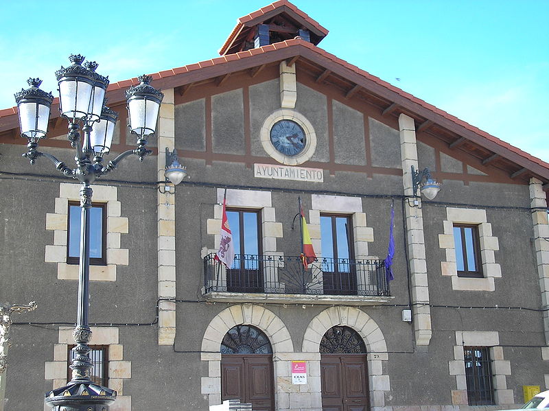
File:Ayuntamiento_de_Navaleno.jpg · Wikimedia Commons · See Wikimedia Commons
Navaleno
Sign in to saveNavaleno, which means "Meadow of Hay", is a municipality located to the northwest of the province of Soria, in the autonomous community of Castile and León, in Spain.
Navaleno is a small municipality in northwestern Soria province within Spain's Castile and León region, whose name translates to "Meadow of Hay." It is a local administrative division in rural Spain with geographical and cultural significance to its province.
AI-generated from the Wikipedia summary — may contain errors.
Key facts
- Settlement.name
- Navaleno
- Settlement.settlement_type
- Municipality
- Settlement.image_skyline
- Ayuntamiento de Navaleno.jpg
- Settlement.image_caption
- Town Hall
- Settlement.image_flag
- Flag Navalenoz.svg
- Settlement.image_shield
- Escudo_de_Navaleno.svg
- Settlement.pushpin_map
- Spain Castile and León#Spain
- Settlement.pushpin_map_caption
- Location in Spain
- Settlement.subdivision_type
- Country
- Settlement.subdivision_type1
- Autonomous community
- Settlement.subdivision_type2
- Province
- Settlement.subdivision_type3
- Comarca
- Settlement.subdivision_name3
- Comarca de Pinares
- Settlement.subdivision_type4
- Judicial district
- Settlement.subdivision_name4
- Soria
- Settlement.elevation_m
- 1123
- Settlement.area_total_km2
- 25.03
- Settlement.population_demonym
- navalenenses
via Wikipedia infobox
Wikidata facts
- Instance of
- municipality of Spain
- Official name
- Navaleno
- Demonym
- navalenenses
- Country
- Spain
- Located in
- Pinares Comarca
- Continent
- Europe
- Population
- 698
- Area
- 25.03
- Elevation
- 1123
- Time zone
- UTC+02:00
- Shares border with
- Vadillo
- Official website
- www.navaleno.es
- Image
- Navaleno - Vista parcial desde la carretera.jpg
- Licence plate code
- SO
Show 5 more facts
- Commons category
- Navaleno
- postal code
- 42149
- Commons gallery
- Navaleno
- male population
- 407
- female population
- 362
via Wikidata · CC0
~2 min read
Encyclopedic overview
7 sectionsContents
- Geography
- History
- Economy
- Curiosities
- Celebrations
- References
- External links
Navaleno, which means "Meadow of Hay", is a municipality located to the northwest of the province of Soria, in the autonomous community of Castile and León, in Spain.
== Geography == thumb|left|View It is located in the zone of Low Pine Groves (Pinares Bajos) between the mountain ranges of Urbión and Resomo by the north, the mountain ranges of Nafria to the south and Cabrejas to the east. It belongs to the jurisdiction district of Soria, and is crossed by the road N-234 (Burgos-Soria), main communication way of the zone.
Excerpted from Wikipedia’s “Navaleno” article, available under the CC BY-SA 4.0 licence.
Gallery (7)
On the map
2 mapped locations
Available in 63 languages
- Español
- Français
- Deutsch
- 中文
- Русский
- Português
- Italiano
- العربية
- Afrikaans
- Albanian
- Aragonese
- Asturian
- azb
- Basque
- Catalan
- cbk_zam
- Cebuano
- Chechen
Show 44 more
- Corsican
- Egyptian Arabic
- Esperanto
- Extremaduran
- Galician
- Georgian
- Haitian Creole
- Hakka Chinese
- Hawaiian
- Hungarian
- Ido
- Interlingua
- Interlingue
- Jamaican Creole English
- Kazakh
- Kongo
- Ligurian
- lld
- Lombard
- Malagasy
- Malay
- Nederlands
- Norwegian Nynorsk
- nrm
- Occitan
- Old English
- Papiamento
- Pennsylvania German
- Polski
- Romany
- Sicilian
- simple
- Svenska
- Tahitian
- Tatar
- Tiếng Việt
- Tok Pisin
- Ukrainian
- Uzbek
- Venetian
- Walloon
- Waray
- zh_min_nan
- فارسی
via Wikidata sitelinks · CC0