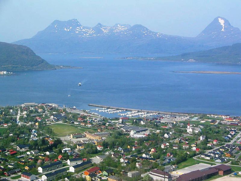
File:Nesna1.jpg · Wikimedia Commons · See Wikimedia Commons
Nesna Municipality
Sign in to savemunicipality in Nordland, Norway
OverviewAI-generated
Nesna Municipality is an active government entity located in Norway, with its city also named Nesna. The municipality was established in 1837, though some records indicate an inception date of 1838. It has a population of 1,838 people living in 861 households.
The area of the municipality is 402.82. Its official website is nesna.kommune.no. The subject is referenced by 171 other encyclopedia articles.
Synthesized by Vinony from 20 facts across 4 sources: Wikidata, Firecrawl, ROR, Vinony graph. Generated from structured data (not the Wikipedia text) and checked against those facts — may still contain errors.
Key facts
- Country
- Norway
- County
- Nordland
- District
- Helgeland
- Established
- 1 January 1838
- Created as
- Formannskapsdistrikt
- Administrative centre
- Nesna
- Mayor 2015
- Hanne Davidsen ( Ap )
- Total
- 183.19 km (70.73 sq mi)
- Land
- 181.30 km (70.00 sq mi)
- Water
- 1.89 km (0.73 sq mi) 1%
- Rank
- # 310 in Norway
- Highest elevation
- 921.75 m (3,024.1 ft)
- Density
- 9.9/km (26/sq mi)
- Change 10 years
- −4.9%
- Demonym
- Nesnaværing
- Norwegian form
- Bokmål
- Time zone
- UTC+01:00 ( CET )
- Summer dst
- UTC+02:00 ( CEST )
via Wikipedia infobox
Research organization · ROR
- Type
- Government
- Founded
- 1838
- Location
- Nesna, Norway
- Status
- Active
GRID grid.458261.c
Wikidata facts
- Instance of
- municipality of Norway
- Demonym
- nesning
- Country
- Norway
- Located in
- Nordland
- Capital
- Nesna
- Population
- 1796
- Area
- 0.29
- Time zone
- UTC+01:00
- Shares border with
- Dønna Municipality
- Official website
- www.nesna.kommune.no
- Image
- Nesna1.jpg
- Households
- 51
Show 6 more facts
- Commons gallery
- Nesna
- Commons category
- Nesna
- topic's main category
- Category:Nesna Municipality
- language used
- Bokmål
- inception
- 1837-00-00
- native label
- Nesna
via Wikidata · CC0
~10 min read
Encyclopedic overview
Nesna is a municipality in Nordland county, Norway. It is part of the Helgeland traditional region. The administrative centre of the municipality is the village of Nesna. Other villages in Nesna include Handnesneset, Husby, Saura, and Vikholmen.
Map of Nesna municipality The municipality consists of the three main islands Tomma, Hugla (known as "Hugløy" by its inhabitants), and Handnesøya, and one peninsula that bears the name of the municipality, Nesna. The old Husby Estate is headquartered in Husby on Tomma island.
Excerpted from Wikipedia’s “Nesna Municipality” article, available under the CC BY-SA 4.0 licence.
Gallery (8)
On the map
50 mapped locations