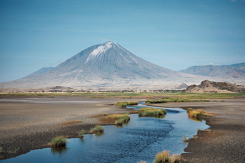
File:Lengai_from_Natron.jpg · Wikimedia Commons · See Wikimedia Commons
Key facts
- Elevation
- 2,962 m (9,718 ft)
- Prominence
- 1,360 m (4,460 ft)
- Isolation
- 16.68 km (10.36 mi)
- Formed by
- Volcanism along the Gregory Rift
- Mountain type
- Stratovolcano
via Wikipedia infobox
Wikidata facts
- Instance of
- mountain
- Country
- Tanzania
- Located in
- Ngorongoro District
- Elevation
- 2960
- Material used
- carbonatite
- Image
- Lengai from Natron.jpg
Show 6 more facts
- Commons category
- Ol Doinyo Lengai
- Commons gallery
- Ol Doinyo Lengai
- located in/on physical feature
- East African Rift
- mountain range
- Crater Highlands
- topographic prominence
- 1360
- topographic isolation
- 16.68
Sources (1)
via Wikidata · CC0
~21 min read
Encyclopedic overview
Mount Ol Doinyo Lengai from above in Aug 2021 Ol Doinyo Lengai is an active stratovolcano in northern Tanzania. It consists of a volcanic cone with two craters, the northern of which has erupted during historical time. Uniquely for volcanoes on Earth, it has erupted natrocarbonatite, an unusually low temperature and highly fluid type of magma. Eruptions in 2007–2008 affected the surrounding region.
Name
Excerpted from Wikipedia’s “Ol Doinyo Lengai” article, available under the CC BY-SA 4.0 licence.