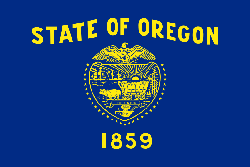
File:Flag_of_Oregon.svg · Wikimedia Commons · See Wikimedia Commons
Oregon
Sign in to saveAlso known as OR, Oregon, United States, State of Oregon, Ore., The Beaver State, Oreg., US-OR
État des États-Unis
Oregon is a state located in the Pacific Northwest region of the United States, bordered by Washington to the north, Idaho to the east, California and Nevada to the south, and the Pacific Ocean to the west. Its geographic position in the western United States makes it an important region along the Pacific coast and the Columbia River.
AI-generated from the Wikipedia summary — may contain errors.
Key facts
- U.S. state.name
- Oregon
- U.S. state.image_seal
- Seal of Oregon.svg
- U.S. state.image_map
- Oregon in United States.svg
- U.S. state.nickname
- The Beaver State
- U.S. state.motto
- Alis volat propriis
- U.S. state.anthem
- Oregon, My Oregon
- U.S. state.Former
- Oregon Territory
- U.S. state.seat
- Salem
- U.S. state.LargestCity
- Portland
- U.S. state.LargestCounty
- Multnomah
- U.S. state.LargestMetro
- Portland
- U.S. state.population_demonym
- Oregonian
- U.S. state.Lieutenant Governor_alt
- Secretary of State
- U.S. state.Upperhouse
- State Senate
- U.S. state.Lowerhouse
- House of Representatives
- U.S. state.Judiciary
- Oregon Supreme Court
- U.S. state.Representative
- 5 Democrats 1 Republican
- U.S. state.postal_code
- OR
via Wikipedia infobox
Research
116,606 papers- Oregon's experiment.ReviewHealth care analysis : HCA : journal of health philosophy and policy · 1993Brannigan MDOI: 10.1007/BF02196966
- The Perilous Policy of Oregon's Psilocybin Services.The journal of the American Academy of Psychiatry and the Law · 2023Holoyda BDOI: 10.29158/JAAPL.230023-23
- Oregon's bold experiment: whatever happened to rationing?ReviewJournal of health politics, policy and law · 1999Leichter HMDOI: 10.1215/03616878-24-1-147
- Oregon: does physician-assisted suicide work?ReviewJournal of law and medicine · 2004Rothschild A
- Oregon's Hospital Payment Cap and Enrollee Out-of-Pocket Spending and Service Use.JAMA health forum · 2024Murray RC, Norton EC, Ryan AMDOI: 10.1001/jamahealthforum.2024.2614
- Drug Decriminalization, Fentanyl, and Fatal Overdoses in Oregon.JAMA network open · 2024Zoorob MJ, Park JN, Kral AH et al.DOI: 10.1001/jamanetworkopen.2024.31612
- Oregon's Death With Dignity Act-Reply.JAMA oncology · 2018Blanke C, Ellis L, Meyskens FDOI: 10.1001/jamaoncol.2017.5323
- Oregon's bold Medicaid initiative.JAMA · 1991Stason WB
via PubMed
Wikidata facts
- Instance of
- U.S. state
- Part of
- Pacific Northwest
- Demonym
- Oregonano
- Country
- United States
- Located in
- United States
- Contains
- Lake County
- Continent
- North America
- Capital
- Salem
- Population
- 4237256
- Area
- 255026
- Elevation
- 1005
- Time zone
- Pacific Time Zone
- Body of water
- Snake River
- Head of government
- Tina Kotek
- Legislature
- Oregon Legislative Assembly
- Anthem
- Oregon, My Oregon
- Shares border with
- Washington
- Highest point
- Mount Hood
- Headquarters
- Salem
- Official website
- www.oregon.gov
- Image
- Columbia river gorge from crown point.jpg
- Households
- 1642579
- Motto
- Alis volat propriis
- Flag
- flag of Oregon
Show 35 more facts
- Significant event
- Nez Perce War
- topic's main Wikimedia portal
- Portal:Oregon
- Commons category
- Oregon
- topic's main category
- Category:Oregon
- inception
- 1859-02-14
- category for people born here
- Category:Births in Oregon
- category for people who died here
- Category:Deaths in Oregon
- category for films shot at this location
- Category:Films shot in Oregon
- category for people buried here
- Category:Burials in Oregon
- category of associated people
- Category:People from Oregon
- office held by head of government
- Governor of Oregon
- nickname
- Beaver State
- compulsory education (minimum age)
- 7
- compulsory education (maximum age)
- 18
- short name
- Ore.
- lowest point
- Pacific Ocean
- history of topic
- history of Oregon
- twinned administrative body
- Toyama Prefecture
- water as percent of area
- 2.43
- foundational text
- Constitution of Oregon
- motto
- Alis volat propriis
- native label
- Estado ng Oregon
- maximum temperature record
- 117
- minimum temperature record
- -54
- has seal, badge, or sigil
- Seal of Oregon
- marriageable age
- 18
- OpenStreetMap zoom level
- 6
- topic has template
- Template:Oregon
- official map URL
- geo.maps.arcgis.com/home/index.html
- different from
- Oregon
- related category
- Category:Oregon-related lists
- per capita income
- 35393
- mean age
- 39.5
- hashtag
- Oregon
- minimum wage
- 13.50
Sources (15)
via Wikidata · CC0
Article · Français
L'Oregon (/ɔ.ʁe.ɡɔ̃/ ; en anglais : /ˈɔɹɨɡən/ ) est un État du Nord-Ouest des États-Unis, situé sur la côte Pacifique entre les États de Washington au nord, de Californie au sud, du Nevada au sud-est, et de l'Idaho à l'est. Ses frontières au nord et à l'est suivent pour l'essentiel les cours du fleuve Columbia et de la rivière Snake. Le territoire est intégralement traversé par la chaîne des Cascades qui forme une importante barrière climatique : l'ouest de l'État, de climat océanique, est recouvert par la forêt tempérée humide tandis que sa partie est, semi-aride, est occupée par le Haut désert de l'Oregon. Le parc national de Crater Lake se trouve dans le sud de l'État. La réserve indienne de Warm Springs s'étend sur 2 640,2 km2 dans le nord de l'État, sur le versant Est de la chaîne des Cascades. L'actuel territoire de l'Oregon était occupé par les peuples amérindiens Bannocks, Chinook, Klamaths et Nez-Percé, il est atteint par l'expédition Lewis et Clark en 1805. À partir des années 1830, la piste de l'Oregon est empruntée par les pionniers dont le nombre dépasse rapidement celui des autochtones. Le traité de l'Oregon, signé le 15 juin 1846, fixe la frontière américano-canadienne et aboutit à la création du territoire de l'Oregon dont la partie sud-ouest qui forme l'Oregon actuel est admise le 14 février 1859 comme 33e État de l'Union. Entre 1902 et 1908, les efforts de la Direct Legislation League font de l'Oregon un précurseur en matière de démocratie directe (référendum, initiative populaire, révocation populaire des élus) par l'instauration de l'Oregon System qui s'étendra par la suite à d'autres États. L'Oregon est un État traditionnellement démocrate. Il est surnommé « L’État du castor » et ses habitants sont appelés Orégonais et Orégonaises. L'Oregon a pour capitale Salem tandis que la ville la plus peuplée est Portland. Cette dernière s'étend au nord de la vallée de la Willamette qui regroupe 70 % de la population orégonaise. L'ouest de Portland est occupé par le technopole de Silicon Forest qui accueille les principaux centres de recherche d'Intel, l'Oregon est également le berceau de Nike et de Columbia Sportswear Company. En 2019, sa population s'élève à 4 217 737 habitants.
Abstract from DBpedia / Wikipedia · CC BY-SA
Gallery (32)
On the map
2 mapped locations
Available in 198 languages
- Español
- Français
- Deutsch
- 中文
- 日本語
- Русский
- Português
- Italiano
- العربية
- हिन्दी
- Afrikaans
- Albanian
- Albanian
- Amharic
- Aragonese
- Aramaic
- Armenian
- Arpitan
Show 179 more
- Asturian
- Aymara
- azb
- Azerbaijani
- Bahasa Indonesia
- Balinese
- Bangla
- Basque
- bat_smg
- Bavarian
- be_x_old
- Belarusian
- Bhojpuri
- Bikol
- Bishnupriya
- Bislama
- Bosnian
- Breton
- Bulgarian
- Buriat
- Burmese
- Catalan
- cbk_zam
- cdo
- Cebuano
- Central Kurdish
- Chechen
- Chuvash
- Cornish
- Corsican
- Crimean Tatar
- Croatian
- Czech
- Danish
- Egyptian Arabic
- eml
- Esperanto
- Estonian
- Ewe
- Faroese
- Fiji Hindi
- Filipino
- Finnish
- Gagauz
- Galician
- Georgian
- Gothic
- Greek
- Guarani
- Gujarati
- Haitian Creole
- Hakka Chinese
- Hausa
- Hawaiian
- Hebrew
- Hungarian
- Icelandic
- Ido
- Igbo
- Iloko
- Inari Sami
- Interlingua
- Interlingue
- Inuktitut
- Inupiaq
- Irish
- Javanese
- Kabyle
- Kannada
- Kanuri
- Karachay-Balkar
- Kazakh
- kbp
- kge
- Kurdish
- Kyrgyz
- Ladino
- Latin
- Latvian
- Ligurian
- Limburgish
- Lingua Franca Nova
- Lithuanian
- lld
- Lojban
- Lombard
- Low German
- Luxembourgish
- Macedonian
- Maithili
- Malagasy
- Malay
- Malayalam
- Manipuri
- Manx
- Māori
- Marathi
- Mari
- Mazanderani
- Mingrelian
- Mongolian
- Moroccan Arabic
- Navajo
- nds_nl
- Nederlands
- Nepali
- Newari
- Northern Frisian
- Northern Luri
- Northern Sami
- Norwegian
- Norwegian Nynorsk
- Occitan
- Old English
- Oromo
- Ossetic
- Pali
- Pampanga
- Papiamento
- Pashto
- Picard
- Piedmontese
- Polski
- Punjabi
- Quechua
- Romanian
- Romansh
- Sanskrit
- Sardinian
- Saterland Frisian
- Scots
- Scottish Gaelic
- Serbian
- Serbian (Latin)
- Sicilian
- Silesian
- simple
- Sindhi
- Sinhala
- Slovak
- Slovenian
- Somali
- Svenska
- Swahili
- Tajik
- Talysh
- Tamil
- Tatar
- Tiếng Việt
- Toki Pona
- Tumbuka
- Türkçe
- Ukrainian
- Upper Sorbian
- Urdu
- Uyghur
- Uzbek
- Venetian
- Volapük
- Waray
- Welsh
- West Flemish
- Western Frisian
- Western Mari
- Western Panjabi
- Wu Chinese
- Xhosa
- Yakut
- Yiddish
- Yoruba
- Zaza
- Zeelandic
- zh_classical
- zh_min_nan
- zh_yue
- Zhuang
- فارسی
- ไทย
- 한국어
via Wikidata sitelinks · CC0