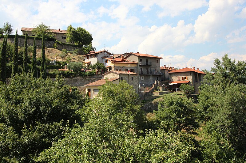
File:OrtignanoPanorama2.jpg · Wikimedia Commons · See Wikimedia Commons
Ortignano Raggiolo is a small municipality (comune) located in Italy. It is notable as one of Italy's many local administrative divisions that make up the country's regional governance structure.
AI-generated from the Wikipedia summary — may contain errors.
Key facts
- Country
- Italy
- Region
- Tuscany
- Province
- Arezzo (AR)
- Frazioni
- Badia a Tega, Raggiolo, San Piero in Frassino, Villa
- Mayor
- Fiorenzo Pistolesi
- Total
- 36.4 km (14.1 sq mi)
- Elevation
- 483 m (1,585 ft)
- Density
- 24.2/km (62.7/sq mi)
- Demonym s
- Ortignanesi and Raggiolatti
- Time zone
- UTC+1 ( CET )
- Summer dst
- UTC+2 ( CEST )
- Dialing code
- 0575
- Website
- Official website
via Wikipedia infobox
Wikidata facts
- Instance of
- comune of Italy
- Official name
- Ortignano Raggiolo
- Country
- Italy
- Located in
- Province of Arezzo
- Population
- 836
- Area
- 36.3
- Elevation
- 483
- Time zone
- UTC+02:00
- Shares border with
- Castel San Niccolò
- Official website
- www.comune.ortignano-raggiolo.ar.it
- Image
- OrtignanoPanorama2.jpg
- Dialing code
- 0575
- Licence plate code
- AR
- Patron saint
- Matthew the Apostle
Show 4 more facts
- Commons category
- Ortignano Raggiolo
- postal code
- 52010
- public holiday
- patronal festival
- member of
- The most beautiful villages in Italy
Sources (6)
via Wikidata · CC0
~1 min read
Encyclopedic overview
Raggiolo, view from Strada Provinciale 64 di Ortignano Raggiolo Ortignano Raggiolo is a comune (municipality) in the Province of Arezzo in the Italian region Tuscany, located about 40 kilometres (25 mi) southeast of Florence and about 25 kilometres (16 mi) northwest of Arezzo.
Ortignano Raggiolo borders the following municipalities: Bibbiena, Castel Focognano, Castel San Niccolò, Loro Ciuffenna, Poppi. It is one of I Borghi più belli d'Italia ("The most beautiful villages of Italy").
Excerpted from Wikipedia’s “Ortignano Raggiolo” article, available under the CC BY-SA 4.0 licence.