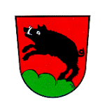
File:Wappen_Parkstein.png · Wikimedia Commons · See Wikimedia Commons
Parkstein
Sign in to saveParkstein (; Northern Bavarian: Parkstoa) is a municipality in the district of Neustadt an der Waldnaab in Bavaria in Germany. In 2020, it counted approximately 2,300 inhabitants. The origins of its castle, built atop a conical shaped mountain, also called the Parkstein, date back to around the year 1000. A first written account of its existence can be traced back to the year 1053 in the documentations of the monks of Niederalteich of the Reichstag in Merseburg. Parkstein was chartered in 1435.
Key facts
- German location.image_coa
- Wappen_Parkstein.png
- German location.image_plan
- Parkstein in NEW.svg
- German location.state
- Bayern
- German location.region
- Oberpfalz
- German location.district
- Neustadt a.d.Waldnaab
- German location.Verwaltungsgemeinschaft
- Neustadt an der Waldnaab
- German location.elevation
- 547
- German location.area
- 30.84
- German location.postal_code
- 92711
- German location.area_code
- 09602
- German location.licence
- NEW
- German location.Gemeindeschlüssel
- 09 3 74 144
- German location.divisions
- 13 Ortsteile
- German location.website
- www.parkstein.de
- German location.mayor
- Reinhard Sollfrank
- German location.leader_term
- 2020–26
via Wikipedia infobox
Wikidata facts
- Population
- 2359
- Area
- 30.84
- Elevation
- 547
- Official website
- www.parkstein.de
- Image
- St Pankratius - Parkstein 010.jpg
- Households
- 647
- Dialing code
- 09602
- Licence plate code
- NEW
Show 6 more facts
- Commons category
- Parkstein
- postal code
- 92711
- number of houses
- 457
- P8168
- Hans Deppe
- P12749
- Markus Husterer
- hashtag
- Parkstein
Sources (9)
via Wikidata · CC0
Article · Svenska
Parkstein är en köping (Markt) i Landkreis Neustadt an der Waldnaab i Regierungsbezirk Oberpfalz i förbundslandet Bayern i Tyskland. Den tidigare kommunen Ilsenbach uppgick 1 januari 1972 i Parkstein följt 1 januari 1978 av Eppenreuth och Wurz. Köping ingår i kommunalförbundet tillsammans med kommunerna Kirchendemenreuth, Störnstein, Püchersreuth och Theisseil.
Abstract from DBpedia / Wikipedia · CC BY-SA
Gallery (2)
On the map
2 mapped locations