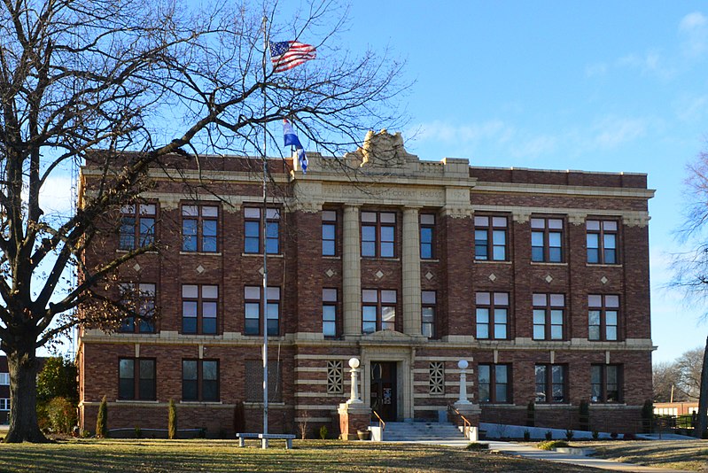
File:Pemiscot_Co_MO_Courthouse_20170128-3732.jpg · Wikimedia Commons · See Wikimedia Commons
Pemiscot County
Sign in to saveAlso known as Pemiscot County, Missouri, Pemiscot County, MO
county in Missouri, United States
Key facts
- Country
- United States
- State
- Missouri
- Founded
- February 19, 1851
- Named after
- Fox word meaning "liquid mud"
- Seat
- Caruthersville
- Largest city
- Caruthersville
- Total
- 513 sq mi (1,330 km )
- Land
- 493 sq mi (1,280 km )
- Water
- 21 sq mi (54 km ) 4.1%
- Estimate 2025
- 14,465
- Density
- 31.8/sq mi (12.3/km )
- Time zone
- UTC−6 ( Central )
- Summer dst
- UTC−5 ( CDT )
- Congressional district
- 8th
- Website
- www .pemiscotcounty .org
via Wikipedia infobox
Official website
Pemiscot County Government | Caruthersville, MO | The County Official Website
pemiscotcounty.org →Link to the official site · 6,535 chars · not written by Vinony
Wikidata facts
- Country
- United States
- Located in
- Missouri
- Contains
- Caruthersville
- Capital
- Caruthersville
- Population
- 15661
- Area
- 1327
- Shares border with
- Dyer County
- Official website
- www.pemiscotcounty.org
- Image
- Pemiscot Co MO Courthouse 20170128-3732.jpg
- Households
- 6640
Show 7 more facts
- Commons category
- Pemiscot County, Missouri
- topic's main category
- Category:Pemiscot County, Missouri
- inception
- 1851-00-00
- water as percent of area
- 4.1
- native label
- Pemiscot County
- per capita income
- 21634
- category of associated people
- Category:People from Pemiscot County, Missouri
Sources (11)
via Wikidata · CC0
~14 min read
Encyclopedic overview
Pemiscot County is a county located in the southeastern corner in the Bootheel in the U.S. state of Missouri, with the Mississippi River forming its eastern border. As of the 2020 census, the population was 15,661. The largest city and county seat is Caruthersville. The county was officially organized on February 19, 1851. It is named for the local bayou, taken from the word pem-eskaw, meaning "liquid mud", in the language of the native Meskwaki people. This has been an area of cotton plantations and later other commodity crops.
Murphy Mound Archeological Site has one of the largest platform mounds in Missouri. It is a major earthwork of the Late Mississippian culture, which had settlement sites throughout the Mississippi Valley and tributaries. The site is privately owned and is not open to the public. The site may have been occupied from as early as 1200 CE and continuing to about 1541.
Excerpted from Wikipedia’s “Pemiscot County” article, available under the CC BY-SA 4.0 licence.