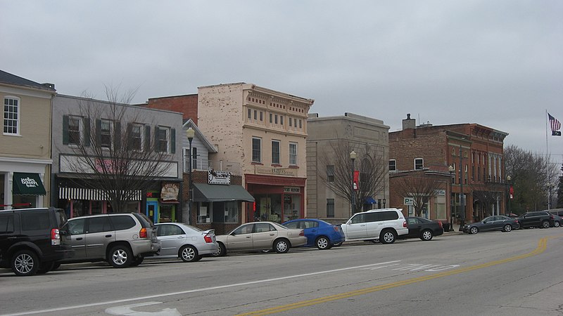
File:Louisiana_Avenue_in_downtown_Perrysburg.jpg · Wikimedia Commons · See Wikimedia Commons
Perrysburg
Sign in to saveAlso known as Perrysburg, Ohio, Perrysburg, OH
city in Wood County, Ohio, United States
Key facts
- Country
- United States
- State
- Ohio
- County
- Wood
- Total
- 11.93 sq mi (30.91 km )
- Land
- 11.89 sq mi (30.80 km )
- Water
- 0.042 sq mi (0.11 km )
- Elevation
- 637 ft (194 m)
- Density
- 1,818.6/sq mi (702.15/km )
- Time zone
- UTC-5 ( Eastern (EST) )
- Summer dst
- UTC-4 (EDT)
- Zip codes
- 43551–43552
- Fips code
- 39-62148
- Website
- www.perrysburgoh.gov/
via Wikipedia infobox
Wikidata facts
- Instance of
- city in the United States
- Official name
- Perrysburg
- Country
- United States
- Located in
- Wood County
- Population
- 25041
- Area
- 29.821713
- Elevation
- 192
- Official website
- ww1.ci.perrysburg.oh.us
- Households
- 8695
- Dialing code
- 419
Show 6 more facts
- postal code
- 43552
- Commons category
- Perrysburg, Ohio
- inception
- 1816-01-01
- P8168
- Sys
- water as percent of area
- 0
- per capita income
- 49330
Sources (9)
via Wikidata · CC0
~13 min read
Encyclopedic overview
Perrysburg is a city in Wood County, Ohio, United States. The population was 25,041 at the 2020 census. The city is along the south side of the Maumee River about 12 miles (19 km) southwest of Toledo and is part of the Toledo metropolitan area.
Perrysburg was surveyed and platted by a federal survey team in the summer of 1816. It served as the county seat from 1822 to 1868. A local legend has held that it was designed by noted architect Charles Pierre L'Enfant, after he planned Washington, DC, but this has not been supported by fact.
Excerpted from Wikipedia’s “Perrysburg” article, available under the CC BY-SA 4.0 licence.