File:Pouzilhac_30.JPG · Wikimedia Commons · See Wikimedia Commons
Pouzilhac
Sign in to saveAlso known as Posilhac
Pouzilhac (; ) is a French commune in the Gard department in southern France, formerly Languedoc-Roussillon.
OverviewAI-generated
Pouzilhac is a commune in France, situated within the Gard department and the arrondissement of Nîmes. It lies in the Occitanie region and shares borders with La Capelle-et-Masmolène, Connaux, Gaujac, and Saint-Victor-la-Coste. The administrative entity has an area of 16.04 and an elevation of 261 above sea level. Its postal code is 30210.
The population of the commune is 756, comprising 351 males and 362 females. Pouzilhac is associated with the canton of Redessan for electoral purposes, while also being located in the canton of Remoulins. A residential street in the area is named Rue du Campanile.
Synthesized by Vinony from 40 facts across 7 sources: Wikidata, Openweathermap, OpenStreetMap, GeoNames, Firecrawl, Vinony graph, Geo. Generated from structured data (not the Wikipedia text) and checked against those facts — may still contain errors.
Weather now
Key facts
- French commune.name
- Pouzilhac
- French commune.commune status
- Commune
- French commune.image
- Pouzilhac 30.JPG
- French commune.caption
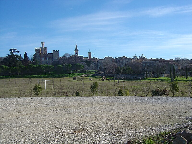
- A general view of Pouzilhac
- French commune.image coat of arms
- Blason de la ville de Pouzilhac (30).svg
- French commune.arrondissement
- Nîmes
- French commune.canton
- Redessan
- French commune.INSEE
- 30207
- French commune.postal code
- 30210
- French commune.mayor
- Thierry Astier
- French commune.term
- 2020–2026
- French commune.intercommunality
- Pont du Gard
- French commune.elevation m
- 230
- French commune.elevation min m
- 168
- French commune.elevation max m
- 261
- French commune.area km2
- 16.04
via Wikipedia infobox
Official website

Commune de Pouzilhac - Site officiel.
Bienvenue sur le site officiel de la commune de POUZILHAC. Actualités de la commune, démarches administratives, agenda des manifestations, contacts...
pouzilhac.fr →Link to the official site · 7,090 chars · not written by Vinony
Wikidata facts
- Instance of
- commune of France
- Official name
- Pouzilhac
- Country
- France
- Located in
- arrondissement of Nîmes
- Population
- 756
- Area
- 16.04
- Elevation
- 213
- Time zone
- UTC+02:00
- Shares border with
- Saint-Paul-les-Fonts
- Official website
- www.pouzilhac.fr
- Image
- Pouzilhac 30.JPG
Show 9 more facts
- Commons category
- Pouzilhac
- postal code
- 30210
- associated electoral district
- canton of Redessan
- male population
- 351
- female population
- 362
- P8168
- Irving Berlin
- email address
- mailto:[email protected]
- phone number
- +33-9-62-14-11-65
- fax number
- +33-4-66-37-45-26
Sources (4)
via Wikidata · CC0
~2 min read
Encyclopedic overview
6 sectionsContents
- Geography
- History
- Population
- Sights
- See also
- References
Pouzilhac (; ) is a French commune in the Gard department in southern France, formerly Languedoc-Roussillon.
==Geography== Pouzilhac is situated on the right bank of the Rhone next to the route national 86 and its close access to the A7 motorway (Remoulins, Tavel, Bollène). The commune covers 16 km² and has 733 inhabitants since the last population census in 2018. Surrounded by the municipalities of Valliguières, La Capelle-et-Masmolène and Saint-Paul-les-Fonts, Pouzilhac is located 14 km southwest of Bagnols-sur-Cèze, the largest city in the area. Located at 218 meters above sea level, the Ragouse is the main waterway that crosses the town of Pouzilhac.
Excerpted from Wikipedia’s “Pouzilhac” article, available under the CC BY-SA 4.0 licence.
Gallery (5)
On the map
2 mapped locations