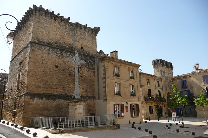
File:Rempart_à_Remoulins.JPG · Wikimedia Commons · See Wikimedia Commons
Remoulins
Sign in to saveAlso known as Remolins
Remoulins (; ) is a commune in the Gard department in southern France.
OverviewAI-generated
Remoulins is a commune in France, situated in the Gard department within the Occitanie region. It serves as the capital of the canton of Remoulins and is located in the arrondissement of Nîmes. The municipality has a postal code of 30210 and shares borders with Castillon-du-Gard, Fournès, Saint-Bonnet-du-Gard, and Saint-Hilaire-d'Ozilhan.
The area of Remoulins is 8.24 square kilometers, with an elevation above sea level of 122 meters. Its population is recorded as 2,381, comprising 1,103 males and 1,178 females. The commune is associated with the electoral district of the canton of Redessan.
Synthesized by Vinony from 39 facts across 6 sources: Wikidata, Openweathermap, OpenStreetMap, GeoNames, Vinony graph, Geo. Generated from structured data (not the Wikipedia text) and checked against those facts — may still contain errors.
Weather now
7-day forecast
via Open-Meteo
Place details
- Locality
- Remoulins
- Region
- Occitanie
- Country
- France
- Population
- 2,164
- Timezone
- Europe/Paris
via OpenStreetMap · GeoNames
Key facts
- French commune.name
- Remoulins
- French commune.commune status
- Commune
- French commune.image
- Rempart_à_Remoulins.JPG
- French commune.caption
- Old town walls
- French commune.image coat of arms
- Blason de la ville de Remoulins (30).svg
- French commune.arrondissement
- Nîmes
- French commune.canton
- Redessan
- French commune.INSEE
- 30212
- French commune.postal code
- 30210
- French commune.mayor
- Nicolas Cartailler
- French commune.term
- 2020–2026
- French commune.intercommunality
- Pont du Gard
- French commune.elevation m
- 27
- French commune.elevation min m
- 6
- French commune.elevation max m
- 122
- French commune.area km2
- 8.24
via Wikipedia infobox
Wikidata facts
- Instance of
- commune of France
- Official name
- Remoulins
- Country
- France
- Located in
- arrondissement of Nîmes
- Population
- 2278
- Area
- 8.24
- Elevation
- 29
- Time zone
- UTC+02:00
- Capital of
- canton of Remoulins
- Shares border with
- Vers-Pont-du-Gard
- Official website
- www.remoulins.fr
- Image
- Eglise à Remoulins 2.JPG
Show 9 more facts
- Commons category
- Remoulins
- postal code
- 30210
- native label
- Remoulins
- associated electoral district
- canton of Redessan
- male population
- 1103
- female population
- 1178
- P8168
- Sabeco
- email address
- mailto:[email protected]
- phone number
- +33-4-66-37-14-50
via Wikidata · CC0
Travel guide
Get around
From the main road it is a short 5-minute walk to the Pont du Gard visitor centre. The aqueduct is a further 5-minute walk from here.
Do
This is a popular place for Hikers and cyclists and is on several well marked trails. A booklet is available from the visitors center for €4 detailing trails around the bridge. Canoe France offers the chance to canoe along the Gardon and under the bridge on several different trips. It is possible to swim in the water near the bridge, it is quite cold and very rocky so best be prepared with old shoes.
Buy
There are many tourist orientated shops in the town, as well as at the visitor centre.
Eat
The only food can be bought from the visitor centre
Drink
The only drinks can be bought from the visitor centre
Sleep
It may be best to visit as a day trip from a base in Avignon or Nîmes.
Respect
The Pont du Gard is the most visited antique site in France, with over one million visitors per year. It is, however, located in a fragile Mediterranean environment. A few basic rules should therefore be observed, please: take your waste away with you; stay on the marked paths; keep dogs on a lead; do not pick any plants; do not light fires; do not jump or dive from the bridge
Travel guide from Wikivoyage (CC BY-SA 4.0)
~1 min read
Encyclopedic overview
5 sectionsContents
- Population
- Transport
- See also
- References
- External links
Remoulins (; ) is a commune in the Gard department in southern France.
The town lies on the River Gardon or Gard, and is a short distance downstream of the Roman aqueduct Pont du Gard, in nearby Vers-Pont-du-Gard.
Excerpted from Wikipedia’s “Remoulins” article, available under the CC BY-SA 4.0 licence.
Gallery (2)
On the map
2 mapped locations