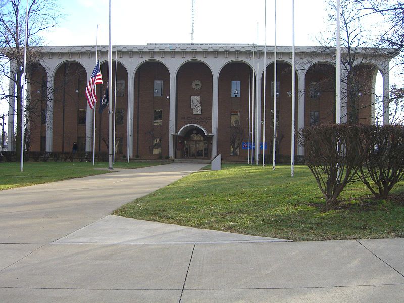
File:Richland_Co_CIMG9449.JPG · Wikimedia Commons · See Wikimedia Commons
Richland County
Sign in to saveAlso known as Richland County, Ohio, Richland County, OH
county in Ohio, United States
Key facts
- Country
- United States
- State
- Ohio
- Founded
- March 1, 1813
- Named after
- their fertile soil
- Seat
- Mansfield
- Largest city
- Mansfield
- Total
- 500 sq mi (1,300 km )
- Land
- 495 sq mi (1,280 km )
- Water
- 4.8 sq mi (12 km ) 1.0%
- Estimate 2025
- 124,893
- Density
- 250/sq mi (97/km )
- Time zone
- UTC−5 ( Eastern )
- Summer dst
- UTC−4 ( EDT )
- Congressional district
- 4th
- Website
- www .richlandcountyoh .gov
via Wikipedia infobox
Wikidata facts
- Country
- United States
- Located in
- Ohio
- Contains
- Mansfield
- Capital
- Mansfield
- Population
- 124936
- Area
- 1296
- Shares border with
- Huron County
- Official website
- www.richlandcountyoh.us
- Image
- Richland Co CIMG9449.JPG
- Households
- 48967
- Licence plate code
- 70
Show 9 more facts
- Commons category
- Richland County, Ohio
- topic's main category
- Category:Richland County, Ohio
- inception
- 1808-01-30
- category of associated people
- Category:People from Richland County, Ohio
- different from
- Richland Parish
- water as percent of area
- 1
- native label
- Richland County
- topic has template
- Template:Richland County, Ohio
- per capita income
- 25570
Sources (11)
via Wikidata · CC0
~9 min read
Encyclopedic overview
Richland County is a county located in the U.S. state of Ohio. As of the 2020 census, the population was 124,936. Its county seat is Mansfield. The county was created in 1808 and later organized in 1813. It is named for the fertile soil found there. Richland County is included in the Mansfield, OH Metropolitan Statistical Area as well as the Mansfield-Ashland-Bucyrus, OH Combined Statistical Area. The county is one of the six Metropolitan Statistical Areas that make up Northeast Ohio.
History
Excerpted from Wikipedia’s “Richland County” article, available under the CC BY-SA 4.0 licence.