File:Roburent-inverno.jpg · Wikimedia Commons · See Wikimedia Commons
Roburent
Sign in to saveRoburent () is a comune (commune or municipality) of the Province of Cuneo in the Italian region Piedmont. It is located about south of Turin and about southeast of Cuneo. its population was 552. The comune extends over a largely wooded area of ranging in elevation from above sea level and straddling the Corsaglia and Casotto valleys. It borders the municipalities of Frabosa Soprana, Garessio, Montaldo di Mondovì, Ormea, Pamparato, and Torre Mondovì.
Key facts
- Italian comune.name
- Roburent
- Italian comune.official_name
- Comune di Roburent
- Italian comune.image_skyline
- Roburent-inverno.jpg
- Italian comune.image_caption
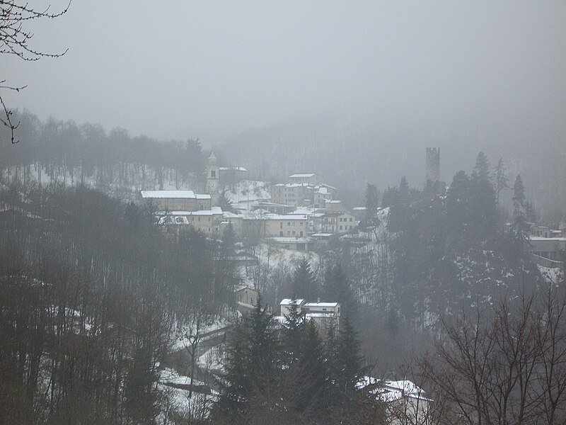
- Roburent in winter
- Italian comune.region
- Piedmont
- Italian comune.province
- Province of Cuneo (CN)
- Italian comune.frazioni
- Cardini, Pra, San Giacomo
- Italian comune.mayor
- Emiliano Negro (lista civica; elected 9 June 2024)
- Italian comune.area_total_km2
- 29.9
- Italian comune.population_total
- 552
- Italian comune.population_as_of
- 1 January 2009
- Italian comune.population_demonym
- Roburentesi
- Italian comune.elevation_m
- 788
- Italian comune.postal_code
- 12080
- Italian comune.area_code
- 0174
- Italian comune.website
- www.comune.roburent.cn.it
via Wikipedia infobox
Wikidata facts
- Instance of
- comune of Italy
- Official name
- Roburent
- Demonym
- roburentesi
- Country
- Italy
- Located in
- Province of Cuneo
- Population
- 474
- Area
- 29.81
- Elevation
- 788
- Time zone
- UTC+02:00
- Shares border with
- Pamparato
- Official website
- www.comune.roburent.cn.it
- Image
- Roburent.jpg
- Dialing code
- 0174
- Licence plate code
- CN
- Patron saint
- Syrus of Genoa
Show 2 more facts
- Commons category
- Roburent
- postal code
- 12080
Sources (6)
via Wikidata · CC0
~4 min read
Encyclopedic overview
3 sectionsContents
- Population centres and trends
- References
- External links
Roburent () is a comune (commune or municipality) of the Province of Cuneo in the Italian region Piedmont. It is located about south of Turin and about southeast of Cuneo. its population was 552. The comune extends over a largely wooded area of ranging in elevation from above sea level and straddling the Corsaglia and Casotto valleys. It borders the municipalities of Frabosa Soprana, Garessio, Montaldo di Mondovì, Ormea, Pamparato, and Torre Mondovì.
== Population centres and trends == There are two main centres of population within the municipal boundaries. Roburent itself, which stands at above sea level, is the capoluogo and site of the municipal administration; it had 183 inhabitants at the time of the 2001 census. San Giacomo at had a resident population of 247. Istat identified Pra (1014 m, pop. 12) as the third well-defined ‘populated centre’ (centro abitato). There were also eight minor settlements classified as ‘populated nuclei’ (nuclei abitati): Cardini (1153 m, pop. 35), Costacalda (1135 m, pop. 6), Mondini (920 m, pop. 14), Montà (780 m, pop. 12), Mottoni (964 m, pop. 2), Nasi (850 m, pop. 9), Patelle (1114 m, pop. 7), and Zitella (800 m, pop. 8).
Excerpted from Wikipedia’s “Roburent” article, available under the CC BY-SA 4.0 licence.
On the map
2 mapped locations