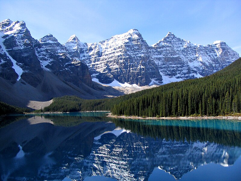
File:Moraine_Lake_17092005.jpg · Wikimedia Commons · See Wikimedia Commons
Rocky Mountains
Sign in to saveAlso known as Rockies, The Rockies
major mountain range in western North America
The Rocky Mountains are a major mountain range that stretches across western North America, forming one of the continent's most significant geographical features. They matter because they influence weather patterns, water systems, and ecosystems across a vast region, while also playing an important role in the history, economy, and culture of North America.
AI-generated from the Wikipedia summary — may contain errors.
Wikidata facts
- Instance of
- mountain range
- Country
- United States
- Located in
- Utah
- Continent
- North America
- Elevation
- 4401
- Highest point
- Mount Elbert
- Material used
- sedimentary rock
- Image
- Moraine Lake 17092005.jpg
- Width
- 650
- Length
- 3000
Show 8 more facts
- on focus list of Wikimedia project
- Wikipedia:Vital articles/Level/4
- described by source
- Granat Encyclopedic Dictionary
- Commons category
- Rocky Mountains
- topic's main category
- Category:Rocky Mountains
- Commons gallery
- Rocky Mountains
- mountain range
- North American Cordillera
- time period
- Precambrian
- native label
- montagnes Rocheuses
Sources (2)
via Wikidata · CC0
~30 min read
Encyclopedic overview
The Rocky Mountains, also known as the Rockies, are a major mountain range and the largest mountain system in North America. The Rocky Mountains stretch 3,000 mi (4,800 km) in a straight-line distance from the northernmost part of Western Canada, to New Mexico in the Southwestern United States. Depending on differing definitions between Canada and the U.S., its northern terminus is located either in northern British Columbia's Terminal Range south of the Liard River and east of the Trench, or in the northeastern foothills of the Brooks Range/British Mountains that face the Beaufort Sea coasts between the Canning River and the Firth River across the Alaska–Yukon border. Its southernmost point is near the Albuquerque metropolitan area, adjacent to the Rio Grande rift, and north of the Sandia–Manzano Mountain Range, also near Santa Fe, New Mexico. Being the easternmost portion of the North American Cordillera, the Rockies are distinct from the tectonically younger Cascade Range and Sierra Nevada, which both lie farther to its west.
The Rockies formed 55 million to 80 million years ago during the Laramide orogeny, in which a number of plates began sliding underneath the North American plate. The angle of subduction was shallow, resulting in a broad belt of mountains running down western North America. Since then, further tectonic activity and erosion by glaciers have sculpted the Rockies into dramatic peaks and valleys. At the end of the last ice age, humans began inhabiting the mountain range. After explorations of the range by Europeans, such as Sir Alexander Mackenzie, and Anglo-Americans, such as the Lewis and Clark Expedition, natural resources such as minerals and fur drove the initial economic exploitation of the mountains, although the range itself has never experienced a dense population.
Excerpted from Wikipedia’s “Rocky Mountains” article, available under the CC BY-SA 4.0 licence.
Gallery (12)
On the map
2 mapped locations
Available in 150 languages
- Español
- Français
- Deutsch
- 中文
- 日本語
- Русский
- Português
- Italiano
- العربية
- हिन्दी
- Afrikaans
- Albanian
- Albanian
- Amharic
- Aragonese
- Armenian
- Assamese
- Asturian
Show 131 more
- Avaric
- Awadhi
- azb
- Azerbaijani
- Bahasa Indonesia
- Bangla
- Bashkir
- Basque
- bat_smg
- Bavarian
- be_x_old
- Belarusian
- Bhojpuri
- Bikol
- Bosnian
- Breton
- Bulgarian
- Buriat
- Burmese
- Catalan
- Cebuano
- Central Kurdish
- Chechen
- Cheyenne
- Cornish
- Corsican
- Crimean Tatar
- Croatian
- Czech
- Danish
- Egyptian Arabic
- Esperanto
- Estonian
- Faroese
- Fiji Hindi
- Filipino
- Finnish
- Galician
- gcr
- Georgian
- Greek
- Guarani
- Hakka Chinese
- Hebrew
- Hungarian
- Icelandic
- Ido
- Iloko
- Interlingua
- Interlingue
- Irish
- Javanese
- Kabyle
- Kara-Kalpak
- Karachay-Balkar
- Kazakh
- Kurdish
- Kyrgyz
- Latin
- Latvian
- Lezghian
- Lingua Franca Nova
- Lithuanian
- lld
- Lombard
- Low German
- Luxembourgish
- Macedonian
- Malagasy
- Malay
- Malayalam
- Marathi
- Mari
- Mingrelian
- Mongolian
- Navajo
- Nederlands
- Newari
- Northern Frisian
- Norwegian
- Norwegian Nynorsk
- nrm
- Occitan
- Old English
- Ossetic
- Piedmontese
- Polski
- Punjabi
- roa_tara
- Romanian
- Rusyn
- Sardinian
- Scots
- Scottish Gaelic
- Serbian
- Serbian (Latin)
- Sicilian
- simple
- Sindhi
- Slovak
- Slovenian
- Standard Moroccan Tamazight
- Svenska
- Swahili
- Tajik
- Tamil
- Tatar
- Telugu
- Tiếng Việt
- Toki Pona
- Türkçe
- Turkmen
- Ukrainian
- Urdu
- Uyghur
- Uzbek
- Venetian
- Veps
- Waray
- Welsh
- Western Frisian
- Western Panjabi
- Wu Chinese
- Yiddish
- Zaza
- zh_classical
- zh_min_nan
- zh_yue
- فارسی
- ไทย
- 한국어
via Wikidata sitelinks · CC0