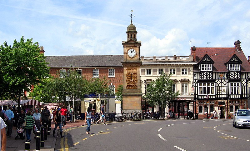
File:Rugby_town_centre.jpg · Wikimedia Commons · See Wikimedia Commons
Key facts
- Population
- 78,117 ( 2021 census )
- Demonym
- Rugbeian
- Os grid reference
- SP5075
- District
- Rugby
- Shire county
- Warwickshire
- Region
- West Midlands
- Country
- England
- Sovereign state
- United Kingdom
- Post town
- RUGBY
- Postcode district
- CV21, CV22, CV23
- Dialling code
- 01788
- Police
- Warwickshire
- Fire
- Warwickshire
- Ambulance
- West Midlands
- Uk parliament
- Rugby
via Wikipedia infobox
Official website
Home - Rugby Borough Council
Rugby Borough Council is the primary local authority for the borough of Rugby, in the heart of the English Midlands.
rugby.gov.uk →Link to the official site · 7,471 chars · not written by Vinony
Wikidata facts
- Instance of
- market town
- Country
- United Kingdom
- Located in
- Rugby
- Population
- 70627
- Time zone
- UTC+01:00
- Capital of
- Rugby
- Shares border with
- Northampton
- Official website
- www.rugby.gov.uk
- Image
- Rugby town hall.jpg
- Dialing code
- 01788
Show 12 more facts
- twinned administrative body
- Rüsselsheim am Main
- Commons category
- Rugby, Warwickshire
- topic's main category
- Category:Rugby, Warwickshire
- category of associated people
- Category:People from Rugby, Warwickshire
- category for people born here
- Category:Births in Rugby, Warwickshire
- category for people who died here
- Category:Deaths in Rugby, Warwickshire
- OS grid reference
- SP5075
- postal code
- CV23
- described by source
- Encyclopædia Britannica 11th edition
- P8168
- COBRA
- different from
- Rugby
- P12749
- Railway Square
Sources (7)
via Wikidata · CC0
~40 min read
Encyclopedic overview
Rugby is a market town in eastern Warwickshire, England, close to the River Avon. At the 2021 census, its population was 78,117, making it the second-largest town in Warwickshire. It is the main settlement within the larger Borough of Rugby, which had a population of 114,400 in 2021.
Rugby is situated on the eastern edge of Warwickshire, near to the borders with Leicestershire and Northamptonshire. It is the most easterly town within the West Midlands region, with the nearby county borders also marking the regional boundary with the East Midlands. It is 83 miles (134 km) north of London, 30 miles (48 km) east-south-east of Birmingham, 11.5 miles (18.5 km) east of Coventry, 18 miles (29 km) north-west of Northampton and 19 miles (31 km) south-south-west of Leicester.
Excerpted from Wikipedia’s “Rugby” article, available under the CC BY-SA 4.0 licence.