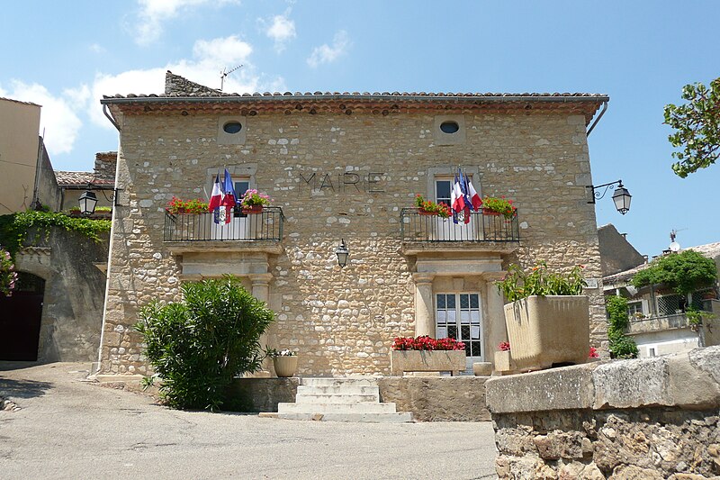
File:Mairie_à_Saint-André-de-Roquepertuis.JPG · Wikimedia Commons · See Wikimedia Commons
Saint-André-de-Roquepertuis
Sign in to saveAlso known as Roquepertuis, Sent Andrieu de Ròcapertúsa, Ròcapertúsa
Saint-André-de-Roquepertuis (; ) is a commune in the Gard department in southern France.
OverviewAI-generated
Saint-André-de-Roquepertuis is a commune in France, situated in the Gard department within the arrondissement of Nîmes. It is located in the Occitanie region and shares borders with Cornillon, Goudargues, Issirac, and Méjannes-le-Clap. The commune has an area of 12.18 and an elevation of 309 above sea level. Its postal code is 30630, and it is associated with the canton of Pont-Saint-Esprit.
The population of Saint-André-de-Roquepertuis is listed as 611, comprising 311 males and 283 females. Another source records the population as 430. The official name of the commune is Saint-André-de-Roquepertuis, also referred to as Roquepertuis.
Synthesized by Vinony from 36 facts across 6 sources: Wikidata, Openweathermap, OpenStreetMap, GeoNames, Vinony graph, Geo. Generated from structured data (not the Wikipedia text) and checked against those facts — may still contain errors.
Weather now
cached 21h agoPlace details
- Locality
- Saint-André-de-Roquepertuis
- Region
- Occitanie
- Country
- France
- Population
- 430
via OpenStreetMap · GeoNames
Key facts
- French commune.name
- Saint-André-de-Roquepertuis
- French commune.commune status
- Commune
- French commune.image
- Mairie à Saint-André-de-Roquepertuis.JPG
- French commune.caption
- Town hall
- French commune.image coat of arms
- Blason de la ville de Saint-André-de-Roquepertuis (30).svg
- French commune.arrondissement
- Nîmes
- French commune.canton
- Pont-Saint-Esprit
- French commune.INSEE
- 30230
- French commune.postal code
- 30630
- French commune.mayor
- Fabienne Michel
- French commune.term
- 2020–2026
- French commune.intercommunality
- CA Gard Rhodanien
- French commune.elevation m
- 83
- French commune.elevation min m
- 70
- French commune.elevation max m
- 309
- French commune.area km2
- 12.18
via Wikipedia infobox
Wikidata facts
- Instance of
- commune of France
- Official name
- Roquepertuis
- Country
- France
- Located in
- arrondissement of Nîmes
- Population
- 562
- Area
- 12.18
- Elevation
- 156
- Time zone
- UTC+02:00
- Shares border with
- Montclus
- Official website
- www.saint-andre-de-roquepertuis.fr
- Image
- Mairie à Saint-André-de-Roquepertuis.JPG
Show 8 more facts
- Commons category
- Saint-André-de-Roquepertuis
- postal code
- 30630
- associated electoral district
- canton of Pont-Saint-Esprit
- male population
- 311
- female population
- 283
- email address
- mailto:[email protected]
- phone number
- +33-4-66-82-21-41
- fax number
- +33-4-66-82-25-42
via Wikidata · CC0
~1 min read
Encyclopedic overview
3 sectionsContents
- Population
- See also
- References
Saint-André-de-Roquepertuis (; ) is a commune in the Gard department in southern France.
==Population==
Excerpted from Wikipedia’s “Saint-André-de-Roquepertuis” article, available under the CC BY-SA 4.0 licence.
Gallery (2)
On the map
2 mapped locations