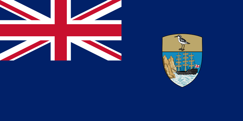
File:Flag_of_Saint_Helena.svg · Wikimedia Commons · See Wikimedia Commons
Saint Helena
Sign in to saveAlso known as St Helena, SH-HL, St. Helena
island in the South Atlantic Ocean
OverviewAI-generated
Saint Helena is an island with a population of 3924. It measures 15 in length and 11 in width, covering an area of 121. The highest elevation above sea level is 818. The island was discovered in 1502.
It is associated with the maritime identification digits "665" and the Commonwealth Sport country code "SHE". The Unicode character for the subject is "🇸🇭". Its Commons category is "Saint Helena Island". The subject is referenced by 4,695 other encyclopedia articles.
Synthesized by Vinony from 11 facts across 2 sources: Wikidata, Vinony graph. Generated from structured data (not the Wikipedia text) and checked against those facts — may still contain errors.
Wikidata facts
- Instance of
- crown colony
- Named after
- Helena Augusta
- Demonym
- Saints
- Continent
- Africa
- Official language
- English language
- Population
- 3924
- Area
- 121
- Elevation
- 818
- Body of water
- South Atlantic Ocean
- Legislature
- Legislative Council of Saint Helena
- Highest point
- Diana's Peak
- Image
- Saint Helena Island.jpg
- Width
- 11
- Length
- 15
Show 13 more facts
- maritime identification digits
- 665
- lowest point
- Atlantic Ocean
- Commons category
- Saint Helena Island
- topic's main category
- Category:Saint Helena
- geography of topic
- geography of Saint Helena
- category of associated people
- Category:Saint Helenian people
- heritage designation
- Tentative World Heritage Site
- Unicode character
- 🇸🇭
- P8168
- 5494 Johanmohr
- time of discovery or invention
- 1502-00-00
- P12749
- Adam Brand
- driving side
- left
- Commonwealth Sport country code
- SHE
Sources (10)
via Wikidata · CC0
~40 min read
Encyclopedic overview
Saint Helena (/ˌsɛnt (h)ɪˈliːnə, ˌsɪnt-, sənt-/, US: /ˌseɪnt-/; US: /ˌseɪnt ˈhɛlənə/ ) is a volcanic tropical island located in the South Atlantic Ocean, west of Africa. The nearest countries geographically are Angola and Namibia. The island is about 1,950 km (1,210 mi) west of Angola, and 4,000 km (2,500 mi) east of Rio de Janeiro, Brazil. It is one of the three constituent parts of Saint Helena, Ascension and Tristan da Cunha, a British overseas territory.
Saint Helena measures about 16 by 8 km (10 by 5 mi) with a population of 4,439 in the 2021 census. It was named after Saint Helena (c. AD 246/248–330), the mother of the Roman emperor Constantine I. It is one of the most remote major islands in the world and was uninhabited until the 16th century, when discovered by the Portuguese explorers en route around the continent of Africa in 1502. For about the next four centuries, the island was an important stopover for ships between Europe and Asia sailing around the African continent, before the opening of the shortcut Suez Canal in 1869.
Excerpted from Wikipedia’s “Saint Helena” article, available under the CC BY-SA 4.0 licence.
Gallery (12)
On the map
3 mapped locations
Available in 126 languages
- Español
- Français
- Deutsch
- 中文
- 日本語
- Русский
- Português
- Italiano
- العربية
- हिन्दी
- Achinese
- Afrikaans
- Albanian
- Albanian
- Amharic
- Aragonese
- Armenian
- Asturian
Show 107 more
- Azerbaijani
- Bahasa Indonesia
- Bangla
- Basque
- Bavarian
- be_x_old
- Belarusian
- Bishnupriya
- Bosnian
- Breton
- Bulgarian
- Catalan
- cdo
- Cebuano
- Central Kurdish
- Chechen
- Chuvash
- Colognian
- Cornish
- Corsican
- Croatian
- Czech
- Danish
- Divehi
- Egyptian Arabic
- Esperanto
- Estonian
- Filipino
- Finnish
- Gagauz
- Galician
- Georgian
- Greek
- Hakka Chinese
- Hausa
- Hebrew
- Hungarian
- Icelandic
- Ido
- Igbo
- Interlingue
- Irish
- Javanese
- Kazakh
- Kinyarwanda
- Kyrgyz
- Latin
- Latvian
- Ligurian
- Limburgish
- Lithuanian
- Lombard
- Low German
- Luxembourgish
- Macedonian
- Malay
- Malayalam
- Manx
- Marathi
- Mingrelian
- Mongolian
- Nederlands
- Northern Sami
- Northern Sotho
- Norwegian
- Norwegian Nynorsk
- nrm
- Occitan
- Old English
- Ossetic
- Pashto
- Polski
- Punjabi
- Romanian
- Scots
- Serbian
- Serbian (Latin)
- Shan
- simple
- Slovak
- Slovenian
- Southern Sotho
- Svenska
- Swahili
- Tamil
- Tatar
- Telugu
- Tiếng Việt
- Tsonga
- Türkçe
- Ukrainian
- Urdu
- Uyghur
- Uzbek
- Venetian
- Waray
- Welsh
- Western Frisian
- Western Panjabi
- Wolof
- Wu Chinese
- Yoruba
- zh_min_nan
- zh_yue
- فارسی
- ไทย
- 한국어
via Wikidata sitelinks · CC0