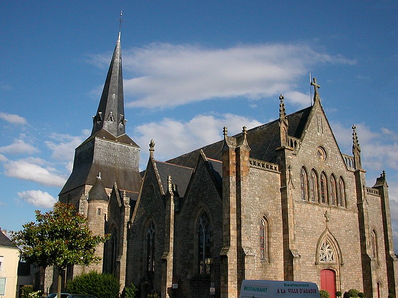
File:Saint-Herblain_église_Saint-Hermeland.jpg · Wikimedia Commons · See Wikimedia Commons
Saint-Herblain
Sign in to saveAlso known as Sant-Ervlan, Saint Herblain, St Herblain
Saint-Herblain (; Gallo: Saent-Erbelaen, , ) is a commune in the Loire-Atlantique department, administrative region of Pays de la Loire, France.
OverviewAI-generated
Saint-Herblain is a commune in the Loire-Atlantique department of France, located in the Pays de la Loire region. It lies near the Loire river and shares borders with Bouguenais, Couëron, Indre, and Nantes. The town serves as the capital for the cantons of Saint-Herblain-Est, Saint-Herblain-Ouest-Indre, Saint-Herblain-1, and Saint-Herblain-2. Its official name is Saint-Herblain, and it operates under the postal code 44800.
The population of Saint-Herblain is recorded at 50,973, comprising 21,751 males and 24,517 females. Another source lists the population as 46,898. The commune covers an area of 30.02 square kilometers and sits at an elevation of 64 meters above sea level, with other measurements indicating elevations of 25 and 23 meters. Saint-Herblain is twinned with Waterford, Viladecans, Cleja, and Kazanlak.
Synthesized by Vinony from 52 facts across 7 sources: Wikidata, Open Meteo, Openweathermap, OpenStreetMap, GeoNames, Vinony graph, Geo. Generated from structured data (not the Wikipedia text) and checked against those facts — may still contain errors.
Weather now
cached 18h ago7-day forecast
via Open-Meteo
Place details
- Locality
- Saint-Herblain
- Region
- Pays de la Loire
- Country
- France
- Population
- 46,898
- Timezone
- Europe/Paris
via OpenStreetMap · GeoNames
Key facts
- French commune.name
- Saint-Herblain
- French commune.native name
- (Gallo)
- French commune.commune status
- Commune
- French commune.image coat of arms
- Blason ville fr Saint-Herblain (Loire-Atlantique).svg
- French commune.image
- Saint-Herblain église Saint-Hermeland.jpg
- French commune.arrondissement
- Nantes
- French commune.canton
- Saint-Herblain-1 and 2
- French commune.INSEE
- 44162
- French commune.postal code
- 44800
- French commune.mayor
- Bertrand Affilé
- French commune.term
- 2020–2026
- French commune.intercommunality
- Nantes Métropole
- French commune.elevation min m
- 1
- French commune.elevation max m
- 64
- French commune.area km2
- 30.02
via Wikipedia infobox
Wikidata facts
- Instance of
- commune of France
- Official name
- Saint-Herblain
- Country
- France
- Located in
- arrondissement of Nantes
- Population
- 50973
- Area
- 30.02
- Elevation
- 37
- Time zone
- UTC+02:00
- Body of water
- Loire
- Capital of
- canton of Saint-Herblain-1
- Shares border with
- Sautron
- Official website
- www.saint-herblain.fr
- Image
- Saint-Herblain mairie.jpg
Show 12 more facts
- twinned administrative body
- Kazanlak
- Commons category
- Saint-Herblain
- postal code
- 44800
- topic's main category
- Category:Saint-Herblain
- male population
- 21751
- female population
- 24517
- social media followers
- 2388
- P8168
- Bagheera kiplingi
- associated electoral district
- canton of Saint-Herblain-2
- email address
- mailto:[email protected]
- contact page URL
- www.saint-herblain.fr/nous-contacter
- phone number
- +33-2-28-25-20-00
via Wikidata · CC0
~1 min read
Encyclopedic overview
9 sectionsContents
- History
- Population
- Breton language
- Transport
- Buildings and structures
- Twin towns - sister cities
- See also
- References
- External links
Saint-Herblain (; Gallo: Saent-Erbelaen, , ) is a commune in the Loire-Atlantique department, administrative region of Pays de la Loire, France.
It is the largest suburb of the city of Nantes, and lies adjacent to its west side.
Excerpted from Wikipedia’s “Saint-Herblain” article, available under the CC BY-SA 4.0 licence.
Gallery (4)
On the map
2 mapped locations