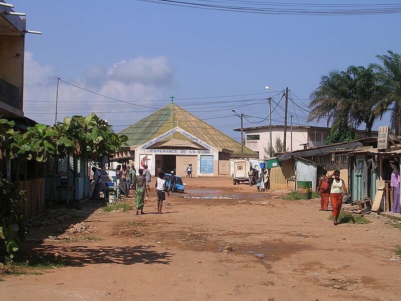
File:San_Pédro-église.JPG · Wikimedia Commons · See Wikimedia Commons
OverviewAI-generated
San-Pédro is a city and tourist destination in Ivory Coast, situated within the Bas-Sassandra Region. It serves as the capital of the Bas-Sassandra Region, San-Pédro Region, San Pédro Department, and Bas-Sassandra District. The city is located near the Gulf of Guinea and the Atlantic Ocean, sharing borders with Soubré, Sassandra, and Tabou. Its elevation above sea level is recorded at 12 meters, with other sources citing figures of 9 and 21 meters.
The population of San-Pédro is 390,654. It operates in the UTC±00:00 time zone, also identified as Africa/Abidjan. The local dialing code is 225.
Synthesized by Vinony from 45 facts across 7 sources: Wikidata, Open Meteo, Openweathermap, OpenStreetMap, GeoNames, Vinony graph, Geo. Generated from structured data (not the Wikipedia text) and checked against those facts — may still contain errors.
Weather now
cached 20h ago7-day forecast
via Open-Meteo
Place details
- Locality
- San-Pédro
- Region
- Bas-Sassandra
- Country
- Côte d’Ivoire
- Population
- 390,654
- Timezone
- Africa/Abidjan
via OpenStreetMap · GeoNames
Key facts
- Ivory coast
- Ivory Coast
- District
- Bas-Sassandra
- Region
- San-Pédro
- Department
- San-Pédro
- Total
- 887 km (342 sq mi)
- Elevation
- 1 m (3.3 ft)
- Density
- 440/km (1,140/sq mi)
- City
- 164,944
via Wikipedia infobox
Wikidata facts
- Instance of
- tourist destination
- Country
- Ivory Coast
- Located in
- Bas-Sassandra Region
- Population
- 390654
- Elevation
- 12
- Time zone
- UTC±00:00
- Body of water
- Atlantic Ocean
- Capital of
- Bas-Sassandra District
- Shares border with
- Tabou
- Image
- San Pédro5.JPG
- Dialing code
- 225
Show 3 more facts
- Commons category
- San Pédro (Ivory Coast)
- Commons gallery
- San Pédro
- topic's main category
- Category:San-Pédro, Ivory Coast
via Wikidata · CC0
~2 min read
Encyclopedic overview
San-Pédro is a city in southwestern Ivory Coast. It is the nation's second largest port and the seat of Bas-Sassandra District and San-Pédro Region. It is also a commune and the seat of and a sub-prefecture of San-Pédro Department. In the 2014 census, the city had a population of 164,944, making it the sixth-largest city in the country. The city is served by San Pédro Airport.
Northwest of the city lies the Taï National Park, known as one of the last sanctuaries of the pygmy hippopotamus, which is listed on the UNESCO's World Heritage List.
Excerpted from Wikipedia’s “San-Pédro” article, available under the CC BY-SA 4.0 licence.