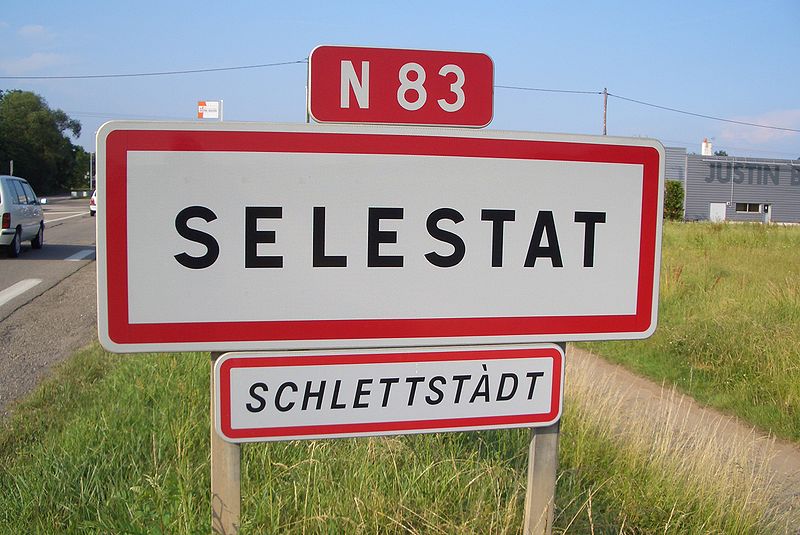
File:Ortsschild_Selestat.JPG · Wikimedia Commons · See Wikimedia Commons
Sélestat
Sign in to saveAlso known as Schlettstadt, Schlettstatt, Schlestadt
Sélestat (; Alsatian: Schlettstàdt; German: Schlettstadt) is a commune in the Grand Est region of France. An administrative division (sous-préfecture) of the Bas-Rhin department, the town lies on the Ill river, from the Rhine and the German border. Sélestat is located between the largest communes of Alsace, Strasbourg and Mulhouse. In 2023, Sélestat had a total population of 19,589.
OverviewAI-generated
Sélestat is a commune in France, situated in the Grand Est region. It serves as the capital of the arrondissement of Sélestat-Erstein and the canton of Sélestat. The town is located in the Bas-Rhin department, within the Unterelsaß area, and borders Ebersheim, Baldenheim, Châtenois, and Ebersmunster. Its official name is also recorded as Schlettstadt.
The commune has a population of 19,589 and covers an area of 44.4 square kilometers. It stands at an elevation of 184 meters above sea level. Sélestat was established in 1201 and has historically been a free imperial city within the Holy Roman Empire. The town received the Croix de guerre 1914–1918 award. It is twinned with Grenchen, Waldkirch, and Dornbirn.
Synthesized by Vinony from 52 facts across 7 sources: Wikidata, Openweathermap, Open Meteo, OpenStreetMap, GeoNames, Vinony graph, Geo. Generated from structured data (not the Wikipedia text) and checked against those facts — may still contain errors.
Weather now
7-day forecast
via Open-Meteo
Place details
- Locality
- Sélestat
- Region
- Grand Est
- Country
- France
- Population
- 18,941
- Timezone
- Europe/Paris
via OpenStreetMap · GeoNames
Key facts
- French commune.name
- Sélestat
- French commune.commune status
- Subprefecture and commune
- French commune.image
- Selestat Tour de l’horloge.jpg
- French commune.caption
- The Clock Tower
- French commune.image coat of arms
- Blason ville fr Sélestat (Alsace).svg
- French commune.arrondissement
- Sélestat-Erstein
- French commune.canton
- Sélestat
- French commune.INSEE
- 67462
- French commune.postal code
- 67600
- French commune.mayor
- Marcel Bauer (LR)
- French commune.term
- 2020–2026
- French commune.intercommunality
- CC de Sélestat
- French commune.elevation m
- 173
- French commune.elevation min m
- 165
- French commune.elevation max m
- 184
- French commune.area km2
- 44.40
via Wikipedia infobox
Wikidata facts
- Instance of
- free imperial city
- Official name
- Шлетштат
- Country
- Holy Roman Empire
- Located in
- arrondissement of Sélestat-Erstein
- Population
- 19589
- Area
- 44.4
- Elevation
- 172
- Time zone
- UTC+02:00
- Body of water
- Ill
- Shares border with
- Mussig
- Official website
- www.selestat.fr
- Image
- Pont Sélestat.JPG
Show 19 more facts
- twinned administrative body
- Dornbirn
- Commons category
- Sélestat
- postal code
- 67600
- topic's main category
- Category:Sélestat
- category for people born here
- Category:Births in Sélestat
- described by source
- Encyclopædia Britannica 11th edition
- Commons gallery
- Sélestat
- inception
- 1201-01-01
- category of associated people
- Category:People from Sélestat
- associated electoral district
- canton of Sélestat
- male population
- 9357
- female population
- 9895
- social media followers
- 3529
- email address
- mailto:[email protected]
- phone number
- +33-3-88-58-85-00
- fax number
- +33-3-88-82-90-71
- P12749
- Klaus Groth
- native label
- Schlettstàdt
- member of
- Décapole
Sources (8)
via Wikidata · CC0
Travel guide
See
thumb|300px|Humanist Library of Sélestat, considered a national treasure of Alsace thumb|Château du Haut-Kœnigsbourg
Travel guide from Wikivoyage (CC BY-SA 4.0)
~34 min read
Encyclopedic overview
33 sectionsContents
- Name
- History
- Birth of the town
- Free imperial city
- Decline
- Since 1815
- Governance
- Geography
- Transport
- Demography
- Economy
- Sights and culture
- Museums
- Religious architecture
- Civil and military architecture
- Municipal archive
- Illwald forest
- Other cultural institutions and events
- Sports
- Notable people
- Born in Sélestat
- Connected to Sélestat
- Twin towns – sister cities
- See also
- References
- Citations
- A
- B
- C
- D
- E
- Works cited
- External links
Sélestat (; Alsatian: Schlettstàdt; German: Schlettstadt) is a commune in the Grand Est region of France. An administrative division (sous-préfecture) of the Bas-Rhin department, the town lies on the Ill river, from the Rhine and the German border. Sélestat is located between the largest communes of Alsace, Strasbourg and Mulhouse. In 2023, Sélestat had a total population of 19,589.
First mentioned in the 8th century, Sélestat later became a free imperial city of the Holy Roman Empire and prospered as a member of the Décapole. During the Renaissance, it was a noted centre of humanism. Sélestat's fortunes declined amid the turmoil of the Reformation and experienced constant warfare. Following the Peace of Westphalia in 1648, it was formally annexed by France, under which its decline continued though it remained a town of strategic importance.
Excerpted from Wikipedia’s “Sélestat” article, available under the CC BY-SA 4.0 licence.
Gallery (44)
On the map
6 mapped locations