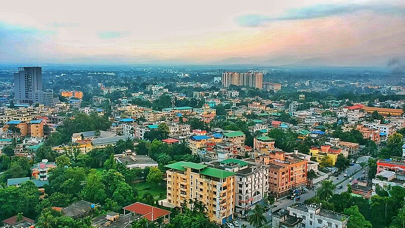
File:Siliguri_view_3.jpg · Wikimedia Commons · See Wikimedia Commons
Siliguri is a major city in West Bengal, India, located in the foothills of the Himalayas and known as the "Gateway of Northeast India" because of its strategic position. It is the third-largest urban area in West Bengal and forms a twin-city with its neighboring city of Jalpaiguri.
AI-generated from the Wikipedia summary — may contain errors.
Key facts
- Settlement.name
- Siliguri
- Settlement.native_name_lang
- bn
- Settlement.settlement_type
- City
- Settlement.image_caption
- Clockwise from top left: Siliguri aerial view, Science Centre entrance, Ewam India Monastery, Toy Train in Siliguri, Teesta River, Lions Clock Tower, Sevoke Roadway Bridge, Siliguri City Centre, ISKCON Temple, Siliguri traffic
- Settlement.pushpin_map
- India West Bengal#India3
- Settlement.pushpin_map_caption
- Location in West Bengal##Location in India
- Settlement.coordinates
- [1]
- Settlement.subdivision_type
- Country
- Settlement.subdivision_type1
- State
- Settlement.subdivision_type2
- District
- Settlement.subdivision_type3
- No. of Wards
- Settlement.subdivision_name1
- West Bengal
- Settlement.subdivision_name3
- 47
- Settlement.established_date
- 1994
- Settlement.nicknames
- Gateway to the Dooars, Gateway of Northeast India, City of Hospitality
- Settlement.government_type
- Municipal corporation
- Settlement.governing_body
- Siliguri Municipal Corporation
- Settlement.leader_title
- Mayor
via Wikipedia infobox
Official website
Welcome to Siliguri Municipal Corporation, Siliguri, West Bengal
Siliguri Municipal Corporation
siligurismc.in →Link to the official site · 18,697 chars · not written by Vinony
Wikidata facts
- Instance of
- big city
- Country
- India
- Located in
- Siliguri subdivision
- Population
- 218718
- Area
- 41.90
- Elevation
- 400
- Time zone
- UTC+05:30
- Capital of
- Siliguri subdivision
- Official website
- www.siligurismc.in
- Image
- Siliguri view.jpg
- Households
- 49895
- Dialing code
- 353
Show 8 more facts
- Commons category
- Siliguri
- topic's main category
- Category:Siliguri
- postal code
- 734001
- category of associated people
- Category:People from Siliguri
- male population
- 112167
- illiterate population
- 51604
- literate population
- 167114
- female population
- 106551
Sources (9)
via Wikidata · CC0
Article · Deutsch
Shiliguri (bengalisch শিলিগুড়ি IAST Śiliguṛi, englisch Siliguri) ist eine Stadt im Norden des indischen Bundesstaates Westbengalen mit ungefähr 650.000 Einwohnern (Volkszählung 2011). Sie ist die größte Stadt des Distrikts Darjiling und liegt am Flussufer der Mahananda.Die in der Stadt vorherrschenden Sprachen sind Bengalisch und Nepali. Shiliguri ist seit 1994 eine . Eine Besonderheit ist, dass sich 14 der 47 Wards im benachbarten Distrikt Jalpaiguri befinden. Das Zentrum Shiliguris liegt vier Kilometer nördlich des für die Region wichtigen Eisenbahnknotens (NJP Train Station), von wo aus der gesamte Schienenverkehr in die ostindischen Gebiete von Assam, Tripura und Nagaland, aber auch in den Norden Bangladeschs führt. Der nächstgelegene Flughafen ist westlich im 15 km entfernten Bagdogra. Von Shiliguri gibt es Busverbindungen nach Bhutan, Kalimpong, Gangtok und Darjiling, was die Stadt zum Ausgangspunkt für Reisen in die östliche Himalayaregion macht. Die Schmalspurstrecke der Darjeeling Himalayan Railway fährt vom Bahnhof in Shiliguri in das nur 80 Kilometer entfernte, aber 2.000 Meter höher gelegene Darjiling. Etwa 25 km nördlich der Stadt überquert die 1941 eröffnete Coronation Bridge den Fluss Tista und stellt damit eine wichtige Straßenverbindung zu den weiter östlich gelegenen Landesteilen her.
Abstract from DBpedia / Wikipedia · CC BY-SA
Gallery (44)
On the map
5 mapped locations