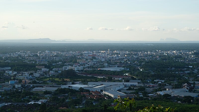
File:Surat_Thani_skyline.jpg · Wikimedia Commons · See Wikimedia Commons
Surat Thani
Sign in to savecity in Surat Thani province, Thailand
Key facts
- Country
- Thailand
- Province
- Surat Thani
- District
- Mueang Surat Thani
- Sanitation
- 21 December 1930
- Town municipality
- 7 December 1935
- City municipality
- 4 May 2007
- Mayor
- Theerakit Wangmuthitakul
- Total
- 68.97 km (26.63 sq mi)
- Rank
- 5th
- Elevation
- 10 m (33 ft)
- Density
- 1,914/km (4,960/sq mi)
- Time zone
- UTC+7 ( ICT )
- Calling code
- 077
- Website
- suratcity .go .th
via Wikipedia infobox
Wikidata facts
- Official name
- เทศบาลนครสุราษฎร์ธานี
- Country
- Thailand
- Located in
- Mueang Surat Thani
- Population
- 130703
- Area
- 68.97
- Elevation
- 9
- Time zone
- UTC+07:00
- Body of water
- Tapi River
- Capital of
- Surat Thani
- Official website
- www.suratcity.go.th
- Image
- Surat Thani waterfront.jpg
Show 5 more facts
- native label
- เทศบาลนครสุราษฎร์ธานี
- IPA transcription
- [sù.râːt tʰāː.nīː]
- postal code
- 84000
- Commons category
- Surat Thani
- different from
- Surat Thani
via Wikidata · CC0
~5 min read
Encyclopedic overview
Surat Thani (Thai: สุราษฎร์ธานี, pronounced [sù.râːt tʰāː.nīː]) is a city in Amphoe Mueang Surat Thani, Surat Thani Province, southern Thailand. It lies 651 km (405 mi) south of Bangkok. It is the capital of Surat Thani Province. The city has a population of 132,040 (2019), and an area of 68.97 km (26.63 sq mi). The city's population density is 1,914 inhabitants per km.
Surat Thani is located near the mouth of the Tapi River on the Gulf of Thailand. The city offers no major tourist attractions in itself, and is mainly known to tourists as the jumping-off point to Ko Samui, Ko Tao, and Ko Pha Ngan. It is the regional commercial center, with a seaport dealing in the main products of the province, rubber and coconuts.
Excerpted from Wikipedia’s “Surat Thani” article, available under the CC BY-SA 4.0 licence.