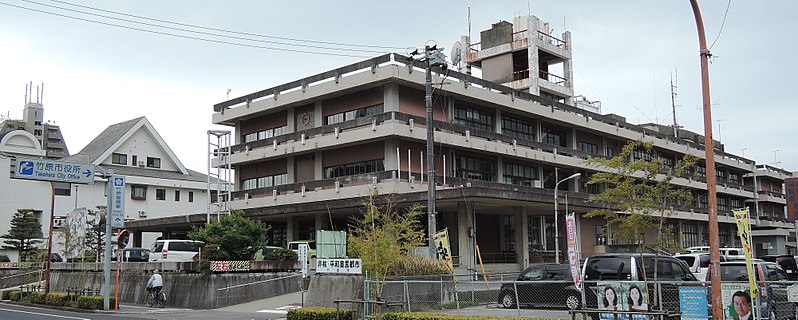
File:Takehara_city_hall.JPG · Wikimedia Commons · See Wikimedia Commons
Takehara
Sign in to savecity in Hiroshima prefecture, Japan
Key facts
- Country
- Japan
- Region
- Chūgoku ( San'yō )
- Prefecture
- Hiroshima
- As shimoichi village settled
- April 1, 1889
- As takehara town name changed
- April 17, 1889
- City settled
- November 3, 1958
- Mayor
- Akimichi Hirai ( ja:平井明道 ) - from January 2026
- Total
- 118.23 km (45.65 sq mi)
- Density
- 197.5/km (511.5/sq mi)
- Time zone
- UTC+09:00 ( JST )
- City hall address
- 5-1-35 Takehara Chuo, Takehara-shi, Hiroshima-ken 725-8666
- Climate
- Cfa
- Website
- www .city .takehara .lg .jp
- Flower
- Ume
- Tree
- Bamboo
via Wikipedia infobox
Wikidata facts
- Instance of
- city of Japan
- Country
- Japan
- Located in
- Hiroshima Prefecture
- Population
- 28644
- Area
- 118.23
- Time zone
- UTC+09:00
- Shares border with
- Mihara
- Official website
- www.city.takehara.lg.jp
- Image
- Takehara City Hall 2021-03 ac.jpg
Show 7 more facts
- topic's main category
- Category:Takehara, Hiroshima
- Commons category
- Takehara, Hiroshima
- twinned administrative body
- Damyang County
- native label
- 竹原市
- name in kana
- たけはらし
- inception
- 1958-11-03
- associated electoral district
- Hiroshima 4th district
via Wikidata · CC0
~6 min read
Encyclopedic overview
Panorama of Takehara City center Aerial photograph of Takehara City center Taketsuru house in Takehara historic preservation district Takehara (竹原市, Takehara-shi) is a city located in Hiroshima Prefecture, Japan. As of 30 April 2023, the city had an estimated population of 23,350 in 12,034 households and a population density of 200 persons per km. The total area of the city is 118.23 square kilometres (45.65 sq mi).
Geography
Excerpted from Wikipedia’s “Takehara” article, available under the CC BY-SA 4.0 licence.