File:Netherlands,_Kagerplassen,_Zijp_(2).JPG · Wikimedia Commons · See Wikimedia Commons
Teylingen
Sign in to saveTeylingen () is a municipality in the Western Netherlands, in the province of South Holland. It was created on 1 January 2006, through the amalgamation of Sassenheim, Voorhout and Warmond. It is named after Teylingen Castle, located in Voorhout. In 2019, it had a population of 37,061.
Key facts
- Settlement.timezone1
- CET
- Settlement.utc_offset1
- +1
- Settlement.name
- Teylingen
- Settlement.settlement_type
- Municipality
- Settlement.image_skyline
- Netherlands, Kagerplassen, Zijp (2).JPG
- Settlement.image_caption
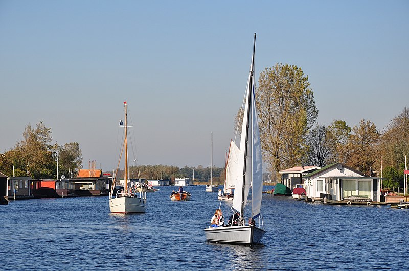
- The Kagerplassen lake system in Teylingen
- Settlement.image_flag
- Teylingen vlag.svg
- Settlement.flag_size
- 100x67px
- Settlement.image_shield
- Coat of arms of Teylingen.svg
- Settlement.shield_size
- 100x80px
- Settlement.image_map
- Map - NL - Municipality code 1525 (2009).svg
- Settlement.map_alt
- Highlighted position of Teylingen in a municipal map of South Holland
- Settlement.map_caption
- Location in South Holland
- Settlement.subdivision_type
- Country
- Settlement.subdivision_name
- Netherlands
- Settlement.subdivision_type1
- Province
- Settlement.subdivision_name1
- South Holland
- Settlement.established_title
- Established
via Wikipedia infobox
Wikidata facts
- Instance of
- municipality of the Netherlands
- Country
- Netherlands
- Located in
- South Holland
- Population
- 37791
- Area
- 33.66
- Elevation
- 0
- Time zone
- UTC+01:00
- Shares border with
- Noordwijk
- Official website
- www.teylingen.nl
- Image
- Netherlands, Kagerplassen, Zijp (2).JPG
- Households
- 14339
Show 9 more facts
- replaces
- Warmond
- Commons category
- Teylingen
- contains settlement
- Voorhout
- topic's main category
- Category:Teylingen
- Commons gallery
- Teylingen
- inception
- 2006-01-01
- category of associated people
- Category:People from Teylingen
- email address
- mailto:[email protected]
- phone number
- +31 252 783 300
Sources (11)
via Wikidata · CC0
~2 min read
Encyclopedic overview
8 sectionsContents
- Population centres
- Topography
- Public transportation
- Notable people
- Sport
- Image gallery
- References
- External links
Teylingen () is a municipality in the Western Netherlands, in the province of South Holland. It was created on 1 January 2006, through the amalgamation of Sassenheim, Voorhout and Warmond. It is named after Teylingen Castle, located in Voorhout. In 2019, it had a population of 37,061.
The municipality is bordered by Noordwijkerhout and Lisse to the north, Haarlemmermeer and Alkemade to the east, Leiderdorp and Leiden to the south, Oegstgeest and Katwijk to the west. It is located in an area called the "Dune and Bulb Region" (Duin- en Bollenstreek). The Kagerplassen are to the east of Sassenheim.
Excerpted from Wikipedia’s “Teylingen” article, available under the CC BY-SA 4.0 licence.
Gallery (13)
On the map
3 mapped locations