Described at
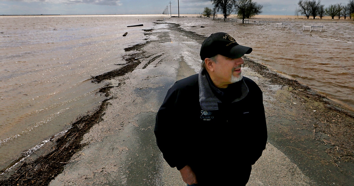
A long-dormant lake has reappeared in California, bringing havoc along with it
People have worked for a century to make California’s Tulare Basin into a food grower’s paradise.
nbcnews.com →Mark Grewal on March 21 on a farm road that was flooded in Lemoore, Calif.Luis Sinco / Los Angeles Times via Getty Images file People have worked for a century to make California’s Tulare Basin into a food grower’s paradise. That pastoral landscape now looks more like the Pacific Ocean in many areas. Months of atmospheric river storms have pummeled the area and saturated the basin’s soil, which sits about halfway between San Francisco and Los Angeles, not far from Fresno. The rains have led to floods that damaged towns and deluged farms and have begun to refill what was once a sprawling lake. The floods have pitted neighboring property owners against one another and raised tensions over how to manage the flows, which have damaged hundreds of structures. And more water is on the way. Experts say a monthslong, slow-burning crisis will play out next: A historic snowpack looms in the mountains above the basin — as it melts, it is likely to put downstream communities through months of torment. The flooding, which follows several years of extreme drought, showcases the weather whiplash typical of California, which vacillates between too wet and too dry. The influence of climate change can make the state’s extremes more intense. The re-forming Tulare Lake — which was drained for farming a century ago — could remain on the landscape for years, disrupting growers in a region that produces a significant proportion of the nation’s supply of almonds, pistachios, milk and fruit. High-stakes decisions over where that water travels could resonate across the country’s grocery store shelves. In the farming communities that dot the historic lake bed, accusations of sabotaged levees, frantic efforts to patch breached banks and feuds — common occurrences during flood fights in the area — have started already, said Matt Hurley, a former water manager for several water districts in the Tulare Basin. Construction equipment for the California High Speed Rail project surrounded by flooding in Tulare County near Allensworth, Calif., on March 22. Patrick T. Fallon / AFP via Getty Images file But later that night, workers with the Burlington Northern Santa Fe railroad unblocked the pipe, which left some Allensworth residents fuming as water flowed closer. The residents had used BNSF materials without permission, said Lena Kent, a railroad spokesperson. Damming the culvert threatened the highway — the only access point to Allensworth at the time — and the rail tracks that run parallel to it. The Tulare Basin is at the southern end of California’s San Joaquin Valley — and in essence, it’s a massive bowl. Before irrigators dug canals and rerouted water for farming in the late 1800s, Tulare Lake filled the bowl’s lower reaches. Shallow water stretched across the landscape, and the lake was the largest body of freshwater west of the Mississippi. Several rivers — Kings, Tule, Kern and Kaweah — historically dead-ended at the lake and replenished its water levels every spring, but farmers have diverted and rerouted so much water that the lake bed is now usually dry. It’s among the most fertile farmland in the country. Today, the irrigation system is designed to “use every single drop of water” that flows into the basin, Mount said. For about two weeks, farmers and emergency workers have been scrambling to plug levees and prevent the worst as the ground became saturated and rivers swelled after a seemingly endless series of atmospheric river storms battered California. The flooding has breached dozens of levees , forced rescues, swamped construction sites at California’s high-speed rail project and seeped into several communities, including Allensworth, a historic community that in 1908 was one of the first settlements west of the Mississippi to be founded and governed by Black Americans. “What you’re seeing now more than anything else is traditional flood problems,” Mount said. “All of that water is making its way into the bottom of the bowl and s
Excerpt from a page describing this subject · 24,819 chars · not written by Vinony
Wikidata facts
- Instance of
- salt pan
- Country
- United States
- Located in
- California
- Area
- 1780
- Elevation
- 56
- Image
- Reconstituted tulare lake.jpg
- Length
- 130
Show 4 more facts
- basin country
- United States
- Commons category
- Tulare Lake
- Commons gallery
- Tulare Lake
Sources (2)
via Wikidata · CC0