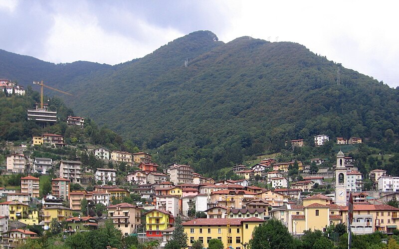
File:Ubiale_vista_crop.jpg · Wikimedia Commons · See Wikimedia Commons
Key facts
- Country
- Italy
- Region
- Lombardy
- Province
- Bergamo (BG)
- Frazioni
- Clanezzo
- Mayor
- Ersilio Gotti
- Total
- 7.3 km (2.8 sq mi)
- Elevation
- 336 m (1,102 ft)
- Density
- 190/km (490/sq mi)
- Demonym
- Ubialesi
- Time zone
- UTC+1 ( CET )
- Summer dst
- UTC+2 ( CEST )
- Dialing code
- 0345
via Wikipedia infobox
Wikidata facts
- Instance of
- comune of Italy
- Official name
- Ubiale Clanezzo
- Country
- Italy
- Located in
- Province of Bergamo
- Population
- 1328
- Area
- 7.35
- Elevation
- 336
- Time zone
- UTC+02:00
- Shares border with
- Villa d'Almè
- Official website
- www.comune.ubialeclanezzo.bg.it
- Image
- Ubiale vista crop.jpg
- Dialing code
- 0345
- Licence plate code
- BG
- Patron saint
- Our Lady of the Rosary
Show 3 more facts
- Commons category
- Ubiale Clanezzo
- postal code
- 24010
- Commons gallery
- Ubiale Clanezzo
Sources (6)
via Wikidata · CC0
~1 min read
Encyclopedic overview
Ubiale Clanezzo (Bergamasque: Übiàl Clenèss) is a comune (municipality) in the Province of Bergamo in the Italian region of Lombardy, located about 50 kilometres (31 mi) northeast of Milan and about 10 kilometres (6 mi) northwest of Bergamo.
Ubiale Clanezzo borders the following municipalities: Almenno San Salvatore, Brembilla, Capizzone, Sedrina, Strozza, Villa d'Almè. Sights include the castle (rebuilt in the 18th century) and the Bridge of Attone, which spans the Imagna torrent.
Excerpted from Wikipedia’s “Ubiale Clanezzo” article, available under the CC BY-SA 4.0 licence.