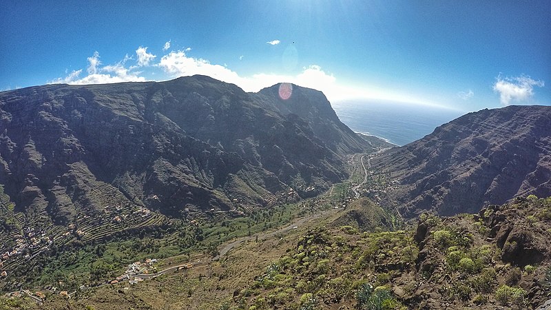
File:Valle_Gran_Rey,_2016.jpeg · Wikimedia Commons · See Wikimedia Commons
Key facts
- Country
- Spain
- Autonomous region
- Canary Islands
- Province
- Santa Cruz de Tenerife
- Island
- La Gomera
- Mayor
- Angel Piñero Cruz
- Total
- 32.36 km (12.49 sq mi)
- Density
- 149/km (387/sq mi)
- Time zone
- UTC+0 ( GMT )
- Website
- www.vallegranrey.es
via Wikipedia infobox
Wikidata facts
- Instance of
- city
- Official name
- Valle Gran Rey
- Country
- Spain
- Located in
- Santa Cruz de Tenerife Province
- Continent
- Europe
- Population
- 4830
- Area
- 32.36
- Elevation
- 45
- Time zone
- UTC+02:00
- Body of water
- Atlantic Ocean
- Shares border with
- Vallehermoso
- Official website
- www.vallegranrey.es
- Image
- Valle Gran Rey, en La Gomera (Sta. Cruz de Tenerife, España).jpg
- Licence plate code
- TF
Show 7 more facts
- Commons category
- Valle Gran Rey
- postal code
- 38870
- native label
- Valle Gran Rey
- located in/on physical feature
- La Gomera
- male population
- 2301
- female population
- 2263
- P8168
- Teddy Kotick
Sources (7)
via Wikidata · CC0
~2 min read
Encyclopedic overview
Vueltas harbour The beach of La Calera
Valle Gran Rey is a municipality in the western part of the island La Gomera, in the province of Santa Cruz de Tenerife of the Canary Islands, Spain. The Guanche name of the area was Orone. The seat of the municipality since 1930 is La Calera; previously it was in Arure.
Excerpted from Wikipedia’s “Valle Gran Rey” article, available under the CC BY-SA 4.0 licence.
Gallery (6)
On the map
2 mapped locations