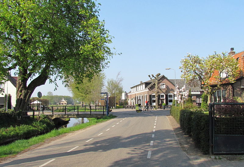
File:De_Vecht.jpg · Wikimedia Commons · See Wikimedia Commons
Voorst
Sign in to saveVoorst, camping-farm de Adelaar|thumb|280px|right Voorst () is a municipality and a town in the eastern Netherlands.
Key facts
- Settlement.name
- Voorst
- Settlement.settlement_type
- Municipality
- Settlement.image_skyline
- De Vecht.jpg
- Settlement.image_caption
- De Vecht
- Settlement.image_flag
- Flag of Voorst.svg
- Settlement.flag_size
- 100x67px
- Settlement.image_shield
- Coat of arms of Voorst.svg
- Settlement.shield_size
- 100x80px
- Settlement.image_map
- Map - NL - Municipality code 0285 (2009).svg
- Settlement.map_alt
- Highlighted position of Voorst in a municipal map of Gelderland
- Settlement.map_caption
- Location in Gelderland
- Settlement.subdivision_type
- Country
- Settlement.subdivision_name
- Netherlands
- Settlement.subdivision_type1
- Province
- Settlement.subdivision_name1
- Gelderland
- Settlement.governing_body
- Municipal council
- Settlement.leader_party
- PvdA
- Settlement.leader_title
- Mayor
via Wikipedia infobox
Wikidata facts
- Instance of
- municipality of the Netherlands
- Demonym
- Voorstenaar
- Country
- Netherlands
- Located in
- Gelderland
- Capital
- Voorst
- Population
- 24790
- Area
- 126.6
- Elevation
- 6
- Time zone
- UTC+01:00
- Shares border with
- Epe
- Official website
- www.voorst.nl
- Image
- De Vecht.jpg
- Households
- 9343
- Dialing code
- 0571
Show 7 more facts
- contains settlement
- Klarenbeek
- topic's main category
- Category:Voorst
- Commons category
- Voorst, Gelderland
- category of associated people
- Category:People from Voorst
- postal code
- 7439
- email address
- mailto:[email protected]
- phone number
- +31571279911
Sources (11)
via Wikidata · CC0
~3 min read
Encyclopedic overview
6 sectionsContents
- Population centres
- Notable people
- Sport
- Gallery
- References
- External links
Voorst, camping-farm de Adelaar|thumb|280px|right Voorst () is a municipality and a town in the eastern Netherlands.
== Population centres == Appen (near a wood where nice walks can be taken) Bussloo (with a recreation centre with a small lake and beach) De Kar (near a motorway junction (A1, Amsterdam- Berlin) De Vecht De Wijk Gietelo (castle ruin of Nijenbeek on the IJssel dyke) Klarenbeek (partly in the municipality Apeldoorn; small railroad station) Klein-Amsterdam Nijbroek Posterenk (also near the A1, with an old Dutch wind-mill) Spekhoek Steenenkamer, actually an outskirt of Deventer Terwolde Teuge (with an airfield, where parachuting is taught) Twello, half-way between Apeldoorn and Deventer, which is the main village of the municipality, having over 11,000 inhabitants; the town-hall, some industry, most schools, a railway station, a shopping centre etc. can be found there Voorst, an old village along the road between Apeldoorn and Zutphen, with a beautiful old church; 1 mile south of Voorst, another small railroad station was opened in 2006 Wilp, a tiny village on the IJssel opposite to Deventer; it has a small, very old church and a hospital for mentally handicapped people; the village already existed in 768; Saint Lebuinus built a chapel there; the name is allegedly derived from wel-apa that is: well-water; it is possible, that prehistoric Celtic or Germanic people worshipped a holy well there.
Excerpted from Wikipedia’s “Voorst” article, available under the CC BY-SA 4.0 licence.
Gallery (16)
On the map
3 mapped locations