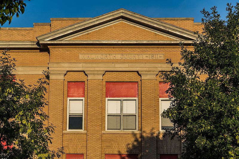
File:Walworth_County_Court_House_(1911),_Selby,_South_Dakota_(29360818481).jpg · Wikimedia Commons · See Wikimedia Commons
Walworth County
Sign in to saveAlso known as Walworth County, South Dakota, Walworth County, SD
county in South Dakota, United States
Key facts
- Country
- United States
- State
- South Dakota
- Founded
- 1873 (created), 1883 (organized)
- Named after
- Walworth County, Wisconsin
- Seat
- Selby
- Largest city
- Mobridge
- Total
- 745 sq mi (1,930 km )
- Land
- 709 sq mi (1,840 km )
- Water
- 36 sq mi (93 km ) 4.8%
- Estimate 2025
- 5,217
- Density
- 7.50/sq mi (2.89/km )
- Time zone
- UTC−6 ( Central )
- Summer dst
- UTC−5 ( CDT )
- Congressional district
- At-large
- Website
- walworthco .org
via Wikipedia infobox
Wikidata facts
- Named after
- Walworth County
- Country
- United States
- Located in
- South Dakota
- Contains
- Selby
- Capital
- Selby
- Population
- 5315
- Area
- 745
- Shares border with
- McPherson County
- Official website
- walworthco.org
- Image
- Walworth County Court House (1911), Selby, South Dakota (29360818481).jpg
- Households
- 2263
Show 8 more facts
- Commons category
- Walworth County, South Dakota
- topic's main category
- Category:Walworth County, South Dakota
- different from
- Walworth County
- water as percent of area
- 4.8
- native label
- Walworth County
- inception
- 1873-00-00
- category of associated people
- Category:People from Walworth County, South Dakota
- per capita income
- 34827
Sources (10)
via Wikidata · CC0
~6 min read
Encyclopedic overview
Walworth County is a county in the U.S. state of South Dakota. As of the 2020 census, the population was 5,315. Its county seat is Selby. The county was created in 1873 and organized in 1883. It is named for Walworth County, Wisconsin.
The Missouri River flows southward along the county's west boundary line. Swan Creek flows west-northwest through the county's SW corner, discharging into the Missouri. The county's terrain consists of semi-arid rolling hills, carved by drainages and gullies. Most of the area is devoted to agriculture. The terrain slopes to the south and east, although the western portion of the county drops westward into the Missouri River valley. The county's highest point is on the eastern portion of its north boundary line, at 1,982 ft (604 m) ASL. The county has a total area of 745 square miles (1,930 km), of which 709 square miles (1,840 km) is land and 36 square miles (93 km) (4.8%) is water.
Excerpted from Wikipedia’s “Walworth County” article, available under the CC BY-SA 4.0 licence.