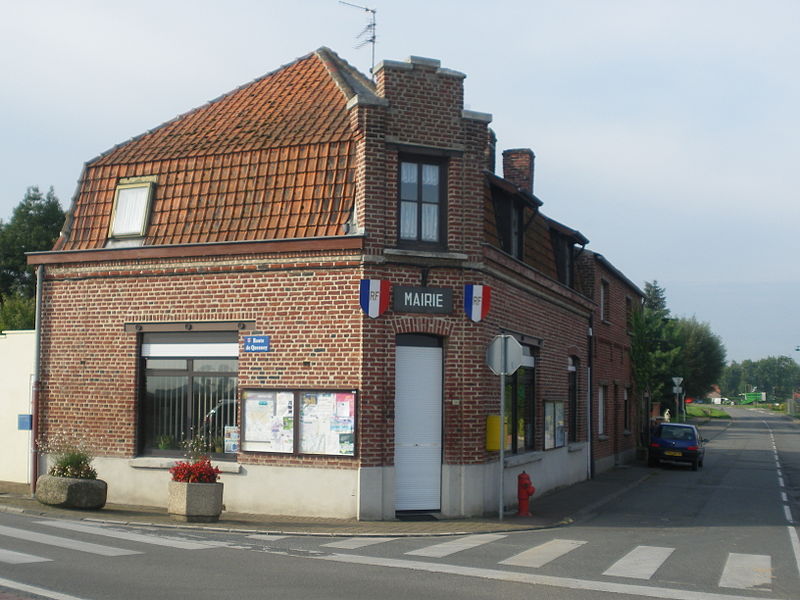
File:Mairie_de_Warneton_(France).JPG · Wikimedia Commons · See Wikimedia Commons
Warneton
Sign in to saveAlso known as Waasten, Warneton-Sud, Zuid-Waasten, Frans-Waasten, Zuud-Woastn
französische Gemeinde
OverviewAI-generated
Warneton is a commune in the Nord department of France, situated within the Hauts-de-France region. It lies in the arrondissement of Lille and the Lille metropolis, specifically within the canton of Quesnoy-sur-Deûle. The municipality serves as a border city and shares boundaries with Comines and Deûlémont. Its official postal code is 59560, and it is associated with the canton of Armentières for electoral purposes.
The area of Warneton is 4.17 square kilometers, with an elevation above sea level recorded at 20 meters. The population totals 241 residents, comprising 120 males and 119 females. The local government maintains an official website for public information.
Synthesized by Vinony from 38 facts across 7 sources: Wikidata, Openweathermap, Open Meteo, OpenStreetMap, GeoNames, Vinony graph, Geo. Generated from structured data (not the Wikipedia text) and checked against those facts — may still contain errors.
Weather now
7-day forecast
via Open-Meteo
Key facts
- French commune.name
- Warneton
- French commune.commune status
- Commune
- French commune.image
- Mairie de Warneton (France).JPG
- French commune.caption
- The town hall in Warneton
- French commune.image coat of arms
- Blason de la ville de Warneton (Nord).svg
- French commune.arrondissement
- Lille
- French commune.canton
- Armentières
- French commune.INSEE
- 59643
- French commune.postal code
- 59560
- French commune.mayor
- Yvon Pétronin
- French commune.term
- 2020–2026
- French commune.intercommunality
- Métropole Européenne de Lille
- French commune.elevation m
- 20
- French commune.elevation min m
- 11
- French commune.elevation max m
- 25
- French commune.area km2
- 4.17
via Wikipedia infobox
Wikidata facts
- Instance of
- border city
- Official name
- Warneton
- Country
- France
- Located in
- arrondissement of Lille
- Population
- 231
- Area
- 4.17
- Elevation
- 17
- Time zone
- UTC+02:00
- Shares border with
- Deûlémont
- Official website
- mairie-warneton.fr
- Image
- Mairie de Warneton (France).JPG
Show 6 more facts
- Commons category
- Warneton (Nord)
- postal code
- 59560
- associated electoral district
- canton of Armentières
- male population
- 120
- female population
- 119
- P8168
- Japenzin
via Wikidata · CC0
Article · Deutsch
Warneton (flämisch: Frans Waasten) ist eine französische Gemeinde mit 237 Einwohnern (Stand: 1. Januar 2019) im Département Nord in der Region Hauts-de-France. Sie gehört zum Arrondissement Lille und ist Teil des Kantons Armentières (bis 2015: Kanton Quesnoy-sur-Deûle). Die Einwohner werden Warnetonnois genannt.
Abstract from DBpedia / Wikipedia · CC BY-SA
Gallery (3)
On the map
2 mapped locations