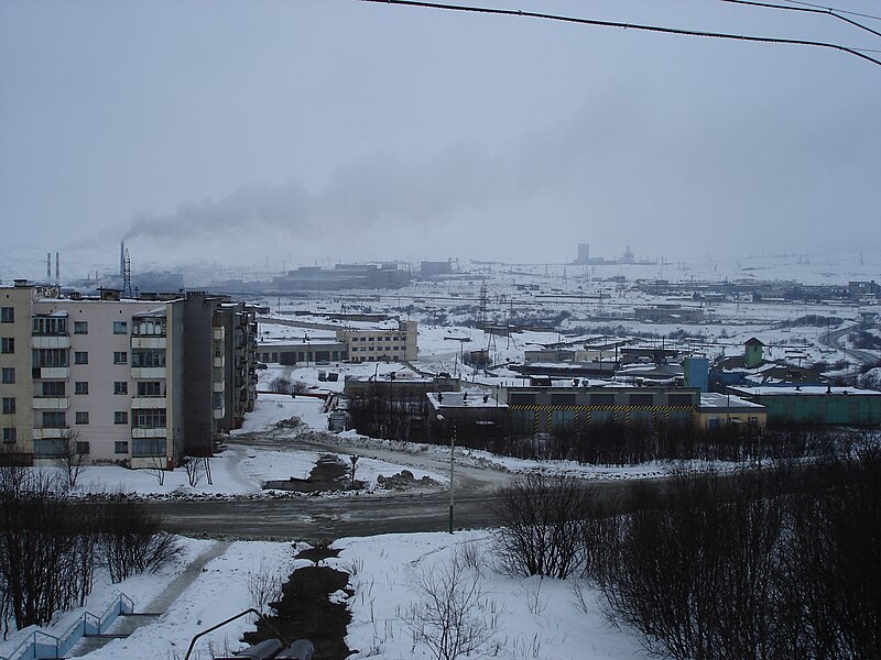
File:Вид_на_промплощадку.jpg · Wikimedia Commons · See Wikimedia Commons
Zapolyarny
Sign in to saveAlso known as Zapolyarnyy
human settlement in Pechengsky District, Murmansk Oblast, Russia
In the Vinony graph
Within Vinony's link graph, Zapolyarny is referenced by 60 other articles, and connects out to 2010 Russian census, Russia and Finland.
The entry is geolocated on the map.
Vinony files it under Cities and towns built in the Soviet Union, Cities and towns in Murmansk Oblast and Former urban-type settlements of Murmansk Oblast.
Its subject is documented across 42 Wikipedia language editions.
Key facts
- Country
- Russia
- Federal subject
- Murmansk Oblast
- Administrative district
- Pechengsky District
- Town status since
- February 1, 1963
- Elevation
- 150 m (490 ft)
- Total
- 15,825
- Estimate 2023
- 14,231 ( −10.1% )
- Time zone
- UTC+3 ( MSK )
- Website
- pechengamr .gov-murman .ru
via Wikipedia infobox
Wikidata facts
- Country
- Soviet Union
- Located in
- Pechengsky District
- Population
- 14231
- Area
- 4620
- Elevation
- 150
- Time zone
- UTC+03:00
- Official website
- www.zapadmin.ru
- Image
- Zapolyarny-2021 - 9.jpeg
- Dialing code
- 81554
Show 4 more facts
- Commons category
- Zapolyarny
- inception
- 1956-01-01
- postal code
- 184430
- native label
- Заполярный
Sources (2)
via Wikidata · CC0
~1 min read
Encyclopedic overview
Proposed coat of arms of Zapolyarny
Zapolyarny (Russian: Заполя́рный; Norwegian: Zapoljarnyj) is a town in Pechengsky District of Murmansk Oblast, Russia, located on the Kola Peninsula, 10 kilometers (6.2 mi) northeast of the Kola Superdeep Borehole project. Population: 15,825 (2010 census); 18,640 (2002 census); 23,564 (1989 Soviet census).
Excerpted from Wikipedia’s “Zapolyarny” article, available under the CC BY-SA 4.0 licence.
Gallery (4)
On the map
Available in 42 languages
- Español
- Français
- Deutsch
- 中文
- Русский
- Italiano
- العربية
- azb
- Azerbaijani
- Belarusian
- Bulgarian
- Catalan
- Cebuano
- Chechen
- Crimean Tatar
- Czech
- Danish
- Egyptian Arabic
Show 23 more
via Wikidata sitelinks · CC0