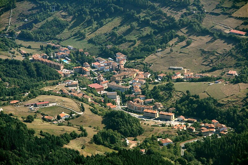
File:Zegama.jpg · Wikimedia Commons · See Wikimedia Commons
Zegama
Sign in to saveAlso known as Cegama
Zegama, popularly known as "the shadow of Aizkorri", is a town and municipality in the Goierri region of the province of Gipuzkoa, in the autonomous community of the Basque Country, northern Spain.
Key facts
- Settlement.name
- Zegama
- Settlement.settlement_type
- Municipality
- Settlement.native_name
- Cegama
- Settlement.image_skyline
- Zegama.jpg
- Settlement.image_caption
- View of Zegama from Aizkorri
- Settlement.image_shield
- Escudo de Zegama.jpg
- Settlement.pushpin_map
- Spain
- Settlement.pushpin_label_position
- left
- Settlement.pushpin_map_caption
- Location in Spain
- Settlement.subdivision_type
- Country
- Settlement.subdivision_name
- Spain
- Settlement.subdivision_type1
- Autonomous community
- Settlement.subdivision_name1
- Basque Country
- Settlement.subdivision_type2
- Province
- Settlement.subdivision_name2
- Gipuzkoa
- Settlement.subdivision_type3
- Eskualdea
- Settlement.subdivision_name3
- Goierri
- Settlement.area_total_km2
- 35.07
via Wikipedia infobox
Wikidata facts
- Instance of
- municipality of Spain
- Official name
- Zegama
- Demonym
- zegamarra
- Country
- Spain
- Located in
- Goierri
- Continent
- Europe
- Official language
- Basque
- Population
- 1348
- Area
- 35
- Elevation
- 296
- Time zone
- UTC+02:00
- Shares border with
- Segura
- Official website
- www.zegama.eus
- Image
- Zegama.jpg
- Licence plate code
- SS
Show 7 more facts
- nickname
- beleak
- Commons category
- Zegama
- postal code
- 20215
- P8168
- Chiemsee
- inception
- 1615-00-00
- male population
- 773
- female population
- 755
Sources (8)
via Wikidata · CC0
~3 min read
Encyclopedic overview
7 sectionsContents
- Nature and culture
- Climate
- Economy
- Sports
- Notables of Zegama
- References
- External links
Zegama, popularly known as "the shadow of Aizkorri", is a town and municipality in the Goierri region of the province of Gipuzkoa, in the autonomous community of the Basque Country, northern Spain.
== Nature and culture == thumb|Otzaurte right on the dividing line between major watersheds Zegama's main characteristic is its natural location as the last Gipuzkoan town up the valley of river Oria, very close to the Aizkorri-Aratz Natural Park, in which the highest mountain in the Basque Autonomous Community can be found, the popular Aizkorri summit (1,528 m), located at the same name mountain range towering over the whole area. The Oria River, the longest one in the province of Gipuzkoa, rises in several springs and their corresponding streams flowing down the dramatic slopes of the valley that merge in a main stream before the nucleus of the town. The southern Otzaurte hamlet (IPA: /o'tsaurte/) stands on the dividing line of the waters running onto the Mediterranean watershed and those flowing north to the Atlantic through the Oria river.
Excerpted from Wikipedia’s “Zegama” article, available under the CC BY-SA 4.0 licence.
Gallery (4)
On the map
2 mapped locations