Category
page 1Northeast India

Assam
Assam is a state in northeastern India, located south of the Eastern Himalayas along the Brahmaputra and Barak River valleys. It covers an area of , and is the second largest state in northeastern India by area. As per the 2011 census, the state had a population of 31.2 million, and is the largest in terms of population in the region. It shares international borders with Bhutan to the north and with Bangladesh to the southwest. It borders the Indian states of Arunachal Pradesh to the north; Nagaland and Manipur to the east; Meghalaya, Tripura, and Mizoram to the south; and West Bengal to the w

Arunachal Pradesh
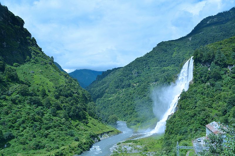
region administered by India as a state

Sikkim
Sikkim ( ; ) is a state in northeastern India. It borders Bhutan in the east, the Tibet Autonomous Region of China in the north and northeast, Koshi Province of Nepal in the west, and West Bengal in the south. Sikkim is also close to the Siliguri Corridor, which borders Bangladesh. Sikkim is the least populous and second-smallest among the Indian states. Situated in the Eastern Himalaya, Sikkim is notable for its biodiversity, including alpine and subtropical climates, as well as being a host to Kangchenjunga, the highest peak in India and third-highest on Earth. Sikkim's capital and largest c

Manipur
Manipur (, ) is a state in northeastern India with Imphal as its capital. It borders the Indian states of Assam to the west, Mizoram to the south, and Nagaland to the north and shares the international border with Myanmar, specifically the Sagaing Region to the east and Chin State to the southeast. Covering an area of 22,330 square kilometers (8,621 mi²), the state consists mostly of hilly terrain with the 1813-square-kilometre (700 mi²) Imphal Valley inhabited by the Meitei (Manipuri) community, historically a kingdom. Surrounding hills are home to Naga and Kuki-Zo communities, who

Tripura
Tripura () is a state in northeastern India. The third-smallest state in the country, it covers ; and the seventh-least populous state with a population of 3.67 million. It is bordered by Assam and Mizoram to the east, and by Bangladesh to the north, south and west. Tripura is divided into eight districts and 23 sub-divisions, where Agartala is the capital and the largest city in the state. Tripura has 19 different tribal communities with a majority Bengali population. Bengali, Kokborok, and English are the state's official languages.

Nagaland
Nagaland () is a state in the north-eastern region of India. It is bordered by the Indian states of Arunachal Pradesh to the north, Assam to the west, Manipur to the south, and the Naga Self-Administered Zone of the Sagaing Region of Myanmar (Burma) to the east. Its capital city is Kohima and its largest city is the twin Chümoukedima–Dimapur. The state has an area of with a population of 1,980,602 as per the 2011 Census of India, making it one of the least populated states in India.

Mizoram
Mizoram is a state in northeastern India, with Aizawl as its capital and largest city. It shares 722-kilometres (449 miles) of international borders with Bangladesh to the west, and Myanmar to the east and south, with domestic borders with the Indian states of Assam, Manipur, and Tripura. It covers an area of 21,081 square kilometres (8,139 sq mi). Via satellite data forests cover 84.53% of Mizoram's area, making it the fourth most heavily forested state in India. With an estimated population of 1.26 million in 2023, it is the second least populated state in India. With an urbanisation rate of

Meghalaya
Meghalaya (; "the abode of clouds") is a state in northeast India. Its capital is Shillong. Meghalaya was formed on 21 January 1972 by carving out two districts from the state of Assam: the united Khasi Hills and Jaintia Hills, and the Garo Hills. The estimated population of Meghalaya in 2014 was 3,211,474. Meghalaya covers an area of approximately 22,429 square kilometres, with a length-to-breadth ratio of about 3:1. The state is bound to the south by the Bangladeshi divisions of Mymensingh and Sylhet, to the west by the Bangladeshi division of Rangpur, and to the north and east by India's St
Northeast India
group of Northeastern Indian states

Bengal slow loris
species of mammal
Insurgency in Northeast India
insurgency

Ganges Basin
part of the Ganges-Brahmaputra basin
North Eastern Council
statutory advisory body for Northeast India
Seven Sister States
the contiguous states of Arunachal Pradesh, Assam, Meghalaya, Manipur, Mizoram, Nagaland and Tripura in northeastern India
Christoph von Fürer-Haimendorf
Austrian ethnologist (1909–1995)
Ministry of Development of North Eastern Region
government of India ministry
Pherzawl
Pherzawl (anglicized: Perdʒo:l) is the headquarter of the Pherzawl District of Manipur, India. Pherzawl district was created by bifurcating Churachandpur district.
Q2893890
Kamtapur is an autonomous area in the Assam state of India administered by the Kamatapur Autonomous Council.
Northeastern Himalayan subalpine conifer forests
Ecoregion (WWF)
Foreigners (Protected Areas) Order 1958
travel restrictions for non-Indian citizens in India