Category
page 1Oceanographical terminology

island
alt=A satellite view of the Hawaiian islands, with the top of the image being North. There are few clouds, and most of the image is the seawater swirling in the wind, surrounding the islands.|thumb|upright=1.3|The Hawaiian Islands, a major archipelago in the [[Pacific Ocean]]
An island or isle is a piece of land, distinct from a continent, completely surrounded by water. There are continental islands, which were formed by being split from a continent by plate tectonics, and oceanic islands, which have never been part of a continent. Oceanic islands can be formed from volcanic activity, grow in

archipelago
thumb|upright=1.6|The Indonesian Archipelago, located in Asia and [[Oceania, is the largest archipelagic state in the world.]]
thumb|upright|The Aegean Sea with its large number of islands is the origin of the term archipelago.
thumb|The Mergui Archipelago in Myanmar
An archipelago ( ), sometimes called an island group or island chain, is a chain, cluster, or collection of islands. An archipelago may be in an ocean, a sea, or a smaller body of water. Examples of archipelagos include the Aegean Islands (the origin of the term), the Canadian Arctic Archipelago, the Stockholm Archipelago, the Mal

beach
A beach is a landform alongside a body of water which consists of loose particles. The particles composing a beach are typically made from rock, such as sand, gravel, shingle, pebbles, etc., or biological sources, such as mollusc shells or coralline algae. Sediments settle in different densities and structures, depending on the local wave action and weather, creating different textures, colors and gradients or layers of material.

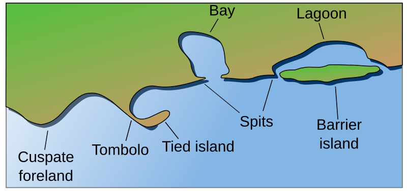
bay
thumb|Bay at Castletown, Isle of Man
thumb|Bay of Baracoa, Cuba

iceberg
thumb|upright=1.2|An iceberg in the Arctic Ocean
thumb|Tabular iceberg
thumb|Iceberg from overhead showing above and submerged ice

atoll
thumb|The atoll of Tetiʻaroa in [[French Polynesia]]

sea level
average level for the surface of one or more of Earth's oceans

lagoon
thumb| Balos coastal lagoon of northwestern Crete. The shallow lagoon is separated from the Mediterranean Sea by narrow shoals connecting to a small, rocky mountain.
thumb|Garabogazköl lagoon in [[Turkmenistan]]
thumb|Venetian Lagoon
coast
thumb|Sunrise on the [[Jersey Shore coastline at Spring Lake, New Jersey, U.S.]]
thumb|Rugged coastline of the West Coast, New Zealand|West Coast Region of New Zealand
A view of the plain near Dikili in Turkey|thumb
thumb|Southeast coast of Greenland
thumb|Escorca coast, [[Serra de Tramuntana (Balearic Islands)]]

plankton
thumb|upright=1.5| Part of the contents of one dip of a hand net. The image contains diverse planktonic organisms, ranging from [[photosynthetic cyanobacteria and diatoms to many different types of zooplankton, including both holoplankton (permanent residents of the plankton) and meroplankton (temporary residents of the plankton, e.g., fish eggs, crab larvae, worm larvae). 100 μm = one tenth of a mm.]]
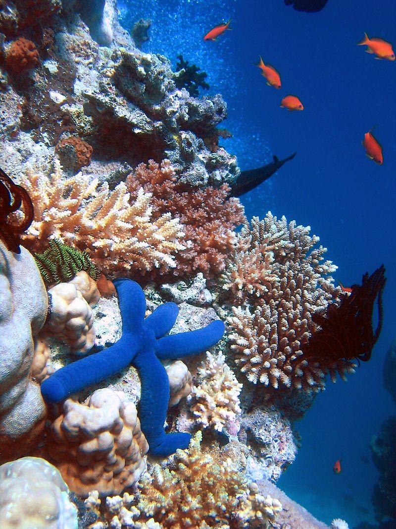
coral reef
ridge of rock in the sea formed by the growth and deposit of coral
.JPG)
mangrove
thumb|upright=1.3|Mangroves are hardy shrubs and trees that thrive in salt water and have specialised adaptations so they can survive the volatile energies of intertidal zones along marine coasts.

wind wave
surface waves that occur on the free surface of bodies of water

cape
headland of large size extending into a body of water, usually the sea

ocean current
continuous flow of ocean water

continental shelf
portion of a continent that is submerged under an area of relatively shallow water known as a shelf sea

sea water
Seawater, or sea water, is water from a sea or ocean. On average, seawater in the world's oceans has a salinity of about 3.5% (35 g/L, 35 ppt, 600 mM). This means that every kilogram (roughly one liter by volume) of seawater has approximately of dissolved salts (predominantly sodium () and chloride () ions). The average density at the surface is 1.025 kg/L. Seawater is denser than both fresh water and pure water (density 1.0 kg/L at ) because the dissolved salts increase the mass by a larger proportion than the volume. The freezing point of seawater decreases as salt concentrati
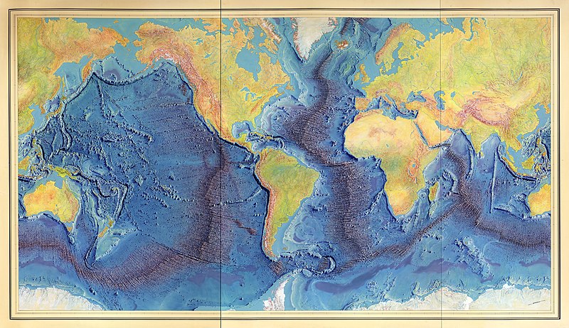
mid-ocean ridge
basaltic underwater mountain system formed by plate tectonic spreading

oceanic trench
depressions of the sea floor

pelagic zone
any water that is neither close to the bottom nor near the shore
benthos
REDIRECT Benthic zone#Benthos

sea ice
ice formed from frozen seawater

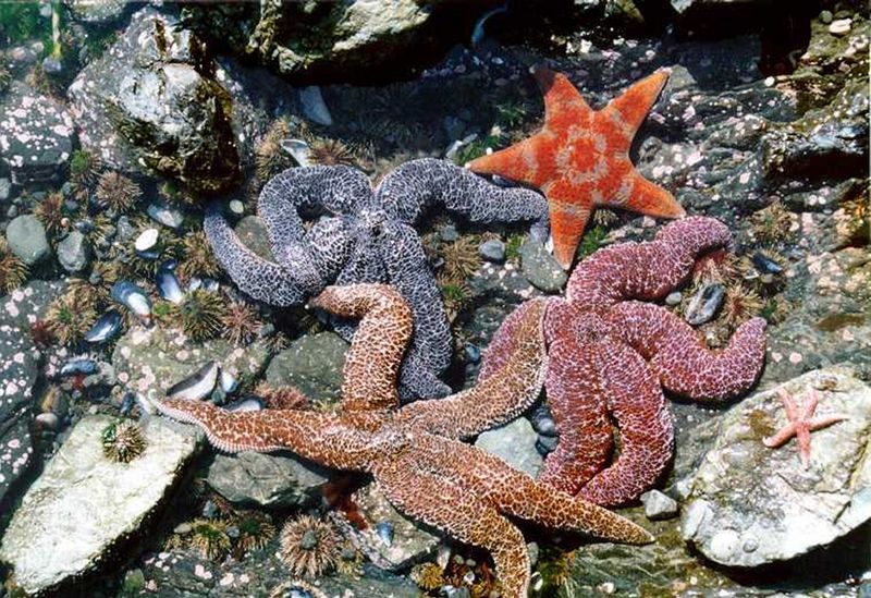
littoral zone
part of a sea, lake or river that is close to the shore

marine pollution
pollution that gets thrown in the oceans

shoal
right|thumb|Sandbar between St. Agnes, Isles of Scilly|St Agnes and [[Gugh on the Isles of Scilly, off the coast of Cornwall, England, United Kingdom]]
thumb|A tidal sandbar connecting the islands of Waya Island|Waya and Wayasewa of the [[Yasawa Islands, Fiji]]
thumb|Sandbar between Nosy Iranja Be and Nosy Iranja Kely(Nosy Iranja, [[Madagascar)]]

abyssal plain
flat area on the ocean floor
abyssal zone
layer of the pelagic zone of the ocean; the deeper part of the midnight zone which starts in the bathypelagic waters above, the area below the abyssal zone is the sparsely inhabited hadal zone

gulf
REDIRECT Bay#Gulf

zooplankton
thumb|upright=1.8| Zooplankton sample including several species of copepods (1–5), [[gastropod larva (6) doliolids (7), fish eggs (8), and decapod larva (9) (Photo by Iole Di Capua)]]

oceanic crust
part of Earth's lithosphere
ocean acidification
climate change-induced decline of pH levels in the ocean
seafloor spreading
process at mid-ocean ridges, where new oceanic crust is formed through volcanic activity and then gradually moves away from the ridge

submarine volcano
underwater vents or fissures in the Earth's surface from which magma can erupt

rip current
narrow current of water which moves directly away from the shore, cutting through the lines of breaking waves

nekton
Nekton or necton (from the ) is any aquatic organism that can actively and persistently propel itself through a water column (i.e. swim) without touching the bottom. Nekton generally have powerful tails and appendages (e.g. fins, pleopods, flippers or jets) that make them strong enough swimmers to counter ocean currents, and have mechanisms for sufficient lift and/or buoyancy to prevent sinking. Examples of extant nekton include most fish (especially pelagic fish like tuna and sharks), marine mammals (cetaceans, sirenia and pinnipeds) and reptiles (specifically sea turtles), penguins, coleoid

tombolo
thumb|right|300px|Tombolo near Karystos, [[Euboea, Greece]]
thumb|300px|right|Tombolo contrasted with other coastal landforms
A tombolo is a sandy or shingle isthmus. It is a deposition landform by which an island becomes attached to the mainland by a narrow piece of land such as a spit or bar. Once attached, the island is then known as a tied island. The word tombolo is from the Italian '''', meaning 'pillow' or 'cushion', and sometimes translated incorrectly as ayre (an ayre is a shingle beach of any kind).
benthic zone
ecological region at the lowest level of a body of water such as an ocean or a lake, including the sediment surface and some sub-surface layers
intertidal zone
area between tide marks
deep sea
area of sea with a depth greater than twice the depth of Ekman layer
marine debris
human-created waste that has deliberately or accidentally been released in a lake, sea, ocean or waterway
photic zone
uppermost layer of water in a lake or ocean that is exposed to sunlight more than 1% of surface illumination
ocean thermal energy conversion
renewable energy technology
oceanic basin
geologic basin under the sea
mediterranean sea
type of sea with limited water exchange with outer oceans
swell
series of waves generated by distant weather systems
neritic zone
part of the ocean
continental margin
zone of the ocean floor that separates the thin oceanic crust from thick continental crust
deep-sea fish
Fauna found in deep sea areas
cold seep
ocean floor area where hydrogen sulfide, methane and other hydrocarbon-rich fluid seepage occurs
marine regression
geological process of areas of submerged seafloor being exposed above the sea level
marine ecosystem
among the largest of Earth's aquatic ecosystems
barrier island
coastal landform and a type of dune system
.png)
megatsunami
thumb|right|upright=1.3|Diagram of the 1958 Lituya Bay earthquake and megatsunami|1958 Lituya Bay megatsunami, which proved the existence of megatsunamis
A megatsunami is an extremely large wave created by a substantial and sudden displacement of material into a body of water.
marine snow
shower of mostly organic detritus falling from the upper layers of the water column
marine energy
energy carried by oceans
hadal zone
composed of trench zones, is the delineation for the deepest trenches in the ocean. The hadal zone is found from a depth to the bottom of the ocean of around 6,000 to 11,000 metres and exists in long but narrow topographic V-shaped depressions
oceanic plateau
relatively flat submarine region that rises well above the level of the ambient seabed
longshore drift
geological process by which sediments move along a beach shore
dead zone
low-oxygen areas in oceans and large lakes caused by nutrient and fertilizer pollution
capillary wave
wave traveling along the phase boundary of a fluid, whose dynamics and phase velocity are dominated by the effects of surface tension