2008 Sichuan earthquake
Also known as Great Sichuan earthquake, 2008 Wenchuan earthquake
earthquake in China
AI overview
# 2008 Sichuan Earthquake The 2008 Sichuan earthquake was a major earthquake that struck the Sichuan province in China. It was a significant natural disaster that caused considerable damage and loss of life in the region.
AI-generated from the Wikipedia summary — may contain errors.
Wikidata facts
- Image
- 2008 Sichuan earthquake map no labels.svg
via Wikidata · CC0
Article
The USGS provided a map of Asia in May 2008, which showed a total of 122 earthquakes occurring on the continent. The large red square near the center of the map depicts the 7.9 magnitude Chengdu quake in the Sichuan province. Map showing the location of the 2008 Sichuan earthquake and all the aftershocks following it through May 28, 2008 A USGS map shows that dozens of aftershocks occurred in a small region following the quake.
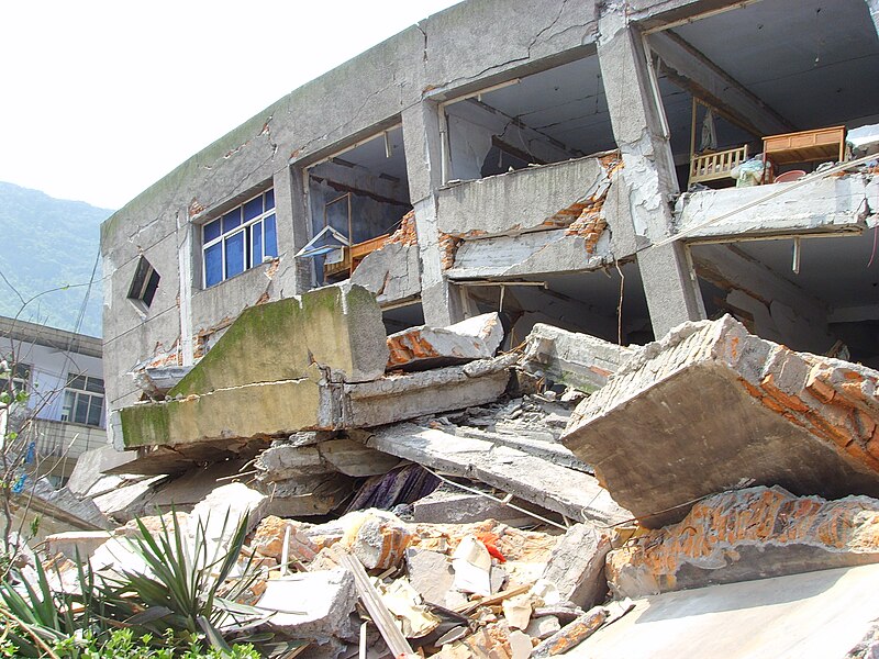
An earthquake occurred in the province of Sichuan, China at 14:28:01 China Standard Time on May 12, 2008. Measuring at 8.0 Ms (7.9–8.3 Mw), the earthquake's epicenter was located 80 kilometres (50 mi) west-northwest of Chengdu, the provincial capital, with a focal depth of 19 km (12 mi). The earthquake ruptured the fault for over 240 km (150 mi), with surface displacements of several meters. The earthquake was also felt as far away as Beijing and Shanghai—1,500 and 1,700 km (930 and 1,060 mi) away, respectively—where office buildings swayed with the tremor, as well as Bangkok, Thailand and Hanoi, Vietnam. Strong aftershocks, some exceeding 6 Ms, continued to hit the area up to several months after the main shock, causing further casualties and damage. The earthquake also caused the largest number of geohazards ever recorded, including about 200,000 landslides and more than 800 quake lakes distributed over an area of 110,000 km (42,000 sq mi).