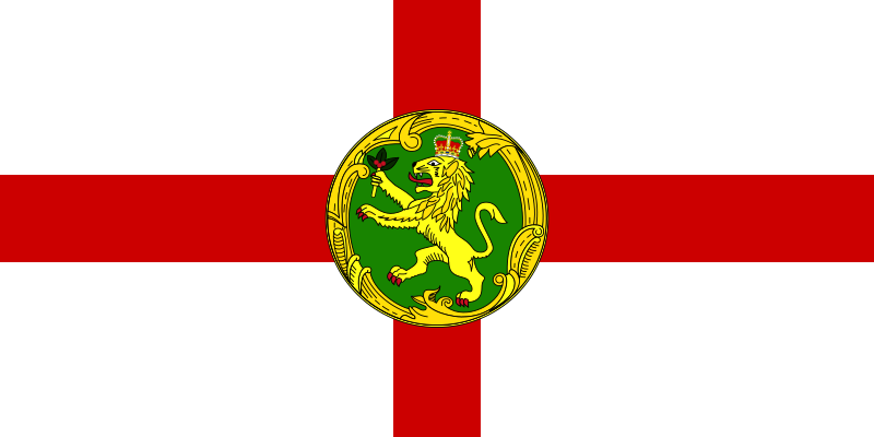
File:Flag_of_Alderney.svg · Wikimedia Commons · See Wikimedia Commons
Alderney
Sign in to saveAlso known as Aurigny, GBA, Great Britain Alderney
thumb|upright=1.2|English Channel with Alderney in the middle thumb|upright=1.2|1890 map of Alderney and adjacent islands Alderney ( ; ; ) is the northernmost of the inhabited Channel Islands. It is part of the Bailiwick of Guernsey, a British Crown dependency. It is long and wide.
Alderney is the northernmost of the inhabited Channel Islands and forms part of the Bailiwick of Guernsey, a British Crown dependency. While small in size, it is a distinct community within this self-governing territory located in the English Channel.
AI-generated from the Wikipedia summary — may contain errors.
Key facts
- Dependency.name
- Alderney
- Dependency.settlement_type
- Jurisdiction of the Bailiwick of Guernsey
- Dependency.linking_name
- Alderney
- Dependency.image_flag
- Flag of Alderney.svg
- Dependency.flag_size
- 140px
- Dependency.flag_link
- Flag of Alderney
- Dependency.image_seal
- Coat of Arms of Alderney.svg
- Dependency.seal_size
- 70px
- Dependency.seal_type
- Coat of arms
- Dependency.seal_link
- Coat of arms of Alderney
- Dependency.anthem
- "God Save the King"God Save the King / Queen
- Dependency.map_alt
- Location of Alderney
- Dependency.image_map2
- Guernsey-Alderney.png
- Dependency.map_alt2
- Map of Guernsey within the Bailiwick
- Dependency.map_caption2
- Map of Alderney within the Bailiwick
- Dependency.subdivision_type1
- Dependent territory of Crown Dependency
- Dependency.subdivision_name1
- Bailiwick of Guernsey
- Dependency.subdivision_type2
- Sovereign state responsible for the Bailiwick
via Wikipedia infobox
Wikidata facts
- Instance of
- Crown Dependencies
- Part of
- Channel Islands
- Country
- Guernsey
- Located in
- Guernsey
- Capital
- Saint Anne
- Currency
- Alderney pound
- Population
- 2167
- Area
- 7.8
- Elevation
- 90
- Time zone
- UTC±00:00
- Body of water
- English Channel
- Legislature
- States of Alderney
- Official website
- alderney.gov.gg
- Image
- Alderney by Sentinel-2.jpg
- Width
- 2.3
- Length
- 5.8
- Licence plate code
- GBA
- Flag
- flag of Alderney
Show 6 more facts
- Commons category
- Alderney
- topic's main category
- Category:Alderney
- Commons gallery
- Alderney - Aurigny
- category of associated people
- Category:People from Alderney
- twinned administrative body
- Beaumont-Hague
- P12749
- Peter Stuhlmacher
Sources (3)
via Wikidata · CC0
~35 min read
Encyclopedic overview
40 sectionsContents
- History
- Victorian era
- Second World War
- Since 1945
- Politics
- Law
- Legal system
- Taxation
- Climate
- Geography and natural history
- Language
- Culture
- Sport
- Pubs
- Media
- Alderney Week
- Miss Alderney
- Comedy Rocks
- Alderney Annual Motor Sprint and Hill Climb
- Alderney Performing Arts Festival
- Alderney Literary Festival
- Alderney Stones
- Education
- Transport
- Utilities
- Healthcare and emergency services
- Fire and Ambulance Service
- Police
- Lifeboats
- Search and rescue
- Notable people
- Coins and stamps
- In popular culture
- Gallery
- See also
- References
- Notes
- Citations
- Further reading
- External links
thumb|upright=1.2|English Channel with Alderney in the middle thumb|upright=1.2|1890 map of Alderney and adjacent islands Alderney ( ; ; ) is the northernmost of the inhabited Channel Islands. It is part of the Bailiwick of Guernsey, a British Crown dependency. It is long and wide.
The island's area is , making it the third-largest island of the Channel Islands, and the second in the Bailiwick only to its namesake. It is around to the west of the Cap de la Hague on the Cotentin Peninsula, Normandy, in France, to the northeast of Guernsey and from the south coast of Great Britain. It is the closest of the Channel Islands both to France and to the United Kingdom. It is separated from the Cap de la Hague by the dangerous Alderney Race ().
Excerpted from Wikipedia’s “Alderney” article, available under the CC BY-SA 4.0 licence.
Gallery (36)
On the map
15 mapped locations
Available in 63 languages
- Español
- Français
- Deutsch
- 中文
- 日本語
- Русский
- Português
- Italiano
- العربية
- Afrikaans
- Azerbaijani
- Bahasa Indonesia
- Basque
- Betawi
- Breton
- Catalan
- Cebuano
- Czech
Show 44 more
- Danish
- Egyptian Arabic
- Esperanto
- Estonian
- Finnish
- Galician
- Georgian
- Greek
- Hausa
- Hebrew
- Hungarian
- Interlingue
- Irish
- Javanese
- Latin
- Latvian
- Limburgish
- Lithuanian
- Malay
- Nederlands
- Norwegian
- Norwegian Nynorsk
- nrm
- Occitan
- Polski
- Romanian
- Scottish Gaelic
- Serbian
- Shan
- simple
- Slovak
- Slovenian
- Svenska
- Tamil
- Tiếng Việt
- Türkçe
- Ukrainian
- Urdu
- Waray
- Welsh
- Wu Chinese
- فارسی
- ไทย
- 한국어
via Wikidata sitelinks · CC0