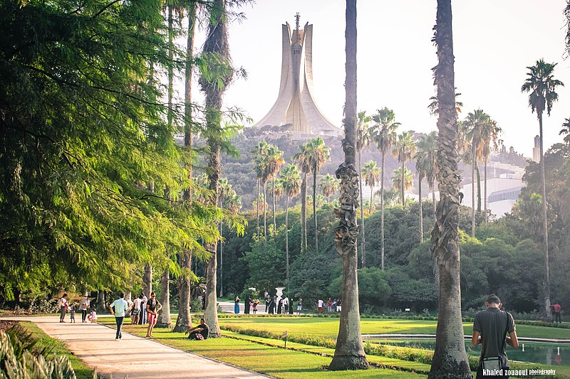
File:Botanical_Garden_Hamma.jpg · Wikimedia Commons · See Wikimedia Commons
OverviewAI-generated
Algiers is a human settlement and city located in Algeria, situated on the coast of the Mediterranean Sea. It serves as the capital of Algeria, the Regency of Algiers, and Algiers Province. The city has also historically been part of France and the Zayyanid Dynasty. Its native labels include الجزائر, Lezzayer, Alger, and Dzayer, with Arabic and Standard Algerian Berber as official languages.
The population of Algiers is 2,364,230. It is located within Algiers Province and has a postal code range of 16000–16132. The local dialing code is 021. Algiers has twinned administrative relationships with Caracas, Montreal, Tunis, and Tyre. The city was established in 944 and covers an area of 363. It is referenced by 7,723 other encyclopedia articles.
Synthesized by Vinony from 50 facts across 7 sources: Wikidata, Open Meteo, Openweathermap, OpenStreetMap, GeoNames, Vinony graph, Geo. Generated from structured data (not the Wikipedia text) and checked against those facts — may still contain errors.
In the Vinony graph
الجزائر العاصمة appears in Vinony's National Capitals collection — one of 222 entries.
Within Vinony's link graph, الجزائر العاصمة is referenced by 7,723 other articles, and connects out to World Heritage Site, Algiers Province and Basilica of Notre-Dame-d'Afrique.
The entry is geolocated on the map in city, across 31 mapped points.
It is catalogued under topics including 10th-century establishments in Africa, 944 establishments and Accuracy disputes from February 2020.
Weather now
cached 9h ago7-day forecast
via Open-Meteo
Place details
- Locality
- Alger ⴷⵣⴰⵢⴻⵔ الجزائر
- Region
- الجزائر ⴷⵣⴰⵢⴻⵔ
- Country
- ⵍⵣⵣⴰⵢⴻⵔ الجزائر
- Population
- 2,364,230
- Timezone
- Africa/Algiers
via OpenStreetMap · GeoNames
Key facts
- Settlement.leader_name1
- Mahdia Benghalia (since 2021)
- Settlement.established_title
- Incorporated
- Settlement.name
- Algiers
- Settlement.native_name
- الجزائر
- Settlement.native_name_lang
- ar
- Settlement.nicknames
- Algiers the White; Algiers the Dazzling; The White City
- Settlement.image_flag
- Flag of Algiers.svg
- Settlement.image_shield
- Algiers-COA.svg
- Settlement.settlement_type
- Capital city
- Settlement.imagesize
- 290px
- Settlement.pushpin_map
- Algeria#Africa
- Settlement.pushpin_relief
- yes
- Settlement.pushpin_mapsize
- 275
- Settlement.pushpin_map_caption
- Location in Algeria and Africa
- Settlement.subdivision_type
- Country
- Settlement.subdivision_type1
- Province
- Settlement.subdivision_name1
- Algiers
- Settlement.subdivision_name
- Algeria
via Wikipedia infobox
Wikidata facts
- Instance of
- city
- Official name
- الجزائر
- Demonym
- Algéroise
- Country
- Almohad Caliphate
- Located in
- French Algeria
- Official language
- Standard Algerian Berber
- Population
- 3415811
- Area
- 363
- Elevation
- 0
- Time zone
- UTC+01:00
- Body of water
- Mediterranean Sea
- Official website
- alger.mta.gov.dz
- Image
- Algiers Montage.png
- Dialing code
- 021
Show 14 more facts
- category for people who died here
- Category:Deaths in Algiers
- twinned administrative body
- Daejeon
- Commons category
- Algiers
- postal code
- 16000–16132
- topic's main category
- Category:Algiers
- Commons gallery
- (الجزائر (مدينة
- category for people born here
- Category:Births in Algiers
- category of associated people
- Category:People from Algiers
- native label
- Dzayer
- inception
- 0944-00-00
- P8168
- Zora Folley
- on focus list of Wikimedia project
- Wikipedia:Vital articles/Level/4
- P12749
- Claudius
Sources (9)
via Wikidata · CC0
Travel guide
Understand
The city's name is derived from al-Jazā'ir (Arabic: الجزائر), which is one of two broken plurals of the word jazīra (Arabic: جَزِيرَة, "island").
Get around
Algiers’ public transportation system includes a single metro line, a single tram line, and buses. Taxis are also available, and you can easily find one in the city center.
Do
thumb|Kasbah Of Algiers thumb|Algiers City Center thumb|Algerian Handicrafts
thumb|Palace23 thumb|The Ancient Civilizations Museum Taking a stroll along the beach promenade and park at is a popular family activity.
Buy
Unofficially exchanging money can be done in the Square Port Said and in Abane Ramdane Street, and in some shops in the area such as mobile phone operators. It's an incredibly common practice and transactions are done openly. The exchange rate is typically 40%-50% better than the official rate. People are most interested in exchanging euro. As of March 2024, you can get about DA235 for €1.
Eat
There are several restaurants in the Bois des Arcades area. This is the hill 500 m southeast of the big Martyrs memorial. Particularly good views over Algiers and the coast can be found from here. The hill is also a woodland, so is a nice area for walking too.
Drink
Algeria's red wine is of very high quality and will be appreciated by wine aficionados. It is rarely found on the international market. Locally produced beer is good quality. Alcohol is readily available in hotels, good restaurants and shops.
Travel guide from Wikivoyage (CC BY-SA 4.0)
Article · العربية
الجزائر العاصمة (باللهجة المحلية: دْزَايرْ)؛ هي عاصمة الجمهورية الجزائرية وأكبر مُدنها من حيث عدد السكان. كانت مدينة الجزائر تُدعى إكوزيوم في زمن الفينيقيين حيث كان أول من أسس المدينة، ومن مُسمّياتها الحالية البهجة، المحروسة والجزائر البيضاء، وهي أيضا عاصمة ولاية الجزائر. تقع المدينة في شمال وسط البلاد مُطلّة على الجانب الغربي لخليج البحر الأبيض المتوسط والمدينة من جزئين: جزءٌ قديم يتمثل في القصبة التي توجد على حافة تلة شديدة الانحدار (122 متراً فوق سطح البحر) خلف المدينة الحديثة، وجزءٌ حديث يوجد على مستوى الساحل القريب من البحر. وفقًا لمعجم العالم الجغرافي فلقد بلغ عدد سكان المدينة 3.335.418 نسمة، في حين أن التجمعات الحضرية تبلغ حوالي 6.727.806 نسمة في عام 2010 وفقًا لتصنيف أكبر 100 مدينة في العالم، وبذلك تصبح مدينة الجزائر العاصمة أكبر مدينة في المغرب العربي من حيث عدد السكان، كما تعدُّ مدينة الجزائر المركز الاقتصادي والاجتماعي الرئيسي في البلاد.
Abstract from DBpedia / Wikipedia · CC BY-SA
Gallery (632)
On the map
31 mapped locations
Available in 180 languages
- Español
- Français
- Deutsch
- 中文
- 日本語
- Русский
- Português
- Italiano
- العربية
- हिन्दी
- Abkhazian
- Adyghe
- Afrikaans
- Akan
- Albanian
- Albanian
- Amharic
- Aragonese
Show 161 more
- Aramaic
- Armenian
- Arpitan
- Asturian
- azb
- Azerbaijani
- Bahasa Indonesia
- Balinese
- Bambara
- Bangla
- Bashkir
- Basque
- bat_smg
- be_x_old
- Belarusian
- Bikol
- Bosnian
- Breton
- Bulgarian
- Burmese
- Catalan
- cdo
- Cebuano
- Central Kurdish
- Chechen
- Chuvash
- Corsican
- Croatian
- Czech
- Danish
- dga
- Egyptian Arabic
- Esperanto
- Estonian
- Extremaduran
- Faroese
- Fiji Hindi
- Filipino
- Finnish
- fiu_vro
- Galician
- Georgian
- Greek
- Haitian Creole
- Hakka Chinese
- Hausa
- Hebrew
- Hungarian
- hyw
- Icelandic
- Ido
- Iloko
- Inari Sami
- Interlingua
- Interlingue
- Irish
- Javanese
- Kabyle
- kai
- Kashubian
- Kazakh
- kbp
- kge
- Kongo
- Kotava
- Kurdish
- Kyrgyz
- Ladino
- Latin
- Latvian
- Ligurian
- Lingala
- Lithuanian
- Lombard
- Low German
- Luxembourgish
- Macedonian
- Maithili
- Malagasy
- Malay
- Malayalam
- Maltese
- Manipuri
- map_bms
- Marathi
- Mazanderani
- Minangkabau
- Mingrelian
- Moksha
- Mongolian
- Moroccan Arabic
- Navajo
- Nederlands
- Nepali
- Northern Frisian
- Norwegian
- Norwegian Nynorsk
- Novial
- Occitan
- Old English
- olo
- Ossetic
- Pampanga
- Papiamento
- Pashto
- Piedmontese
- Polski
- Punjabi
- Romanian
- Santali
- Sardinian
- Scots
- Scottish Gaelic
- Serbian
- Serbian (Latin)
- Shona
- Sicilian
- Silesian
- simple
- Sindhi
- Slovak
- Slovenian
- Somali
- Standard Moroccan Tamazight
- Sundanese
- Svenska
- Swahili
- Tachelhit
- Tajik
- Talysh
- Tamil
- Tatar
- Tibetan
- Tiếng Việt
- Türkçe
- Udmurt
- Ukrainian
- Upper Sorbian
- Urdu
- Uyghur
- Uzbek
- Venetian
- Veps
- Volapük
- Waray
- Welsh
- Western Frisian
- Western Mari
- Western Panjabi
- Wolof
- Wu Chinese
- Yiddish
- Yoruba
- Zaza
- Zeelandic
- zh_min_nan
- zh_yue
- Zulu
- فارسی
- ไทย
- 한국어
via Wikidata sitelinks · CC0