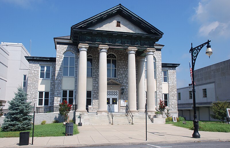
File:Covington,_Va_-_Allegheny_General_District_Court.jpg · Wikimedia Commons · See Wikimedia Commons
Alleghany County
Sign in to saveAlso known as Alleghany County, Virginia, Alleghany County, VA
county in Virginia, United States
Key facts
- Country
- United States
- State
- Virginia
- Named after
- Allegheny Mountains
- Seat
- Covington
- Largest town
- Clifton Forge
- Total
- 449.7 sq mi (1,165 km )
- Land
- 446.572 sq mi (1,156.62 km )
- Water
- 3.152 sq mi (8.16 km ) 0.7%
- Estimate 2025
- 14,546
- Density
- 34.09/sq mi (13.16/km )
- Time zone
- UTC−5 ( Eastern )
- Summer dst
- UTC−4 ( EDT )
- Congressional district
- 6th
- Website
- visitalleghanyhighlands .com
via Wikipedia infobox
Official website
Alleghany County, Virginia
co.alleghany.va.us →Alleghany County took its name from the mountain range in which it is located. It was formed by act of Virginia Legislature on January 5, 1822 from parts of Botetourt, Bath, and Monroe counties. At that time Monroe was a Virginia county and remained so until the formation of West Virginia in May 1862 during the war between the states. The County comprises approximately 452 square miles of which nearly 50% is in the National Forest. The County surrounds one city, Covington, which forms the principal center of population. The Town of Clifton Forge was originally called Williamson after the family which owned the land on which the town was located. However, in 1882 the Chesapeake and Ohio Railway Co. named its new depot there “Clifton Forge” and with the coming of the railroad it became not only a railroad junction, but a division point. After this, growth was very rapid and in 1906 received a charter as an independent city. In July 2001, Clifton Forge reverted from a city to a town. The Town of Iron Gate was predicted to be one of the biggest cities in the Commonwealth, but this did not happen. Iron Gate grew from the development of the iron industry, and in the late 1880’s a tannery was opened. The tannery operated until 1951. Before the formation of Alleghany County, property records and court services for the area were provided from Fincastle, the county seat of Botetourt County. As this involved a two day trip for recordation of deeds or any court business, the formation of the Town of Covington a few years earlier made it desirable and perhaps necessary to provide a nearby location for these services. By further Act of the General Assembly, passed February 15, 1822, the County of Alleghany was attached to the Chancery District Court centered at Lewisburg. One of the most influential persons in the formation of Covington and Alleghany County was Bernard Pitzer who owned and operated the first store in this area and bought from Uriah Humphries 217 acres lying at and west of the Mouth of the Dunlap Creek and Jackson River, now called Rosedale. Bernard Pitzer was assisted in his various activities by his large family. His brother, John Pitzer, Jr., was sheriff of Botetourt County, the most important local official at that time, during the period of the formation of Alleghany County and Covington. From about 1790 to after 1825 the principal cash crop in this area was hemp. Hemp production was encouraged by the state with a bounty being paid from each unit delivered. Locally produced hemp was hauled by wagon to a rope factory in East Richmond. As ship stores accumulated, prices for hemp declined and agriculture shifted to grains, hay, and livestock. Early farmers of the area aimed to be as self-sufficient as possible. According to the Census of 1840, the County’s total population (including Covington and what is now Clifton Forge) was 2,749. Of this number 2,142 were “white free persons,” 60 were “free colored persons,” and 547 were slaves. In the Civil War, Alleghany County furnished more soldiers to the confederacy than it had voters. The County suffered greatly in the war due to its location and many years were required for recovery from the losses sustained. The biggest boost to industrial progress in the area was the decision in 1899 by the West Virginia Pulp and Paper Company to locate a mill at Covington. The coming of the pulp mill stimulated the development and growth of other industrial and commercial interests. The government of Alleghany County has generally been very progressive in developing and supporting policies tending to economic growth and provision for improved services for the citizenry. An essential element for this is to encourage cooperation between agencies of the area where it is mutually advantageous to do so. At the present time, there are many cooperative activities between the jurisdictions.
Read more on their site →Excerpt from the official site · 10,093 chars · not written by Vinony
Wikidata facts
- Named after
- Allegheny Mountains
- Country
- United States
- Located in
- Virginia
- Contains
- Covington
- Capital
- Covington
- Population
- 15223
- Area
- 1162
- Shares border with
- Covington
- Official website
- www.co.alleghany.va.us
- Image
- Covington, Va - Allegheny General District Court.jpg
- Households
- 6529
Show 8 more facts
- Commons category
- Alleghany County, Virginia
- topic's main category
- Category:Alleghany County, Virginia
- different from
- Allegan County
- water as percent of area
- 0.7
- native label
- Alleghany County
- inception
- 1822-00-00
- per capita income
- 28048
- category of associated people
- Category:People from Alleghany County, Virginia
Sources (9)
via Wikidata · CC0
~10 min read
Encyclopedic overview
Alleghany County is an American county located on the far western edge of Commonwealth of Virginia. It is bordered by the Allegheny Mountains, from which the county derives its name, and it is the northernmost part of the Roanoke Region. The county seat is Covington. As of the 2020 census, the population was 15,223.
The county was created in 1822 from parts of Bath County, Botetourt County, and Monroe County (now in West Virginia) with additional portions of Bath County and Monroe County added in 1823 and 1844, respectively. At the time, the majority of the population lived around Covington, and the primary cash crop then was hemp, which was used for rope production.
Excerpted from Wikipedia’s “Alleghany County” article, available under the CC BY-SA 4.0 licence.