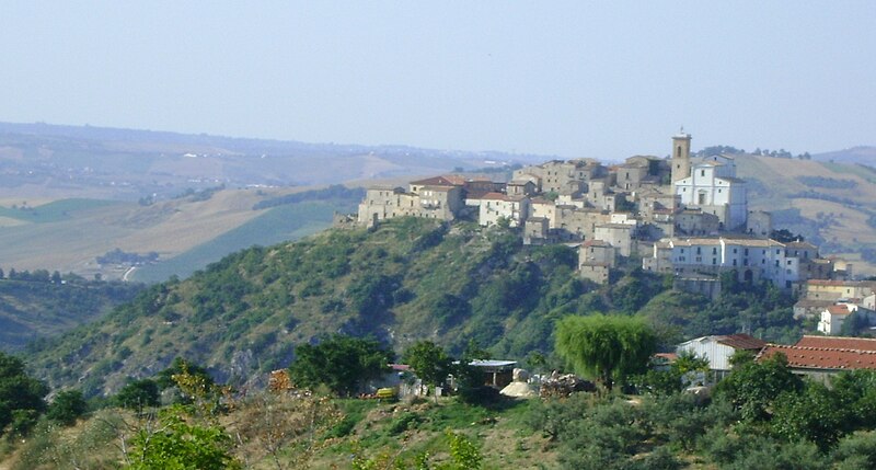
File:Veduta_di_Altino_(CH).JPG · Wikimedia Commons · See Wikimedia Commons
Key facts
- Country
- Italy
- Region
- Abruzzo
- Province
- Chieti (CH)
- Frazioni
- Briccioli, Sant'Angelo, Fonte, Luzio, Mandrella, Rio Secco, Scosse, Colli d Altino, Selva di Altino
- Mayor
- Vincenzo Muratelli
- Total
- 15.33 km (5.92 sq mi)
- Elevation
- 345 m (1,132 ft)
- Density
- 203.1/km (525.9/sq mi)
- Demonym
- Altinesi
- Time zone
- UTC+1 ( CET )
- Summer dst
- UTC+2 ( CEST )
- Dialing code
- 0872
- Istat code
- 069001
- Patron saint
- San Gilberto
- Saint day
- 4 September
- Website
- Official website
via Wikipedia infobox
Wikidata facts
- Instance of
- comune of Italy
- Official name
- Altino
- Country
- Italy
- Located in
- Province of Chieti
- Official language
- Italian
- Population
- 3067
- Area
- 15.33
- Elevation
- 345
- Time zone
- UTC+02:00
- Shares border with
- Sant'Eusanio del Sangro
- Official website
- www.comune.altino.ch.it
- Image
- Veduta di Altino (CH).JPG
- Dialing code
- 0872
- Licence plate code
- CH
- Patron saint
- Saints Cosmas and Damian
Show 4 more facts
- Commons category
- Altino
- postal code
- 66040
- native label
- Altino
- twinned administrative body
- Kalocsa
Sources (7)
via Wikidata · CC0
~2 min read
Encyclopedic overview
Altino (Abruzzese: Davëdìnë) is a comune and town in the province of Chieti in the Abruzzo region of southern Italy. It is located on a rock spur commanding the valley of the Aventino river. The valley is richly cultivated with orchards, fruit, grapes and olives.
Geography
Excerpted from Wikipedia’s “Altino” article, available under the CC BY-SA 4.0 licence.