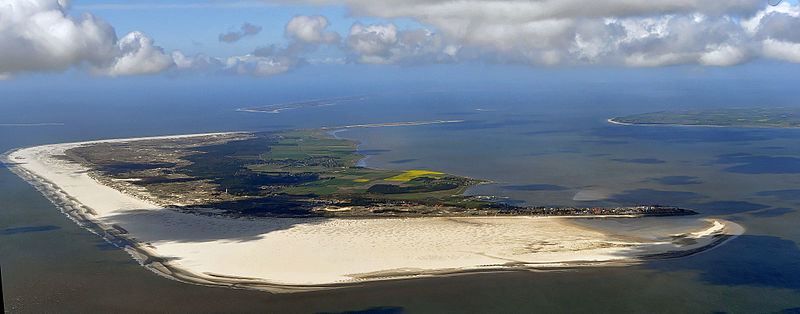
File:Luftaufnahmen_Nordseekueste_2012-05-by-RaBoe-104.jpg · Wikimedia Commons · See Wikimedia Commons
In the Vinony graph
Vinony's link graph records 238 inbound references to Amrum, and connects out to Geest, Europe and Germany.
The entry is geolocated on the map in isle, across 3 mapped points.
It is catalogued under topics including Amrum, Commons link from Wikidata and Islands of Schleswig-Holstein.
Vinony links it to 36 Wikipedia language editions.
Key facts
- Islands.population
- 2,354
- Islands.name
- Amrum
- Islands.image_name
- Luftaufnahmen Nordseekueste 2012-05-by-RaBoe-104.jpg
- Islands.image_caption
- Aerial view of Amrum
- Islands.map_image
- Wadden - Amrun.PNG
- Islands.native_name
- Oomram
- Islands.location
- Wadden Sea
- Islands.archipelago
- North Frisian Islands
- Islands.major_islands
- Sylt, Föhr, Amrum
- Islands.area_km2
- 20.46
- Islands.highest_mount
- Siatler
- Islands.elevation_m
- 32
- Islands.country
- Germany
- Islands.country_admin_divisions_title
- State
- Islands.country_admin_divisions
- Schleswig-Holstein
- Islands.country_admin_divisions_title_1
- District
- Islands.country_admin_divisions_1
- Nordfriesland
- Islands.population_as_of
- 2013
via Wikipedia infobox
Wikidata facts
- Instance of
- island
- Part of
- North Frisian Islands
- Country
- Germany
- Located in
- Föhr-Amrum
- Capital
- Nebel
- Population
- 2331
- Area
- 20.46
- Elevation
- 0
- Time zone
- UTC+02:00
- Body of water
- Wadden Sea
- Official website
- www.amrum.de
- Image
- Amrum satellite view.jpeg
- Width
- 2.5
- Length
- 10
- Dialing code
- 04682
Show 8 more facts
- Commons category
- Amrum
- topic's main category
- Category:Amrum
- located in/on physical feature
- North Sea
- Commons gallery
- Amrum
- postal code
- 25946
- language used
- North Frisian
- native label
- Oomram
- P8168
- Alexander Andrievsky
Sources (3)
via Wikidata · CC0
Article · Deutsch
Amrum (Öömrang: Oomram, dänisch Amrum) ist eine Nordfriesische Insel. Sie liegt südlich von Sylt und westlich von Föhr und gehört zum Kreis Nordfriesland in Schleswig-Holstein. Mit einer Fläche von 20,46 km² (ohne den 10 km² großen Kniepsand) ist sie nach Sylt, Föhr und Pellworm die viertgrößte Insel dieser Inselgruppe. Amrum liegt im Nationalpark Schleswig-Holsteinisches Wattenmeer. In den drei Gemeinden (Nebel, Norddorf und Wittdün) mit den fünf Inseldörfern leben etwa 2300 Einwohner. Die Kommunen gehören zum Amt Föhr-Amrum. Hauptwirtschaftszweig des Seebades Nebel sowie der Seeheilbäder Wittdün und Norddorf ist der Fremdenverkehr. 2016 wurden insgesamt 1,29 Millionen Übernachtungen registriert.
Abstract from DBpedia / Wikipedia · CC BY-SA
Gallery (23)
On the map
3 mapped locations