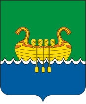
File:Coat_of_Arms_of_Andreapol_(Tver_oblast).png · Wikimedia Commons · See Wikimedia Commons
آندریپول
Sign in to saveAndreapol () is a town and the administrative center of Andreapolsky District in Tver Oblast, Russia, located on the Valdai Hills on the left bank in the upper course of the Western Dvina. Population: 12,000 (1968).
OverviewAI-generated
Andreapol is a human settlement in Tver Oblast, Russia. It serves as the administrative center of Andreapolsky District. The settlement has a population of 10,500 and covers an area of 13 square kilometers. It is situated at an elevation of 220 meters above sea level and operates in the UTC+03:00 time zone.
The earliest written record of the location dates to 1489, while the settlement was formally established in 1907. Andreapol has been part of the Russian Empire, the Soviet Union, and modern Russia. Its local dialing code is 48267, and its postal code is 172800. The town is described in the Brockhaus and Efron Encyclopedic Dictionary.
Synthesized by Vinony from 45 facts across 7 sources: Wikidata, Openweathermap, Open Meteo, OpenStreetMap, GeoNames, Vinony graph, Geo. Generated from structured data (not the Wikipedia text) and checked against those facts — may still contain errors.
Weather now
7-day forecast
via Open-Meteo
Place details
- Locality
- Андреаполь
- Region
- Тверская область
- Country
- Россия
- Population
- 9,209
- Timezone
- Europe/Moscow
via OpenStreetMap · GeoNames
Key facts
- Russian inhabited locality.en_name
- Andreapol
- Russian inhabited locality.ru_name
- Андреаполь
- Russian inhabited locality.map_label_position
- bottom
- Russian inhabited locality.image_coa
- Coat of Arms of Andreapol (Tver oblast).png
- Russian inhabited locality.federal_subject
- Tver Oblast
- Russian inhabited locality.adm_district_jur
- Andreapolsky District
- Russian inhabited locality.adm_selsoviet_jur
- Andreapol
- Russian inhabited locality.adm_selsoviet_type
- Urban settlement
- Russian inhabited locality.adm_ctr_of1
- Andreapolsky District
- Russian inhabited locality.adm_ctr_of2
- Andreapol Urban Settlement
- Russian inhabited locality.inhabloc_cat
- Town
- Russian inhabited locality.mun_district_jur
- Andreapolsky Municipal District
- Russian inhabited locality.urban_settlement_jur
- Andreapol Urban Settlement
- Russian inhabited locality.mun_admctr_of1
- Andreapolsky Municipal District
- Russian inhabited locality.mun_admctr_of2
- Andreapol Urban Settlement
- Russian inhabited locality.pop_2010census
- 8286
- Russian inhabited locality.established_date
- 1906
- Russian inhabited locality.current_cat_date
- 1967
via Wikipedia infobox
Wikidata facts
- Country
- Soviet Union
- Population
- 6956
- Area
- 13
- Elevation
- 220
- Time zone
- UTC+03:00
- Official website
- www.andreapol.ru
- Image
- Андреаполь, железнодорожный вокзал 2020-07-26.jpg
- Dialing code
- 48267
Show 5 more facts
- Commons category
- Andreapol
- inception
- 1907-01-01
- postal code
- 172800
- time of earliest written record
- 1489-07-23
- described by source
- Brockhaus and Efron Encyclopedic Dictionary
Sources (2)
via Wikidata · CC0
On the map
2 mapped locations