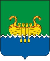
File:Coat_of_Arms_of_Andreapol_(Tver_oblast).png · Wikimedia Commons · See Wikimedia Commons
OverviewAI-generated
Andreapol is a human settlement in Tver Oblast, Russia. It serves as the administrative center of Andreapolsky District. The settlement has a population of 10,500 and covers an area of 13 square kilometers. It is situated at an elevation of 220 meters above sea level and operates in the UTC+03:00 time zone.
The earliest written record of the location dates to 1489, while the settlement was formally established in 1907. Andreapol has been part of the Russian Empire, the Soviet Union, and modern Russia. Its local dialing code is 48267, and its postal code is 172800. The town is described in the Brockhaus and Efron Encyclopedic Dictionary.
Synthesized by Vinony from 45 facts across 7 sources: Wikidata, Openweathermap, Open Meteo, OpenStreetMap, GeoNames, Vinony graph, Geo. Generated from structured data (not the Wikipedia text) and checked against those facts — may still contain errors.
Weather now
7-day forecast
via Open-Meteo
Place details
- Locality
- Андреаполь
- Region
- Тверская область
- Country
- Россия
- Population
- 9,209
- Timezone
- Europe/Moscow
via OpenStreetMap · GeoNames
Key facts
- Russian inhabited locality.en_name
- Andreapol
- Russian inhabited locality.ru_name
- Андреаполь
- Russian inhabited locality.map_label_position
- bottom
- Russian inhabited locality.image_coa
- Coat of Arms of Andreapol (Tver oblast).png
- Russian inhabited locality.federal_subject
- Tver Oblast
- Russian inhabited locality.adm_district_jur
- Andreapolsky District
- Russian inhabited locality.adm_selsoviet_jur
- Andreapol
- Russian inhabited locality.adm_selsoviet_type
- Urban settlement
- Russian inhabited locality.adm_ctr_of1
- Andreapolsky District
- Russian inhabited locality.adm_ctr_of2
- Andreapol Urban Settlement
- Russian inhabited locality.inhabloc_cat
- Town
- Russian inhabited locality.mun_district_jur
- Andreapolsky Municipal District
- Russian inhabited locality.urban_settlement_jur
- Andreapol Urban Settlement
- Russian inhabited locality.mun_admctr_of1
- Andreapolsky Municipal District
- Russian inhabited locality.mun_admctr_of2
- Andreapol Urban Settlement
- Russian inhabited locality.pop_2010census
- 8286
- Russian inhabited locality.established_date
- 1906
- Russian inhabited locality.current_cat_date
- 1967
via Wikipedia infobox
Wikidata facts
- Country
- Soviet Union
- Population
- 6956
- Area
- 13
- Elevation
- 220
- Time zone
- UTC+03:00
- Official website
- www.andreapol.ru
- Image
- Андреаполь, железнодорожный вокзал 2020-07-26.jpg
- Dialing code
- 48267
Show 5 more facts
- Commons category
- Andreapol
- inception
- 1907-01-01
- postal code
- 172800
- time of earliest written record
- 1489-07-23
- described by source
- Brockhaus and Efron Encyclopedic Dictionary
Sources (2)
via Wikidata · CC0
Article · 日本語
アンドレアポリ(アンドレアーポリ、ロシア語: Андреа́поль, Andreapol)は、ロシアのトヴェリ州西部にある都市。ヴァルダイ丘陵のただなかにあり、バルト海へ流れる西ドヴィナ川上流に位置する。州都トヴェリからの距離は西へ280 km、モスクワからは西へ550km。モスクワ上空を守るロシア空軍の迎撃戦闘機基地・アンドレアポリ空軍基地の所在地。人口は2002年全ロシア国勢調査で 9,317人(1968年にはおよそ12,000人)。 西ドヴィナ川左岸のアンドレアポリからは対岸にあたるドゥブナの村は、年代記の1489年の条に初出する。アンドレアポリの位置には17世紀から集落があり1783年にアンドレヤノ・ポーレ(アンドレイの原)と改名し、その後何度か改名した。1907年、この地にボロゴエとヴェリーキエ・ルーキを結びベラルーシへ伸びる鉄道が開通し駅ができて以来アンドレアポリは大きくなり1928年にはドゥブナも併合した。第二次世界大戦では駅と集落は1941年秋から1942年冬までドイツ軍に占領されていた。1967年にアンドレアポリは市となった。 アンドレアポリを中心とするアンドレアポリスキー地区は70%が森林に覆われている。このため林業と製材が町の主な収入源となっており、大きな製材工場がある。その他の産業は農業とその関連産業、窯業である。
Abstract from DBpedia / Wikipedia · CC BY-SA
On the map
2 mapped locations